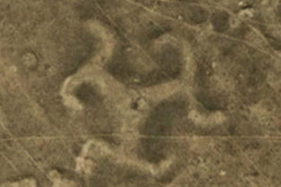
More than 50 geoglyphs with various shapes and sizes have been discovered across northern Kazakhstan in Central Asia, say archaeologists.
These sprawling structures, mostly earthen mounds, create the type of landscape art most famously seen in the Nazca region of Peru.
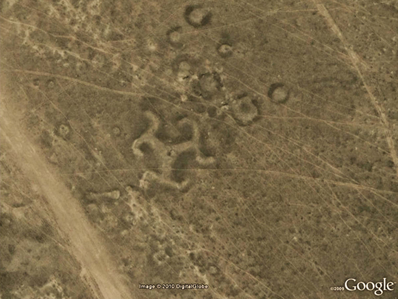
More than 50 geoglyphs have been discovered in northern Kazakhstan. Designed in a variety of geometric shapes, the example shown here is in the shape of a swastika. Researchers from Kostanay University and Vilinus University are conducting a research project to study them. They appear to date back at least 2,000 years, and many of them are made of earthen mounds (although timber was used to make the below swastika).
This geoglyph is in the shape of a ring. While the geoglyphs are often difficult to see on the ground in northern Kazakhstan, they can be seen clearly from the sky and were detected using Google Earth imagery.
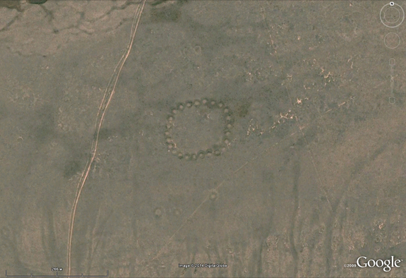
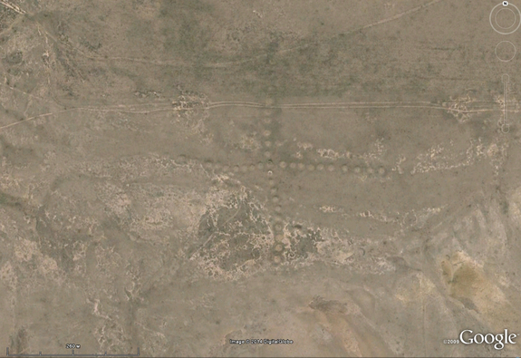
This geoglyph is in the shape of a cross. The geoglyphs in northern Kazakhstan range between 90 meters 400 meters (295 feet and 1,312 feet) in diameter.
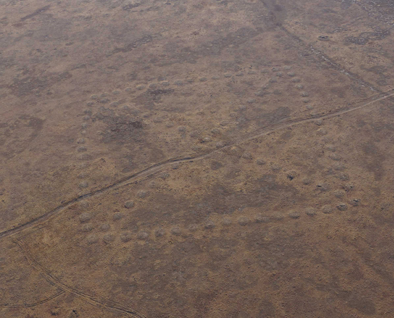
This geoglyph is in the shape of a box with an X running through it. The researchers are conducting a program of aerial photography, excavation, dating and ground-penetrating radar to learn more about the geoglyphs. The excavations unearthed the remains of structures and hearths at the geoglyphs, suggesting rituals took place there. Another idea is that ancient tribes may have used the geoglyphs to mark ownership of the land.
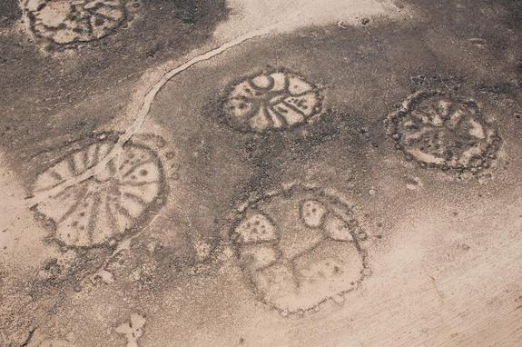
Kazakhstan is one of a growing list of countries that have geoglyphs. Structures like these have been discovered in Peru, Brazil, the United Kingdom, Jordan, Syria, Russia and the United States among other countries. The introduction of high-resolution Google Earth imagery in the past decade has allowed both professional archaeologists and amateurs to study these enigmatic structures in greater depth. This image shows a close-up of the swastika geoglyph from Kazakhstan.
For instance, archaeologists have discovered such “Nazca Lines” called “wheels” in the Middle East. These stone structures show a variety of designs, with a common one being a circle with spokes radiating inside. Here, a cluster of wheels in the Azraq Oasis. Researchers think the wheels were created at least 2,000 years ago.
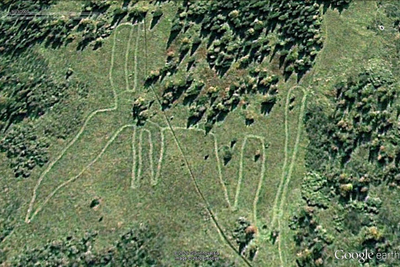
An animal-shaped stone structure that may predate Peru’s Nazca Lines was discovered in Russia, near Lake Zjuratkul in the Ural Mountains, north of Kazakhstan. The sprawling “elk,” which extends some 900 feet (275 meters) at its farthest points, excluding a possible tail, was discovered using Google Earth (shown here in a 2007 image).
Archeology is a fantastic science and Goggle Earth is sometimes an amazing tool to discover hidden treasures!


[…] Discover Nazca Lines found in Kazakhstan. […]