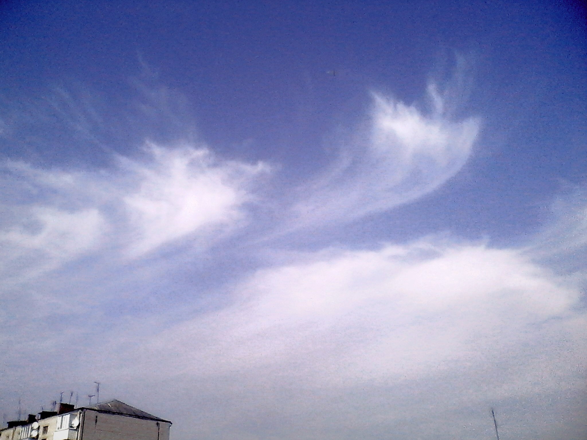
Look up in the sky!
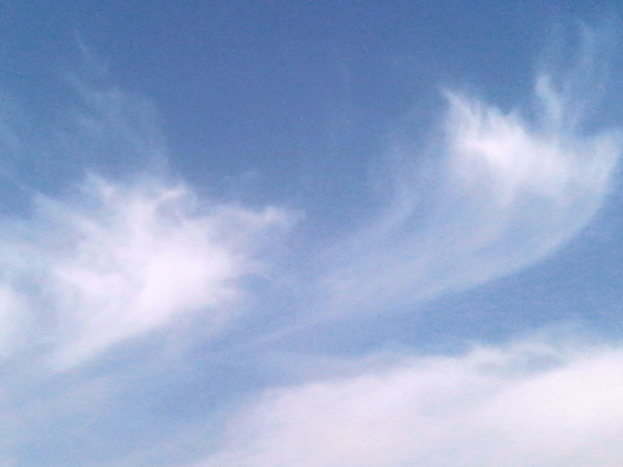
Is it a bird? Is it a plane? Not, it’s a …. jellyfish cloud?!
Yes, “jellyfish clouds” are actually a thing. Technically, the wispy apparitions can form from cirrostratus, altocumulus or cumulus clouds, but the curved dome and delicate tendrils inspire cloud experts imaginations everywhere to think of, well … jellyfish.
The Science Behind the Jellyfish-Like Cloud
The word “cumulus” is Latin for “heap.” Altocumulus clouds are heaps of clouds that develop in the middle layer of the troposphere, about 8,000 to 18,000 feet above the ground. These clouds have a wavy, billowy shape, and they look similar to sheep’s wool.
When warm, moist air rises, the invisible water vapor eventually cools and condenses into tiny water droplets on particles called condensation nuclei. As the process continues, water droplets further accumulate upwards, creating visible heaps in the sky known to us as white, fluffy clouds.
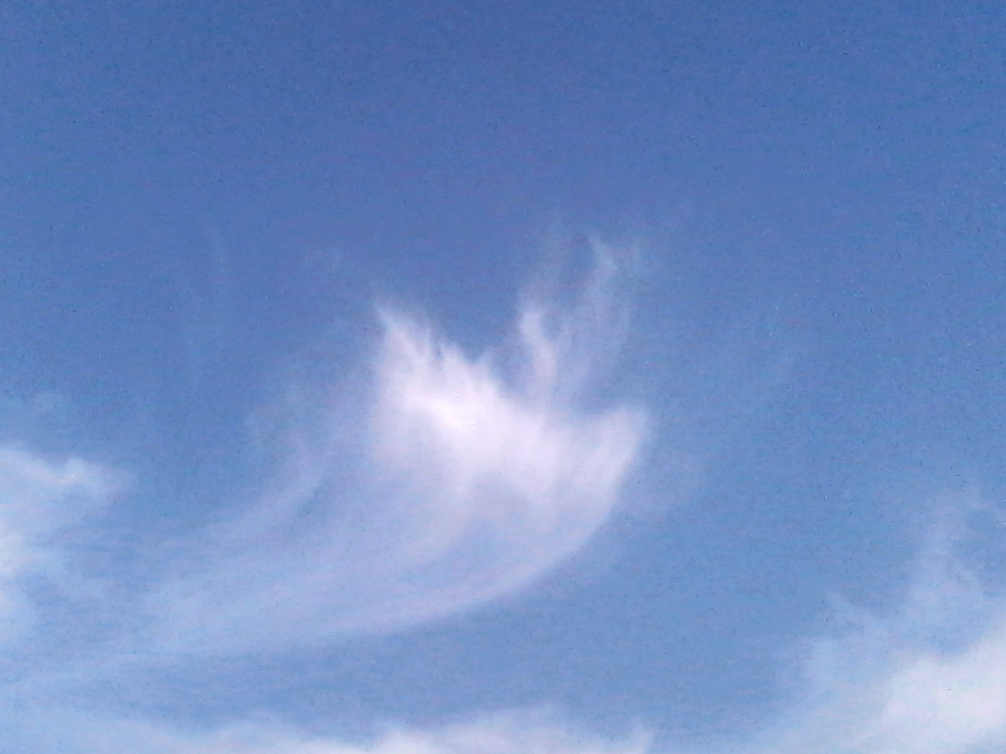
However, in the case of cumulus and altocumulus-based jellyfish clouds, the warm, moist air can only rise so high in the atmosphere before it gets stuck. The moist air encounters an area of much drier air, which causes the moisture to evaporate at a faster rate than it can condense. Essentially, the cloud vaporizes at this height of the atmosphere, thereby stunting the cloud’s growth and producing the “dome” portion of the jellyfish cloud.
At the same time, water droplets within the cloud are becoming too heavy to remain suspended in the air. As gravity pulls the water droplets toward the ground, they encounter yet another layer of dry air and evaporate before they can strike the surface of the earth. This phenomenon, known as virga, produces the tendril-like streaks in the sky below the altocumulus dome.
Other jellyfish clouds develop when limited amounts of moisture are available in colder portions of the atmosphere, cold enough for the moisture to condense and freeze into ice crystals. Clouds that consist of ice crystals are cirrus clouds (known as wispy “mares’ tails”) and cirrostratus clouds (these are a little thicker and gauzier than cirrus clouds). Changes in the wind direction at various heights can “stretch” the ice crystal formations and cause the jellyfish-like appearance.
Something strange is happening right now:
Mysterious Clouds: Double Helix DNA Cloud Contrail Spotted Over Moscow, Russia
Jellyfish clouds develop during fair weather days, when there is enough moisture in the air to produce clouds, but not enough for them to grow large or to produce rain.


")
")

