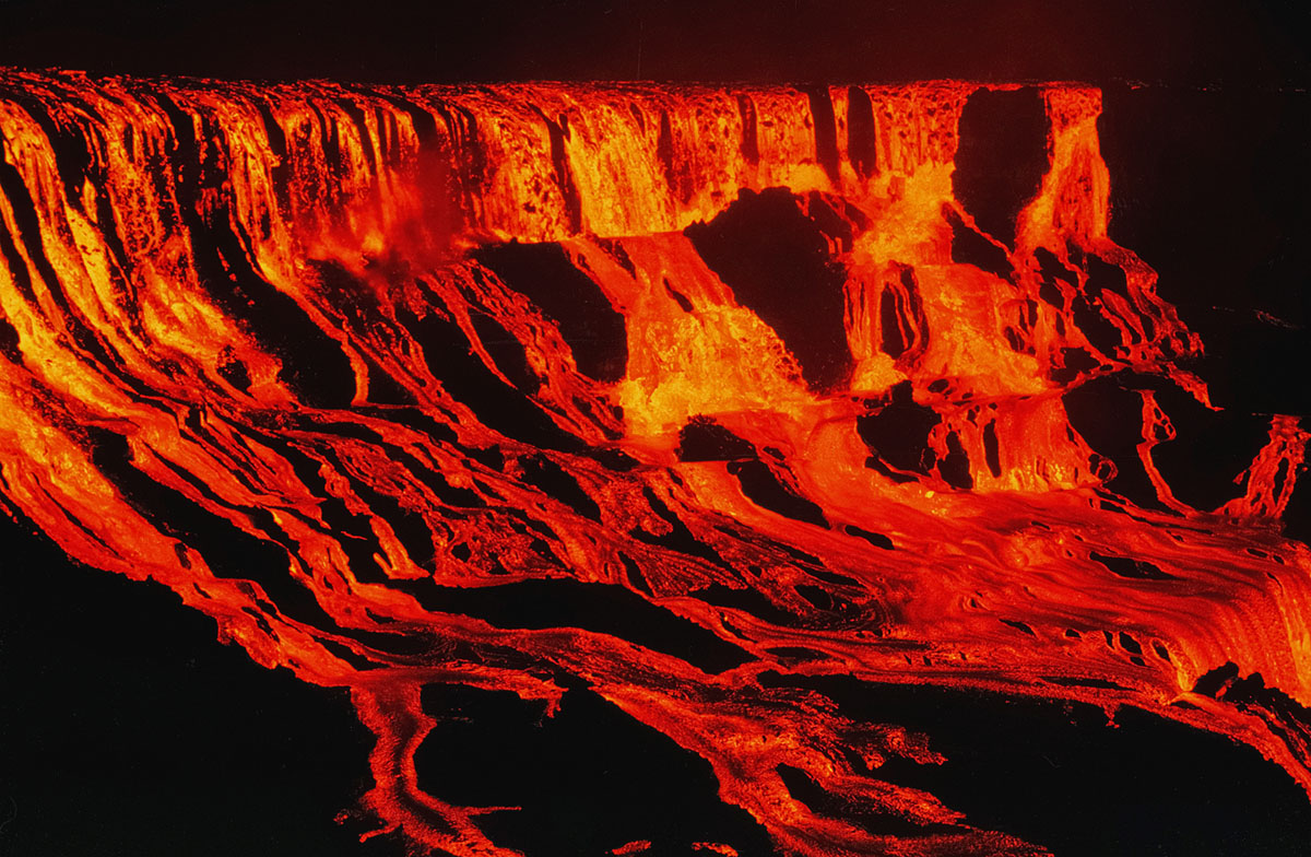
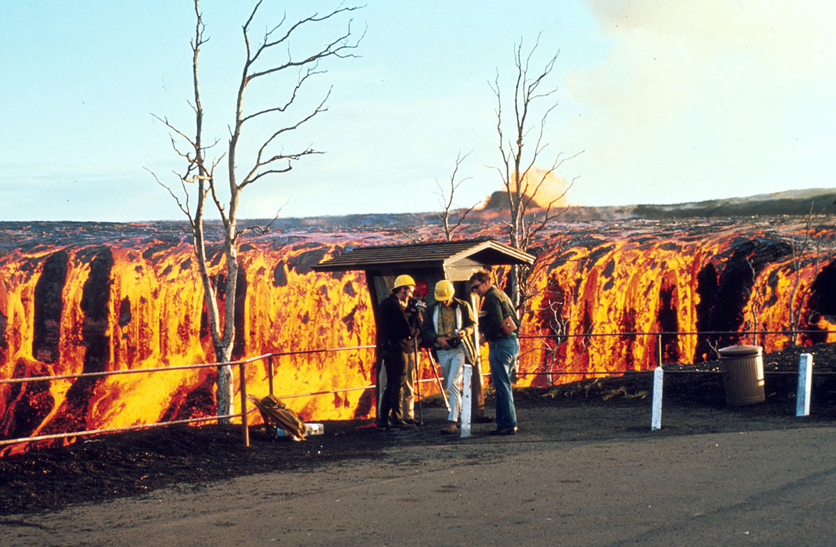
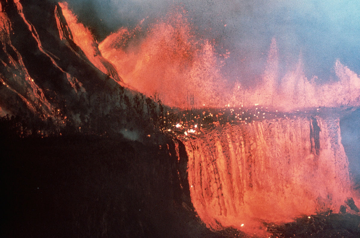
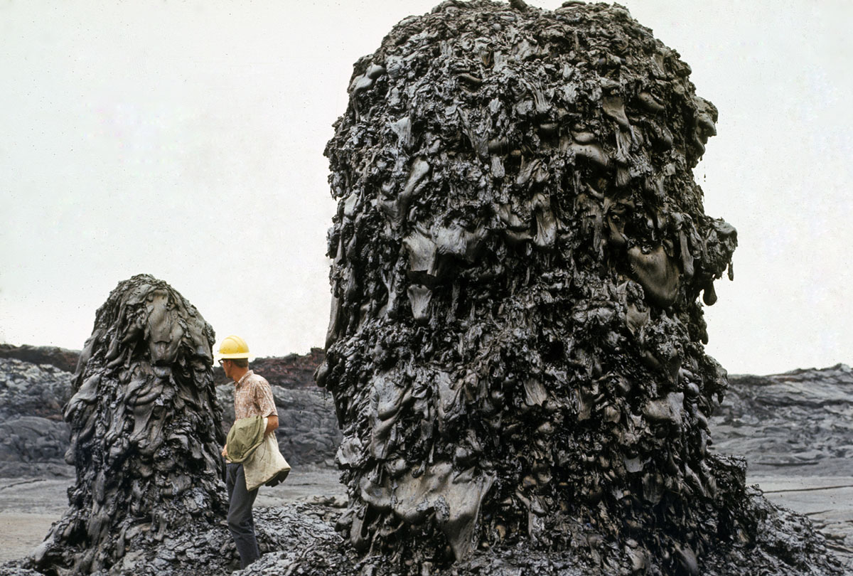
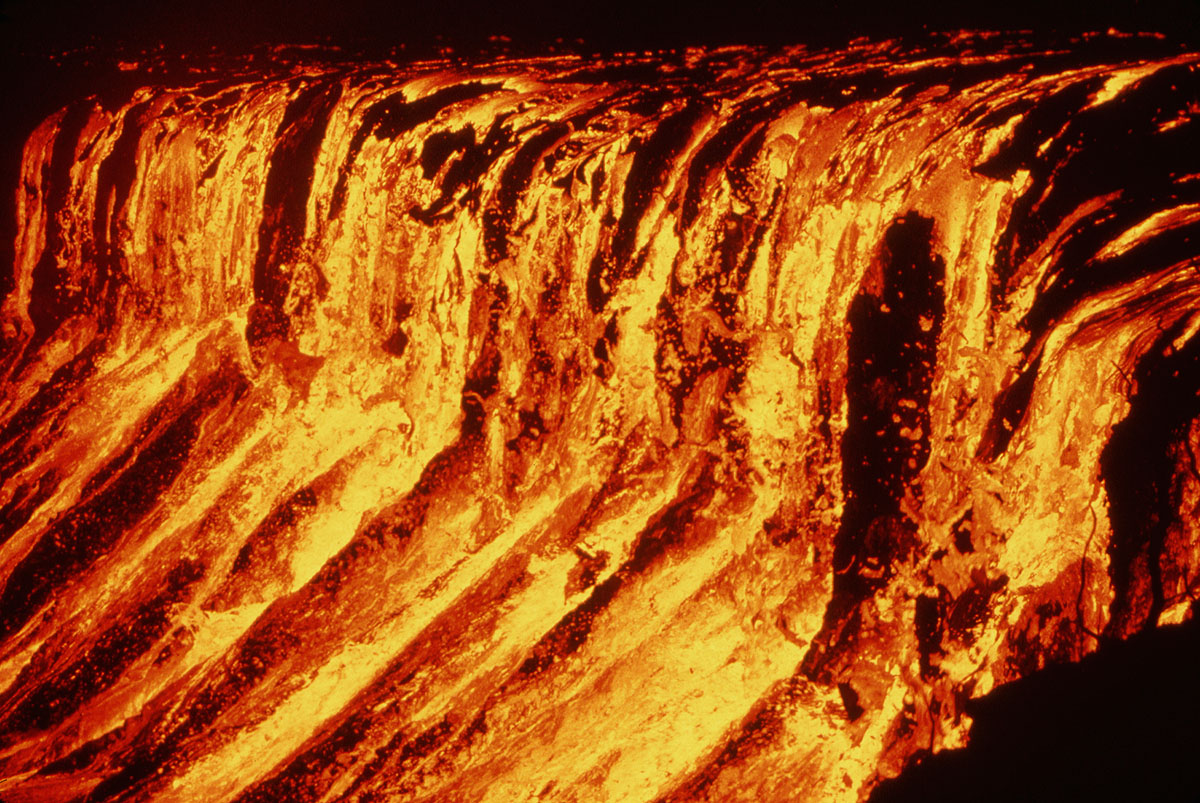
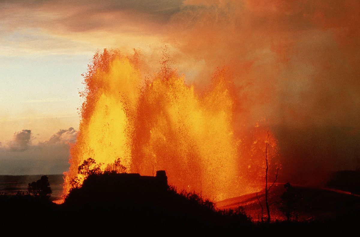
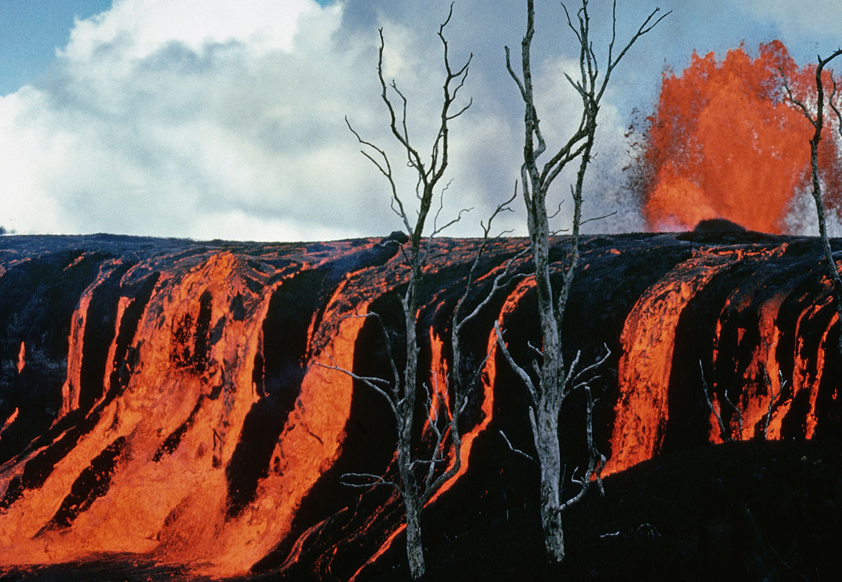
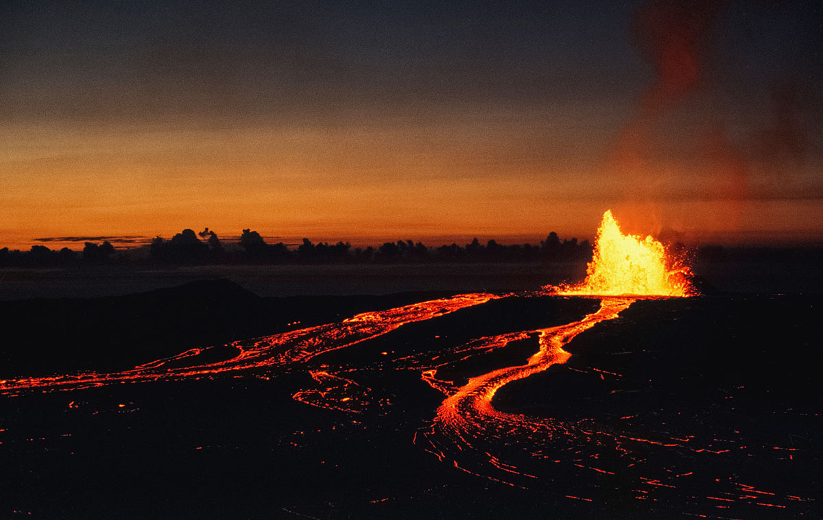
A look back at Kilauea’s spectacular Mauna Ulu eruption: amazing lava fountains, cascading lava falls, and eventually adding 230 acres of new land to Hawaii’s Big Island

1

The volcanic activity in Hawaii today is part of the ongoing Pu’u O’o eruption – the longest-duration eruption ever recorded on Kilauea. The Pu’u O’o eruption has been active, with varying levels of intensity, since January of 1983. And we don’t know how it will end! Looking back a few decades, Kilauea’s previous record-holder was the spectacular Mauna Ulu eruption, which lasted from May of 1969 until July of 1974, generating amazing lava fountains, cascading lava falls, and eventually adding 230 acres of new land to Hawaii’s Big Island. As we wait to see how these new eruptions will play out, take a moment to view some of Kilauea’s most striking photos from the Mauna Ulu eruption, which ended only 40 years ago.

kilauea eruption, 1969-1974 Mauna Ulu Eruption, Kilauea 1969-1974 Mauna Ulu Eruption, 1969-1974 Mauna Ulu Eruption pictures, 1969-1974 Mauna Ulu Eruption usgs
Lava fountain 300 m 1,000 ft) high plays from Mauna Ulu vent area, 1510 December 30, 1969. Lava flows fed by the fountain cascade into ‘Ālo‘i Crater, 600 m (2,000 ft) from the vent. The flow into ‘Ālo‘i was more vigorous before a dam near the vent diverted most of the lava southward (toward right). The fountain was the widest of the eruption and, as the color pattern shows, appears to fan outward from the vent. This was the last major fountain during the eruption. A couple of hours after the photo was taken, the wind shifted, and the black Ford station wagon, still parked in the same place, was pelted with falling pumice and needed, though never received, a new paint job. (USGS)
kilauea eruption, 1969-1974 Mauna Ulu Eruption, Kilauea 1969-1974 Mauna Ulu Eruption, 1969-1974 Mauna Ulu Eruption pictures, 1969-1974 Mauna Ulu Eruption usgs
Kilauea E. rift: Mauna Ulu, Lava fall into Alae from SW corner of crater. Lava falls higher than American Falls at Niagara begin to fill ‘Alae Crater on August 5, 1969 following the catastrophic draining on August 4. Renewed fountaining at Mauna Ulu sent lava shown in the photo into ‘Alae, starting to refill the crater. Photo taken from same location as the preceding image. The mezzanine is the lower level, and lava plunges off it into the deeper pit. The total height of the lava falls is more than 100 m (330 ft), and the width more than 300 m (1000 ft). For the two seasoned observers who witnessed this awe-inspiring event, nothing else matched it during the entire Mauna Ulu eruption. (USGS)
kilauea eruption, 1969-1974 Mauna Ulu Eruption, Kilauea 1969-1974 Mauna Ulu Eruption, 1969-1974 Mauna Ulu Eruption pictures, 1969-1974 Mauna Ulu Eruption usgs
Dome fountain of episode 10, October 10–13, 1969. Photo taken on October 11. This dome fountain is about 20 m (65 ft) high. Symmetrical dome fountains such as this are rare. (USGS)
kilauea eruption, 1969-1974 Mauna Ulu Eruption, Kilauea 1969-1974 Mauna Ulu Eruption, 1969-1974 Mauna Ulu Eruption pictures, 1969-1974 Mauna Ulu Eruption usgs
Hawaii Volcanoes National Park. 1969-1971 Mauna Ulu eruption of Kilauea Volcano. Aloi cascade with geologists in the foreground. Mauna Ulu fountain in the distance. December 30, 1969. (J.B. Judd / USGS)
kilauea eruption, 1969-1974 Mauna Ulu Eruption, Kilauea 1969-1974 Mauna Ulu Eruption, 1969-1974 Mauna Ulu Eruption pictures, 1969-1974 Mauna Ulu Eruption usgs
Hawaii Volcanoes National Park. 1969-1971 Mauna Ulu eruption of Kilauea Volcano. Slump at the edge of Alae Crater on Chain of Craters road. Photo by D.A. Swanson, June 29, 1969. (USGS)
kilauea eruption, 1969-1974 Mauna Ulu Eruption, Kilauea 1969-1974 Mauna Ulu Eruption, 1969-1974 Mauna Ulu Eruption pictures, 1969-1974 Mauna Ulu Eruption usgs
Lava cascades over a cliff at ‘Alae Crater in Hawaii. Fountains of lava tower behind the cliffs. (Photo by © CORBIS/Corbis via Getty Images)
kilauea eruption, 1969-1974 Mauna Ulu Eruption, Kilauea 1969-1974 Mauna Ulu Eruption, 1969-1974 Mauna Ulu Eruption pictures, 1969-1974 Mauna Ulu Eruption usgs
Hawaii Volcanoes National Park. 1969-1971 Mauna Ulu eruption of Kilauea Volcano. Coconut grove near Kahue Point after being surrounded by lava. Photo by D.W. Peterson, @1:35 p.m., September 21, 1970. (USGS)
kilauea eruption, 1969-1974 Mauna Ulu Eruption, Kilauea 1969-1974 Mauna Ulu Eruption, 1969-1974 Mauna Ulu Eruption pictures, 1969-1974 Mauna Ulu Eruption usgs
– Jeff Judd in front of bee hive spatter chimney, Aloi DAS “JJudd at hornito in Aloi. These spires developed on the surface of the lava fill in the crater. Since there was a fissure active in the crater on April 9, 1970, it is uncertain if these spires were true hornitos or were fed from the fissure. (USGS)
kilauea eruption, 1969-1974 Mauna Ulu Eruption, Kilauea 1969-1974 Mauna Ulu Eruption, 1969-1974 Mauna Ulu Eruption pictures, 1969-1974 Mauna Ulu Eruption usgs
Orange lava from the Mauna Ulu vent produces the Alo’i Cascade. (Photo by © CORBIS/Corbis via Getty Images)
kilauea eruption, 1969-1974 Mauna Ulu Eruption, Kilauea 1969-1974 Mauna Ulu Eruption, 1969-1974 Mauna Ulu Eruption pictures, 1969-1974 Mauna Ulu Eruption usgs
Hawaii Volcanoes National Park. 1969-1971 Mauna Ulu eruption of Kilauea Volcano. Dome fountain near Aloi Crater. Photo by D.A. Swanson, January 29, 1971. (USGS)
kilauea eruption, 1969-1974 Mauna Ulu Eruption, Kilauea 1969-1974 Mauna Ulu Eruption, 1969-1974 Mauna Ulu Eruption pictures, 1969-1974 Mauna Ulu Eruption usgs
Lava fountains at Mauna Ulu, viewed from Pu’ Huluhulu. | Location: Kilauea East Rift, Hawaii Volcanoes National Park, Hawaii, USA. (Photo by © CORBIS/Corbis via Getty Images)
kilauea eruption, 1969-1974 Mauna Ulu Eruption, Kilauea 1969-1974 Mauna Ulu Eruption, 1969-1974 Mauna Ulu Eruption pictures, 1969-1974 Mauna Ulu Eruption usgs
The Alo’i cascade, produced by lava from the Mauna Ulu vent. (Photo by © CORBIS/Corbis via Getty Images)
kilauea eruption, 1969-1974 Mauna Ulu Eruption, Kilauea 1969-1974 Mauna Ulu Eruption, 1969-1974 Mauna Ulu Eruption pictures, 1969-1974 Mauna Ulu Eruption usgs
Kilauea E. Rift: Mauna Ulu fountain and flows. 25(19) View from Pu‘u Huluhulu of renewed shield growth, January 30, 1974.
Low fountains and repeated overflows at the Mauna Ulu crater build the shield higher. Lava flows were mostly brief and short, thereby increasing the relief between the top of the shield and its base. The perched lava pond shown in the previous photo is bypassed by the two rivers. (USGS)

That was awesome… and terrifying!

Follow us: Facebook and Twitter

A Look Back at Kilauea’s Spectacular 1969 to 1974 Mauna Ulu Eruption – The Atlantic

1 Comment

  1. Why the hell do so called “Volcanologists” try to walk on hot lava. The damn stuff will do as it pleases regardless of what these fools say. As far as earthquakes, well they occur or not, the volcano blows or not, homes are lost or not. All they can do is say when an area of earth moves but they cannot say when it or what it will actually do. If SHTF, get the hell out of town.

Leave a reply

Please enter your comment!
Please enter your name here

This site uses Akismet to reduce spam. Learn how your comment data is processed.