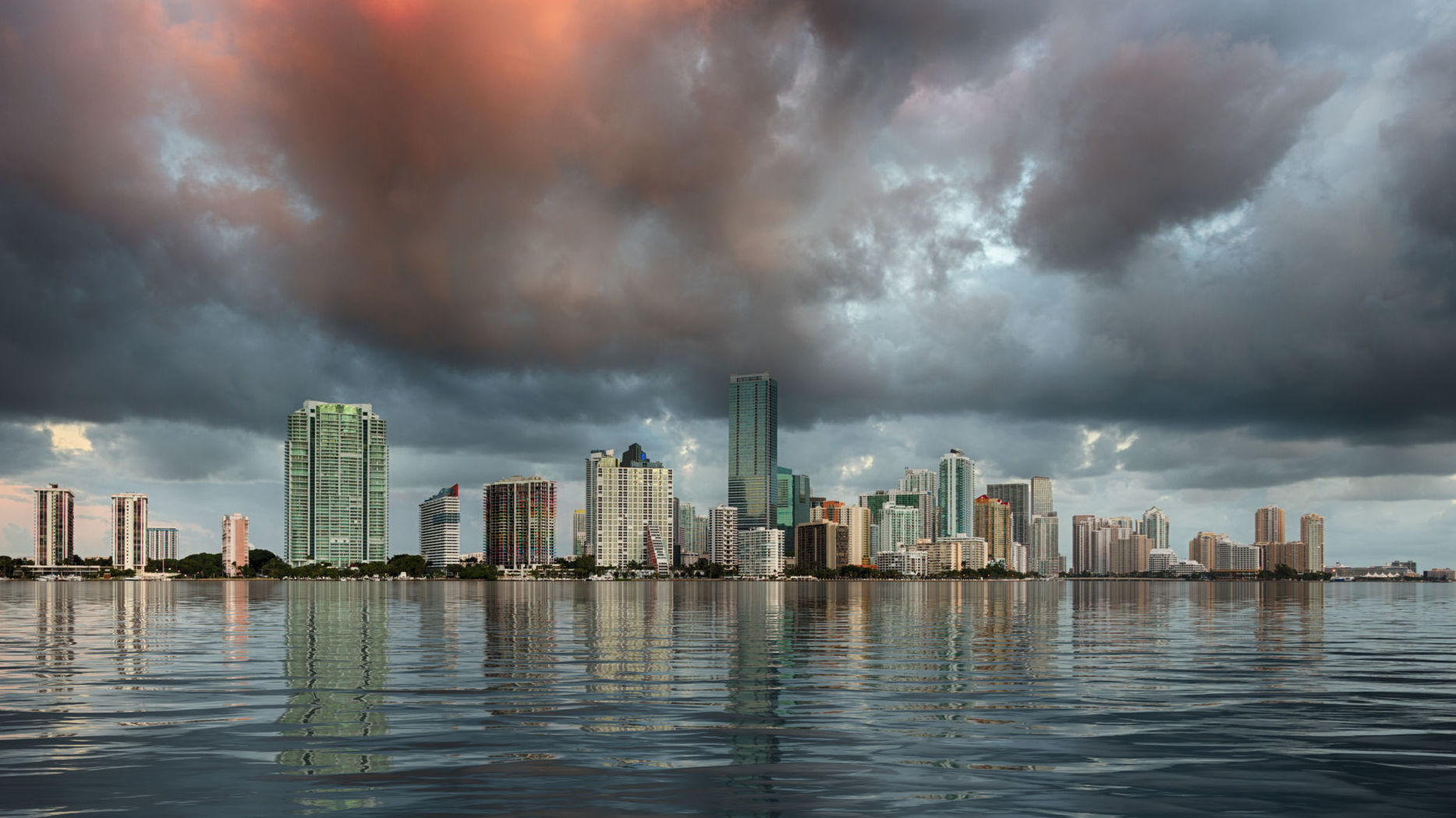
New satellite data shows that in many coastal cities around the world, land is subsiding even faster than sea level is rising. In other words, coastal cities will not disappear because of sea level rise, but because they are sinking underground…
In the next few years, Indonesia will start moving its capital city from one island, Java, to another, Kalimantan, the Indonesian part of Borneo. There are a few reasons for the move, but one of the biggest is that the country’s current capital, Jakarta, is sinking at an alarming rate. By the middle of this century, one-third of the city will be underwater.
It would be easy to mistake Jakarta’s pending demise as the work of sea level rise. Yet the city’s decline is actually being driven by another force — land subsidence spurred by groundwater extraction.
Projections of sea level rise have put a countdown on several coastal cities. But a new study shows that the combination of coastal subsidence and sea level rise acts like a welcome mat for water.
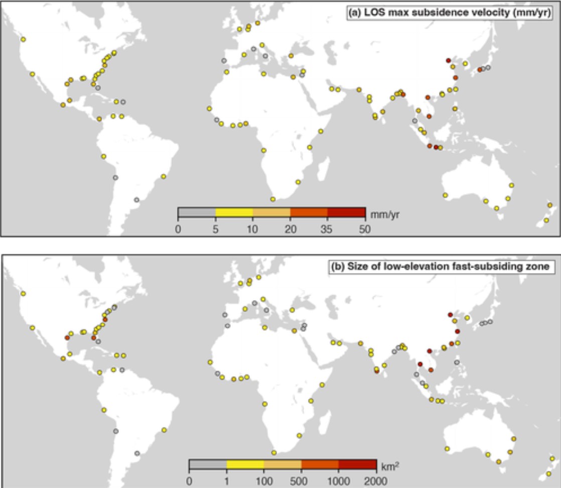
The worst affected cities are all in Asia. These cities, including Chattogram in Bangladesh, Semarang in Indonesia, and Ho Chi Minh City in Vietnam, have areas with subsidence rates of more than 20 millimeters per year, which is 10 times higher than the global mean sea level rise of two millimeters per year. In one-third of the 99 cities studied, however, at least part of the city is sinking by 10 millimeters or more per year.

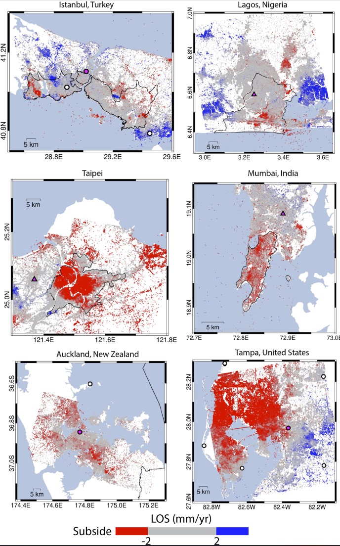
“A lot of cities are planning for sea level rise, but they are not aware of the compounding effect of coastal subsidence,” says Meng (Matt) Wei, an oceanographer at the University of Rhode Island and one of the study’s authors. For instance, he has not seen any reports of subsidence in Barcelona, Spain, but found that the airport, the port, and a residential area are all sinking faster than the sea is rising.
To see where subsidence is most likely to cause imminent coastal flooding, particularly from storm surges, the researchers focused in on rapidly sinking areas that are also low lying.
They found four cities with more than 1,000 square kilometers of land below 10 meters elevation that is sinking quickly. These four subsidence hotspots—Shanghai and Tianjin in China, Hanoi in Vietnam, and Bangkok in Thailand—are all in Asia, but they also found a further 18 cities throughout the world with between 100 and 1,000 square kilometers of fast-subsiding, low-elevation area.
There is hope, though. Around 60 years ago, parts of California were sinking fast, but that subsidence was largely curtailed through changes in groundwater management. And even Jakarta’s subsidence has been cut significantly in the past 20 years, from 280 millimeters per year to 35, though it’s still not enough to save the city.
“In Tokyo, they have had enormous problems with subsidence, but they have basically changed their complete water extraction for the city and the subsidence stopped,” says Roderik van de Wal, an expert in sea level change at Utrecht University in the Netherlands who was not involved in the research.
He says that while subsidence is an urgent issue, local measures can be effective—unlike with sea level rise, which requires global action.
A nice little article destroying the MSM propaganda! Yes, keep that in mind! Coastal land subsidence is far more dangerous than the so-called sea level rise… [HakaiMag]
StrangeSounds.org has been banned from ad networks and is now entirely reader-supported CLICK HERE TO SUPPORT MY WORK… I will send you a small gemstone if you give more than 25$… Thanks in advance!
Here some things to add to your disaster & preparedness kit:
- Protect your home and car with the best EMP, solar flares and lightning shield available…
- Drink clean water at home… Get this filter now…
- Health Ranger Store: Buy Clean Food and Products to heal the world…
- Prepare your retirement by investing in GOLD, SILVER and other PRECIOUS METALS…
- You will ALWAYS have electricity with this portable SOLAR power station…
- Qfiles is another great site for alternative news and information…

 scorches Brazil’s Rio de Janeiro")


Earthquake prone areas experiencing subsidence will have a liquefaction problem. So, when the faults slip, and it’s a biggie, well —they will all sink into a quicksand style of death.
I used to love the ocean, and deep sea fishing, but I weighed out the probability of a major earthquake, and moved over a mile above sea level into the mountains.
Jakarta is part of the beginning of big earth changes. The Indonesian plate is subducting under the plate to the north. That whole region is sinking. They have quietly move folks off some coastal areas that are now under 80 feet of water. This is also why so many floods in India. All sinking and rains can’t drain. All of India is to eventually completely sink. Very quickly as or when the pole shift happens. Also, this plate movement is making room for the New Madrid event to happen. This is why the Mississippi quit flowing for a bit a couple years ago. Why the freeway in Louisiana sank instantly and was blamed on the hurricane. Bridge out of Memphis permanently closed because spar broke due to a torque because one side of the fault shifting. Methane gas release in region. Why Hardrock hotel collapsed in New Orleans. Also, the real reason they shut down the Colonial Pipeline and blamed on hackers. The part that crosses the Mississippi has never been reopened. They barge fuel across. Signs are all there. Person just has to put them together. Get ready.
Reason why…when you place MILLIONS of TONS of concrete, asphalt, glass, steel, Humans, plastic, copper etc etc etc in one spot, the land will SINK!
Example – Manhattan Island NY. They built a HUGE city on a mud spit in between two rivers.