Tornadoes, strong winds and giant hail the size of grapefruits were reported in parts of Nebraska and Kansas Tuesday as a multi-day severe weather threat began in the central U.S., due to what is shaping up to be a classic early-May setup in the nation’s heartland.
The jet stream has now taken a southward plunge over the West, and this feature will gradually slide into the Plains states over the next several days, providing pulses of energy at roughly 30,000 feet above the ground.

This will give rise to rounds of severe thunderstorms – tornado, high winds, hail, lightning – each day and evening in parts of the Plains and Midwest through Thursday.
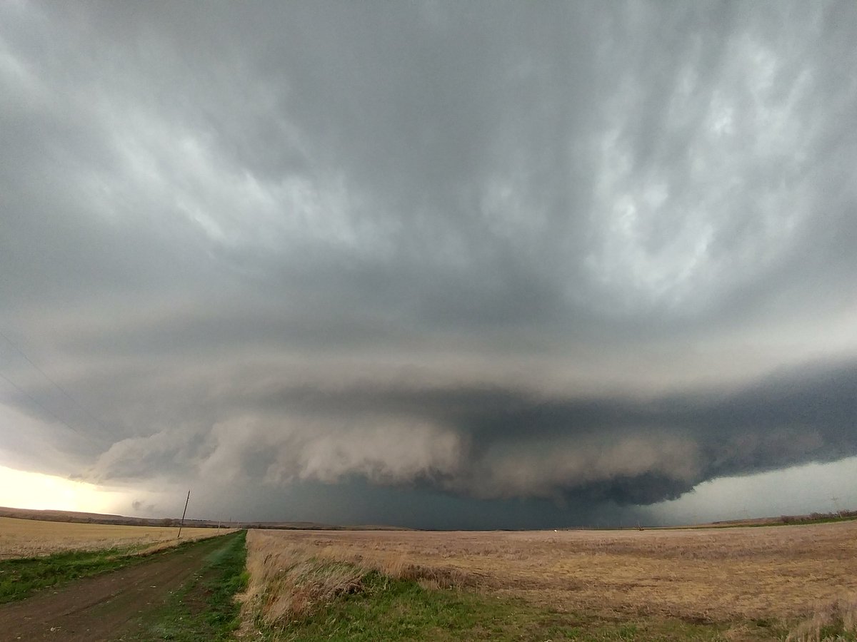
Current radar in eastern Nebraska. Plenty of T-storm Warnings and a Tornado Warning north of Wahoo.
Take shelter in that area and be prepared if this is headed your way.
Be safe, Nebraska! #newx pic.twitter.com/KT0fiOAuE3
— NEStatePatrol (@NEStatePatrol) May 1, 2018
Yesterday tornadoes:
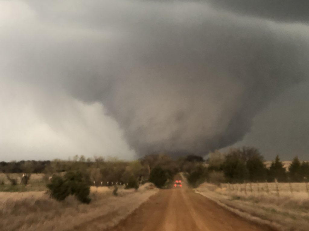
- A confirmed tornado touched down near Fairbury in southeastern Nebraska
- A second likely tornado touched down near Glasco, Kansas, and moved northeastward toward northern Kansas. The tornado crossed Highway 81 eight miles west of Aurora with several power poles snapped along its path.
AMAZING VIDEO: Watch this MASSIVE #tornado spotted in #Tescott, Kansas! The chaser that took the video says it struck a house just before the video began. No word on injuries at this time. We’ll continue to track #severe weather on-air and online. #KSwx #severeweather #kansas pic.twitter.com/57xWCh49r9
— WeatherNation (@WeatherNation) May 2, 2018
- At least one possible tornado touched down near Marquette, Nebraska, but no damage was reported.
- Another possible tornado was reported near Doniphan, Nebraska, with light damage to outbuildings reported by the Doniphan Fire Department.
- A wedge tornado caused damage to one home near Tescott, Kansas, but no injuries were reported. Several power poles were snapped at the ground in Culver by this tornado.
Video: HUGE wedge tornado just south of Tescott, Kansas and Dominator 3 intercept early in its lifecycle! Thankfully tornado remained over mostly rural terrain. Measured peak wind gust of ~125 mph #tornado @breakingweather @SeanSchofer @curtisbrooks80 @MikeTheiss @BraydonMoreSo pic.twitter.com/dzTg5wmcIY
— Reed Timmer (@ReedTimmerAccu) May 2, 2018
Yesterday high winds:
- A semi-truck was jackknifed on a highway as strong winds whipped through Wilson, Kansas. Officials shut down the eastbound lanes of the highway.
- Outbuildings in Shelby, Iowa, were destroyed or badly damaged by strong winds Tuesday. A pole barn was collapsed and grain bins were also damaged.
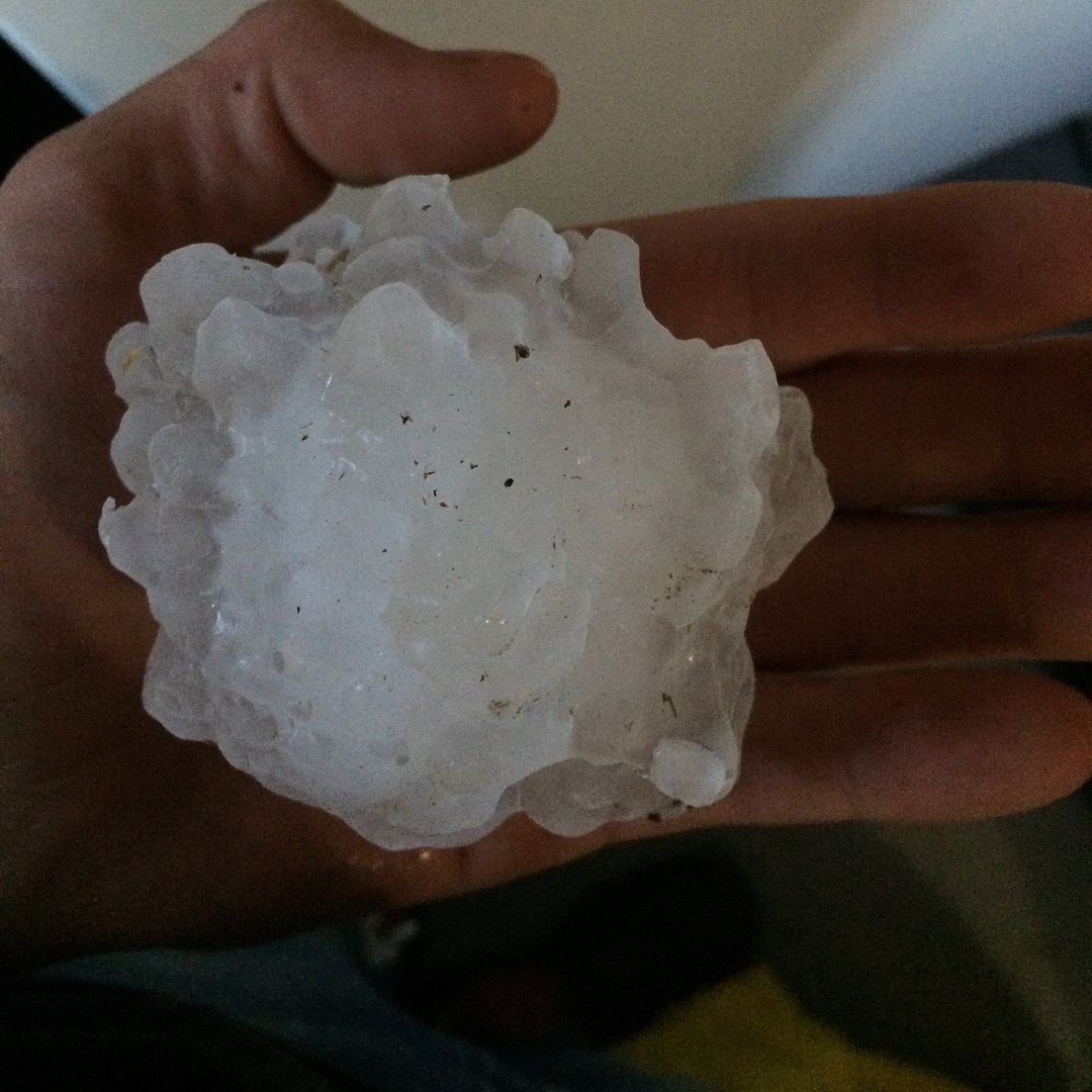
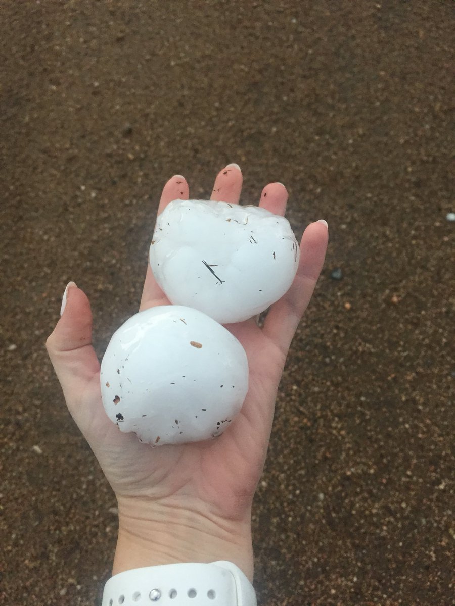
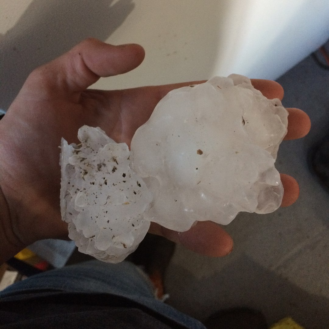
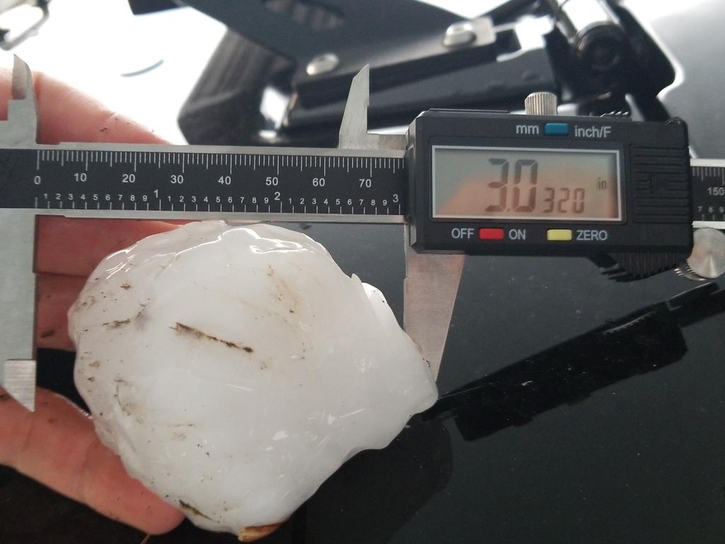
Yesterday hail:
- Some hail up to the size of a grapefruit was reported from northern Kansas to southeastern Nebraska.


What is going on there
The jet stream has now taken a southward plunge over the West, and this feature will gradually slide into the Plains states over the next several days, providing pulses of energy at roughly 30,000 feet above the ground.
To the east of that, increasingly warm and humid air is being drawn northward from the Gulf of Mexico into the Plains and Midwest.
The combination of cold, dry air aloft overlying the warm, humid air near the surface, changing wind speed and direction with height known as wind shear and sources of lift such as frontal boundaries and the dryline is a classic spring pattern for severe weather in the Plains states.
This will give rise to rounds of severe thunderstorms each day and evening in parts of the Plains and Midwest through Thursday. Get prepared!
Follow us: Facebook and Twitter
Damage, Tornadoes Reported in Nebraska as Severe Weather Ramps Up in Midwest
 scorches Brazil’s Rio de Janeiro")


