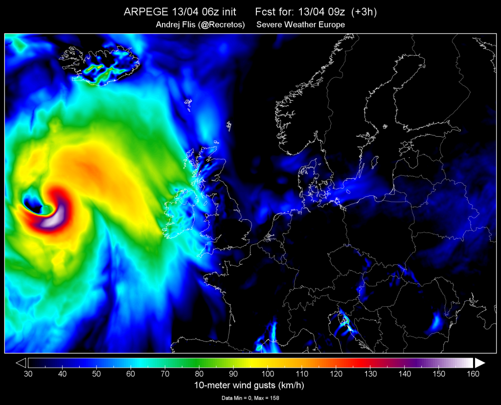
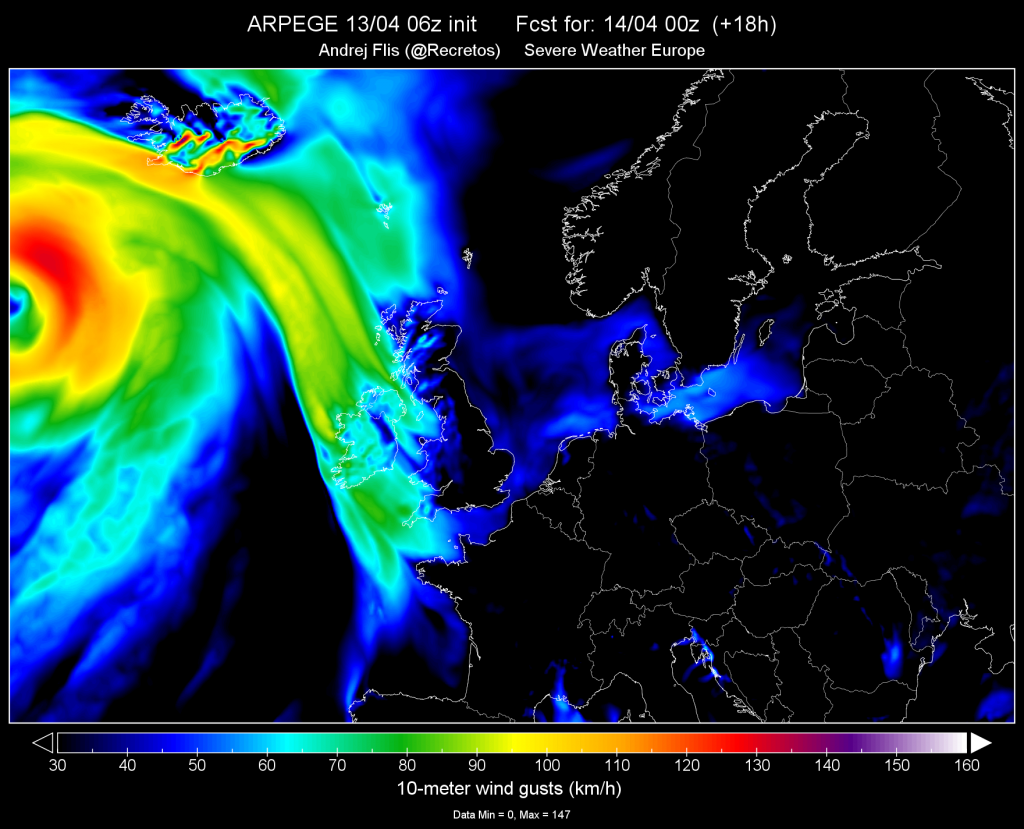
It seems that those rapidly intensifying storms called ‘Bomb Cyclones’ become the new NORMAL in the last weeks. After wreaking avoc in the US midwest, a new spectacular deep 955 mbar ‘bomb cyclone’ is rapidly developing over the N Atlantic today, moving north towards Greenland W of Iceland. The new ‘hurricane’ is expected to produce severe to extremely severe winds locally.
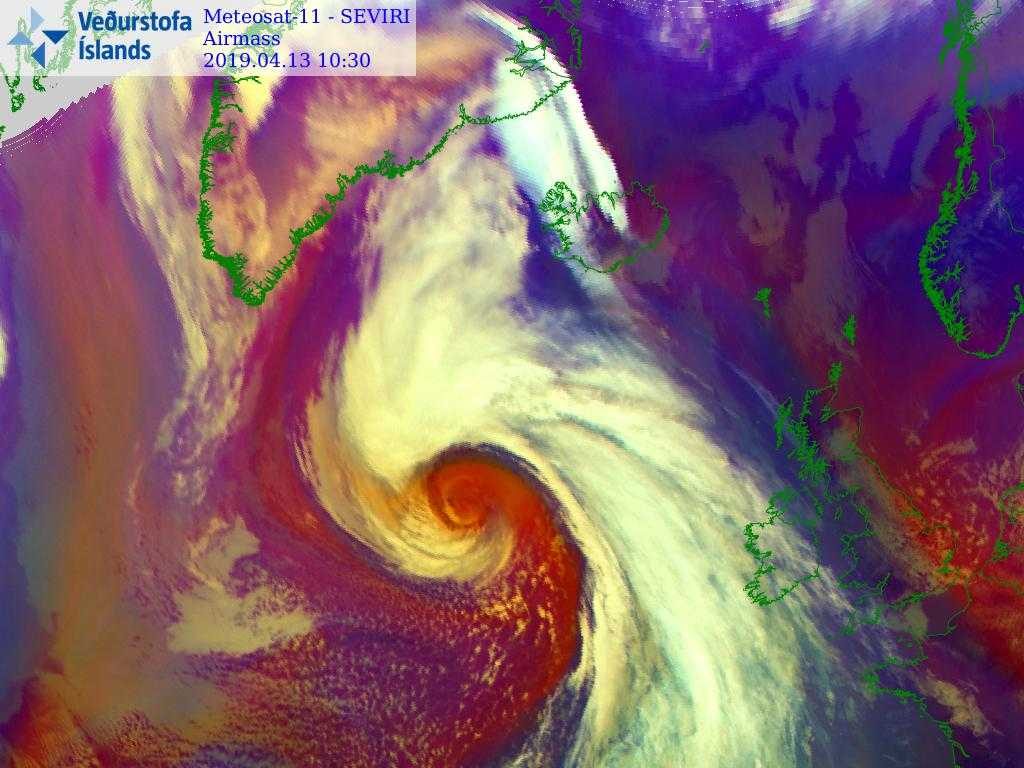
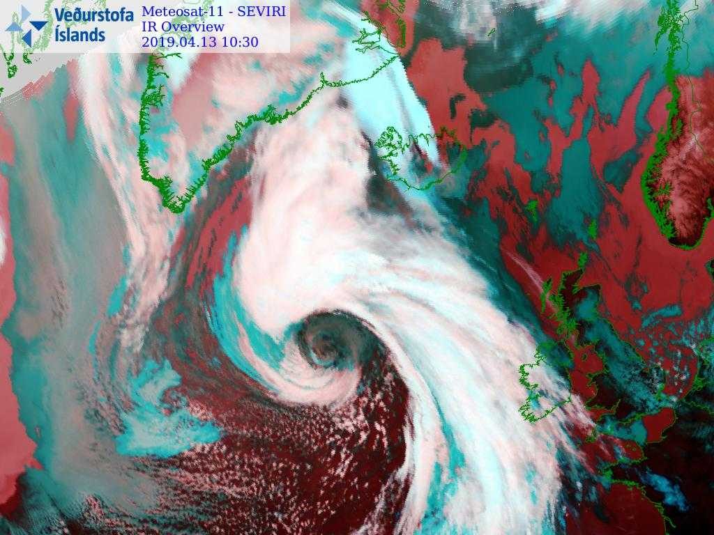
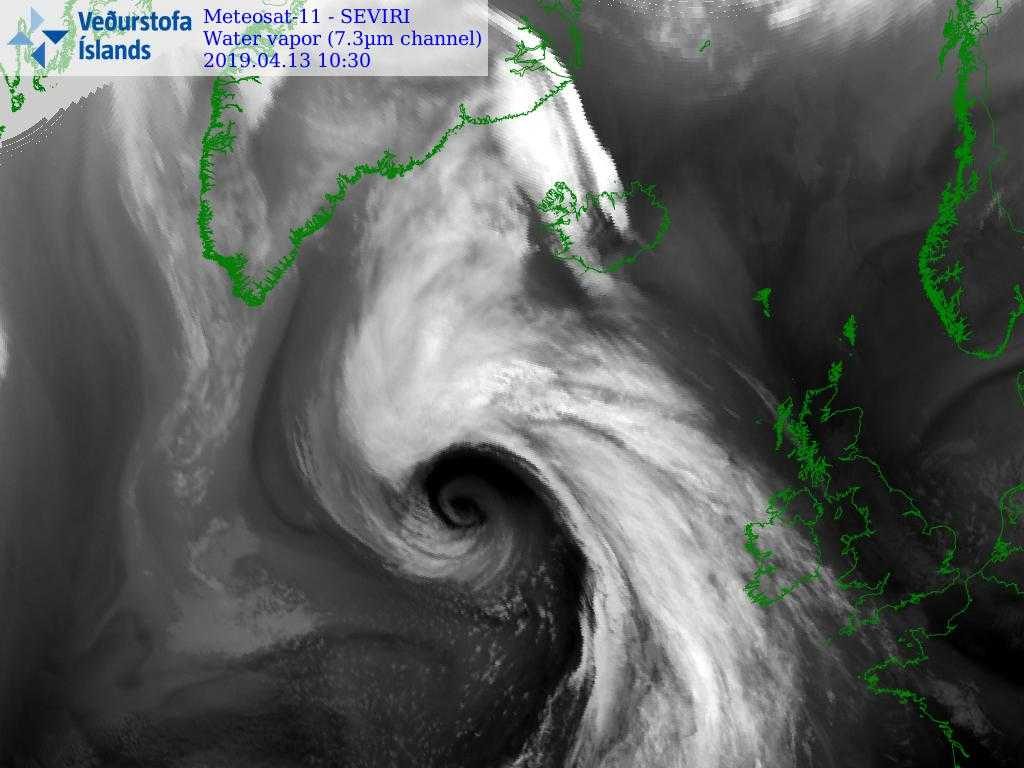
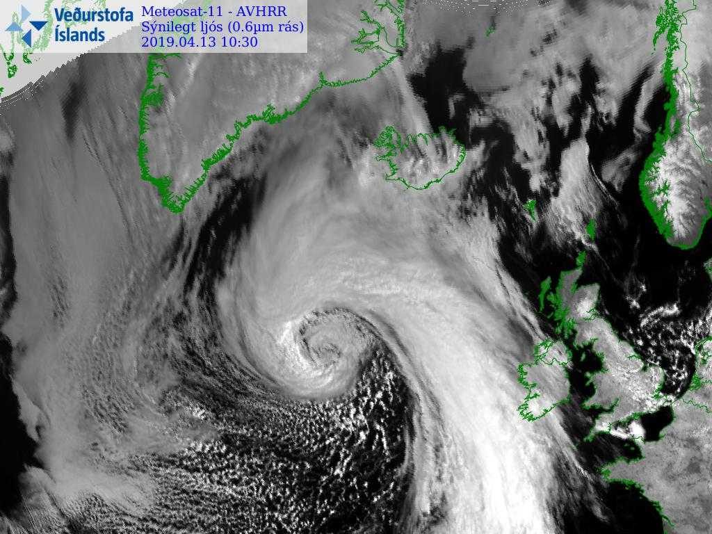
ARPEGE model shows the wind field of the strong cyclone that is moving towards Greenland, W of Iceland. Wind gusts are forecasted to exceed 130-140 km/h over the Iceland highlands. Some models forecast wind gusts over 190+ km/h.
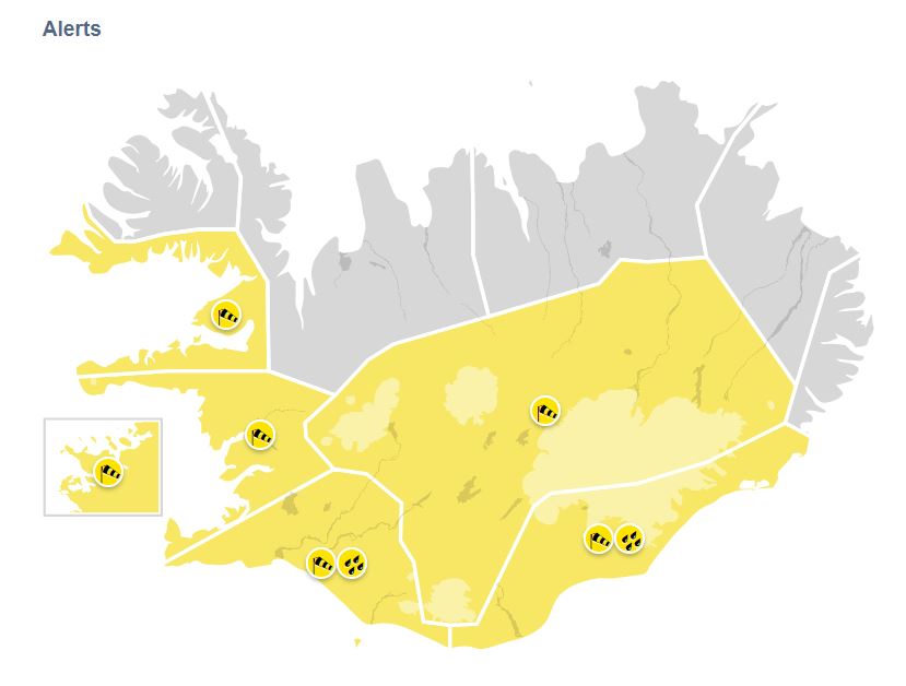
Vedur.is issued powerful wind and rainfall alerts for over the week-end.
Be careful if you are in this area of the globe!
Follow us on FACEBOOK and TWITTER. Share your thoughts in our DISCUSSION FORUMS. Donate through Paypal. Please and thank you
[Vedur]


