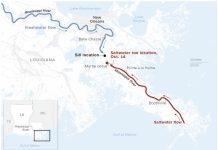
The southernmost portion of Southeast Alaska, the state’s wettest region, including Ketchikan, Prince of Wales Island, Wrangell and Metlakatla, has been in a drought for the last two years.
Last week, though, the drought was updated to a D3, or “extreme” drought, the second-highest category the U.S. Drought Monitor measures. It’s the first time those conditions have ever been recorded in Alaska, according to the Drought Monitor.
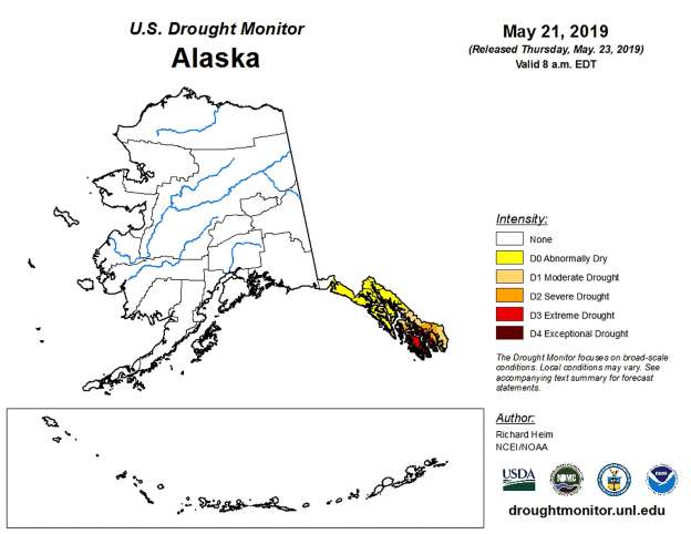
Meanwhile, areas experiencing lesser “severe” and “moderate” droughts on the Panhandle have expanded, the Drought Monitor said.
Droughts look different in the rainforest climate of Southeast Alaska than elsewhere in the world, though, with the key difference being that the region is still getting quite a lot of precipitation by most standards, Thoman said.
Ketchikan has averaged about 100 inches annually since 2017, and Metlakatla has seen between 80 and 90, climatologists say. “In the mass amount of the world that would be an immense amount of rain,” Thoman said. However, that’s still drastically less than what’s normal for the region.
Ketchikan normally averages 150 inches of precipitation a year, and Metlakatla 118. This year, Ketchikan has seen about 5 inches less precipitation than it normally does by this time of year, according to data from the National Weather Service.
Part of SEAK has been categorized as being in an “extreme drought” & a first for AK on the National Drought Monitor However, the current situation is NOT unprecedented & has lasted much longer in past episodes. #akwx #SEAKDrought .@KTOOpubmedia .@KRBDRadio .@KSTKradio .@KFSK1 pic.twitter.com/FgUu91fYH8
— NWS Juneau (@NWSJuneau) May 23, 2019
Cause of the drought
As for the cause of the drought, Thoman said the storm paths are the culprit. Within the last two years, storm systems have tended to move west toward the Bering Sea or curve south toward the Pacific Northwest, taking their rain and snow with them, he said.
Although this week represents the first time an “extreme” drought classification has ever been recorded in Alaska, it’s likely not the first the region has ever seen, climatologists caution. Similar deficits were measured in the early 1990s — before the U.S. Drought Monitor was established — and episodically throughout the 2000s, Thoman said.
That’s largely because drought classifications are relative, Thoman said, and they take into account not only the precipitation deficit but also the social impact that deficit has on community members. Historically, that impact has been measured in terms of what’s typical in the Lower 48.
The National Integrated Drought Information System, for example, classifies “extreme” droughts in part as having “major crop/pasture losses,” something that’s less of a concern in Southeast Alaska than elsewhere in the country. “All of the tools to analyze this are tied to what’s important in the Lower 48, with that agricultural focus,” Thoman said.
Impacts of the extreme drought
In Southeast, some of the biggest impacts are on power rather than agriculture. Residents of the region rely primarily on hydroelectric power for electricity. With reservoir levels receded, some communities have had to switch to backup diesel generators, which are more expensive and ratchet up residents’ electric bills.
Ketchikan Public Utilities urged its customers this week to cut back on their electricity usage to make up the costs.
Some communities have even had to ration their water supply, like Wrangell, which cautioned its residents in March that there was only one month’s supply of water left in the city’s reservoirs.
The social impacts of this most recent drought are more severe than what the region has experienced in past droughts, even when the lack of precipitation was similar, Thoman said.
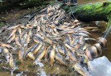
The drier conditions have also caused ecological damage, including an increase in insect pests like the saw fly, damage to coastal foliage and warmer stream temperatures that may inhibit salmon spawning, climatologists said.
At this point, climatologists don’t know how long the drought will last, Thoman said. He noted, though, that over the next several decades, data suggest the region should see more precipitation, not less.
And then the fires will rage!
Follow us on FACEBOOK and TWITTER. Share your thoughts in our DISCUSSION FORUMS. Donate through Paypal. Please and thank you
[adn]


