A winter storm will affect over 90 million Americans as it travels from Texas to Maine, dropping rain, freezing rain and snow, causing numerous power outages and travel delays.

Winter Storm Landon will spread a mess of snow, sleet and freezing rain from the Rockies to the Plains, Midwest and parts of the Northeast through Friday.
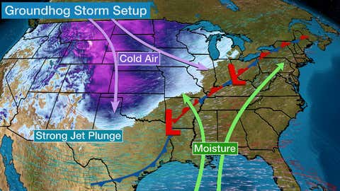
A fresh supply of arctic air is moving into the nation’s midsection as a sharp, southward plunge of the jet stream carves into the western and central U.S, pulling increasing moisture northward over the cold air. When this setup happens in mid-winter, it can deliver a widespread area of snow and ice that affects multiple regions over the course of several days.

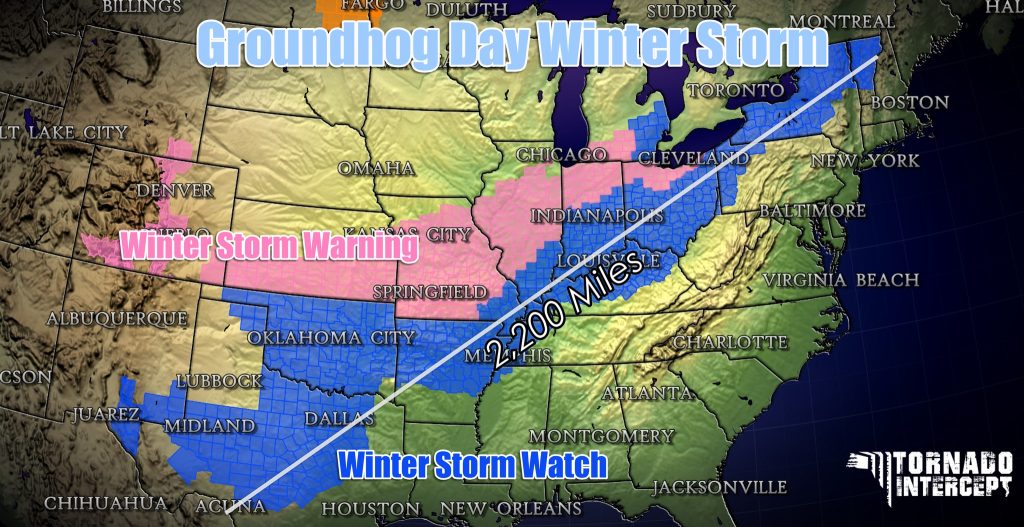
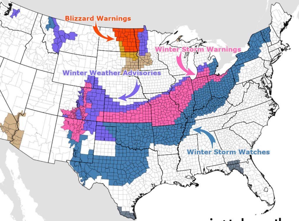
Illustrating the widespread nature of this storm is the fact that winter storm warnings, winter storm watches and winter weather advisories have been issued by the National Weather Service for an area that stretches from Colorado and New Mexico to Maine. That’s a distance of over 2,000 miles as the crow flies.
Travel will become hazardous because of snow, sleet and/or freezing rain on one or multiple days in these regions through the end of the week. Areas that see significant icing could have at least some power outages and tree damage, especially from parts of eastern Oklahoma into the Ozarks and portions of the mid-Mississippi and Ohio valleys.

(Issued by the National Weather Service.)
To compound all this, the fresh cold air sweeping in during and behind the storm could leave roads treacherous well after the storm is over, given forecast lows into at least the teens into parts of north Texas and the single digits or colder in the central Plains and Midwest.
If you have travel plans in these areas, be prepared to postpone or cancel them.
Here is our latest forecast timing followed by the expected snow and ice accumulations for this storm. Check back to weather.com and The Weather Channel app for important forecast updates in the next couple of days.
Forecast Timing
Tuesday night, snow, sleet and freezing rain are expected to become widespread
On Wednesday, Groundhog Day, this wintry mess will stretch from the Rockies into the Plains and parts of the Midwest and Great Lakes, with heavy snow in spots. This snow, sleet and ice will extend as far south as Oklahoma and western Texas. Rain will change to freezing rain and slicken travel in the Dallas-Fort Worth and Little Rock metro areas Wednesday night.

On Thursday, snow, sleet and freezing rain may persist as far south as central and West Texas, Arkansas, western Tennessee and northwestern Mississippi, extending into the Ohio Valley and Great Lakes as rain falls over much of the Interstate 95 Northeast urban corridor. Snow, sleet and freezing rain will spread into the interior Northeast, from northwest Pennsylvania to western, central and upstate New York to northern New England.
A few snow showers may linger Thursday night from Oklahoma into the Ozarks before the storm ends, there. Snow, sleet and freezing rain will continue across a broad area through the overnight hours from the Ohio Valley to much of the interior Northeast.

The final stage of this storm will unfold in the Northeast on Friday.
As the cold front finally sweeps through, rainfall in parts of the Northeast rain may change to a bout of snow and ice as far east as southern New England and the New York tri-state area. However, it’s too early to say whether this might impact travel in these areas.
Much of the precipitation from the storm should be winding down on Friday night.

Snow, Ice Forecast
Snow
Many areas could pick up at least 6 inches of snow along the path of Landon, from the Southern Rockies and Plains into the Midwest and northern New England, including Kansas City, St. Louis, Chicago (especially south side), Indianapolis, Cleveland, Detroit, Buffalo and Burlington, Vermont. Some locations could see up to a foot (locally higher) of snowfall.
At least some light snow accumulations are possible as far south as parts of Texas.

Ice
Freezing rain could accumulate on roads, tree branches, power lines and other surfaces from portions of northern and central Texas and eastern Oklahoma into the Ozarks, mid-Mississippi and Ohio Valley and Northeast.
In some areas, there could be enough ice to break tree branches and knock out power. Right now, that potential is highest in the locations shaded darker purple in the map below, including an area from the Mid-South (northeast Arkansas, far western Tennessee) to the lower Ohio Valley.
All other locations could see at least enough of an ice coating to pose a threat of hazardous travel. However, some scattered power outages and broken tree limbs cannot be ruled out in these areas too, including as far south as north-central Texas and into the interior Northeast, from Pennsylvania to parts of the New York City tri-state to New England.

[Weather]
Subscribe to Galileyo
Galileyo is a new Information Distribution Platform that gathers uncensored information from our proprietary global information sources and delivers that information to you, regardless of the situation on the ground, via global Satellite Phone Networks.
Subscribe to Galileyo
Support my work
If you follow my website StrangeSounds.org, you already know that my site has been banned from ALL ADS NETWORKS! So now I really count on you and your donations to keep Strange Sounds up and running! Support my work and family. Thank you for your help!
Paypal Donation Link
If you use Amazon, you can also use our link below, to enable us getting a small affiliate revenue. Thanks again!
Support Us With Amazon
Or if you enjoy natural health products, I recommend Natural Health Source:
Support Us With Natural Health Source
Finally, you can also subscribe to this blog to get more amazing news curated just for you right in your inbox on a daily basis.
Subscribe to my Newsletter
You should really subscribe to QFiles. You will get very interesting information about strange events around the world.
 QFiles
Thank you, Manuel


