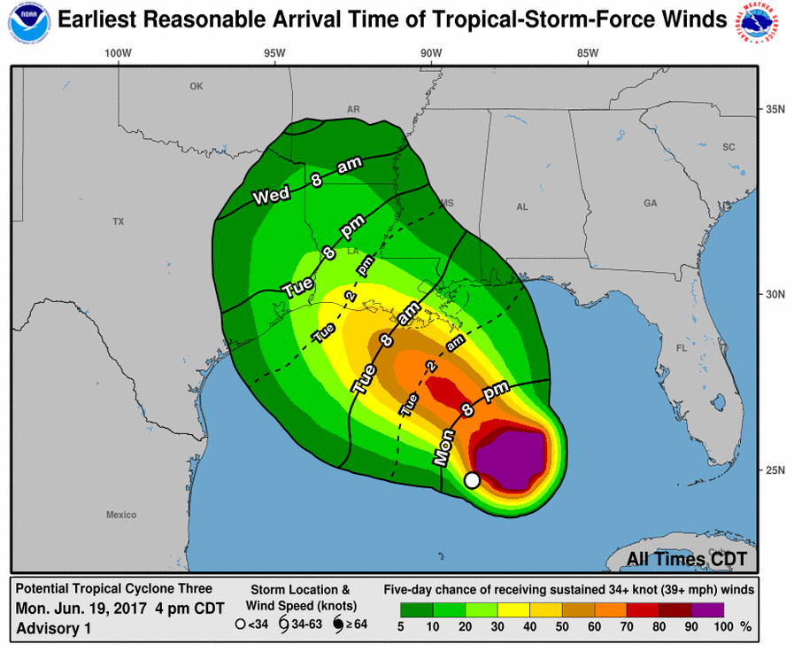
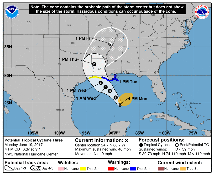
NHC is issuing advisories on Potential Tropical Cyclone Three, located over the Gulf of Mexico about 305 miles (490 km) south of the mouth of the Mississippi River.
A Tropical Storm Warning is in effect for the Louisiana coastline from Intracoastal City to the Mouth of the Pearl River, and a Tropical Storm Watch is in effect from west of Intracoastal City to High Island.
On the forecast track, the disturbance will move toward the Louisiana coast on Tuesday and Wednesday.

Tropical storm conditions are expected to first reach the coast within the warning area on Tuesday. Tropical storm conditions are possible in the watch area on Wednesday.
Total rain accumulations of 4 to 8 inches with isolated maximum amounts of 10 inches over southeastern Louisiana, southern Mississippi and Alabama, and the western Florida Panhandle through Wednesday evening.

Maximum sustained winds are near 40 mph (65 km/h) with higher gusts. Some slight strengthening is possible before the system reaches the coast.
Get prepared for the worst… It’s always better to have more than not enough!


