A series of strong earthquakes rattled Hila, Indonesia within 20 minutes on October 31, 2017.
It all started at 11:31 with a M5.9 earthquake 47km WSW of Hila, Indonesia. The M5.7 earthquake hit 3 minutes later, before the strong and shallow M6.3 earthquake hit at 11:51 at a depth of 32.4km (20.1mi).
Here the epicenter’s map of the M6.3 earthquake:
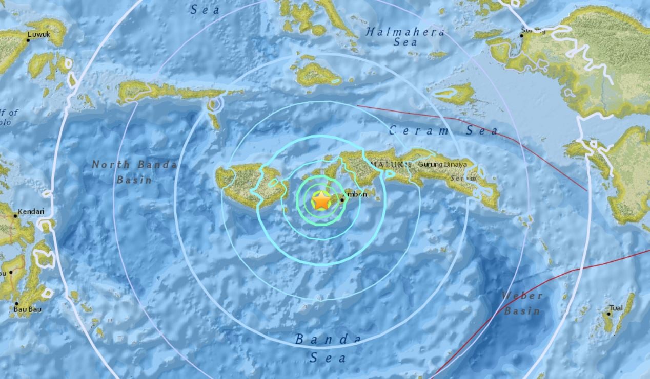
Here the three strong earthquakes that hit Hila within 20 minutes on October 31, 2017:
M 5.9 – 47km WSW of Hila, Indonesia
M 5.7 – 53km WSW of Hila, Indonesia
M 6.3 – 32km WSW of Hila, Indonesia
This is the second quake with a magnitude >6.0 today, after a M6.8 earthquake hit New Caledonia at around 00:40 on October 31, 2017.

Looking at the USGS map, it seems that the seismic activity is gaining in activity today, with 2 earthquakes with a magnitude higher than M6.0 and at least 5 earthquake with magnitudes higher than M5.5 with 2 hours of monitoring:
M 6.8 – 137km E of Tadine, New Caledonia
M 5.9 – 105km E of Tadine, New Caledonia
M 5.8 – 65km NE of Hihifo, Tonga
M 5.9 – 47km WSW of Hila, Indonesia
M 5.7 – 53km WSW of Hila, Indonesia
M 6.3 – 32km WSW of Hila, Indonesia
M 5.7 – 38km WSW of Amahusu, Indonesia
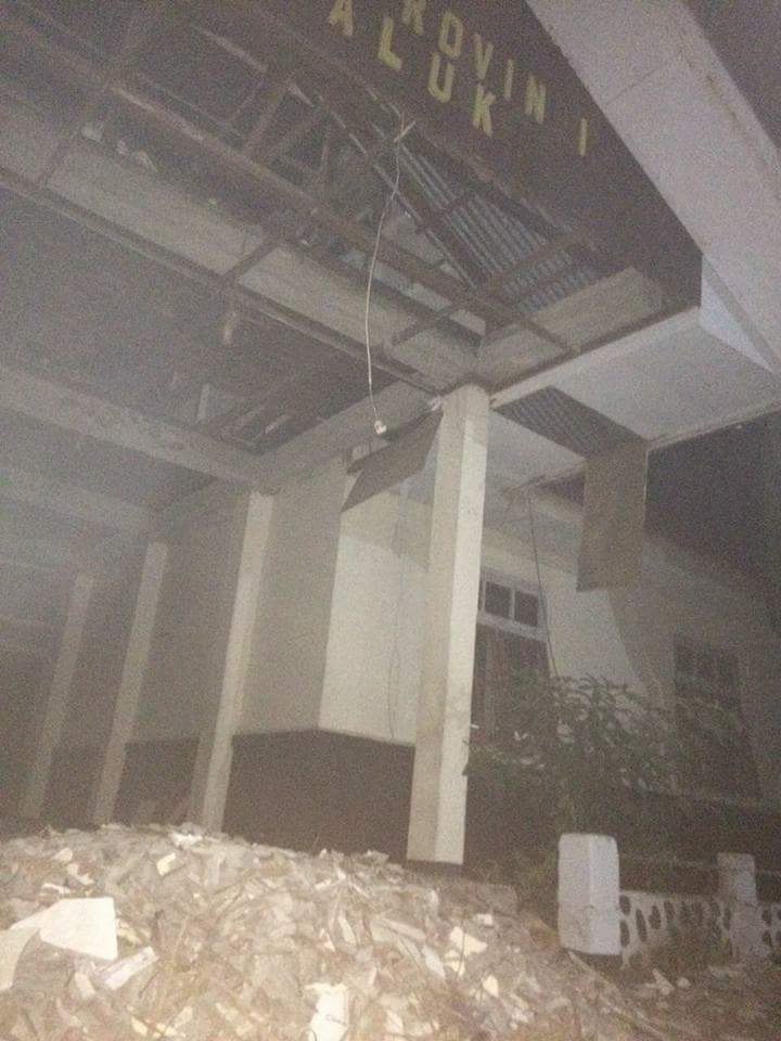
Pretty impressive I would say! Here the first pictures of the damages triggered by the earthquakes in Indonesia:


Keep safe and get ready for the next big one in your area.


