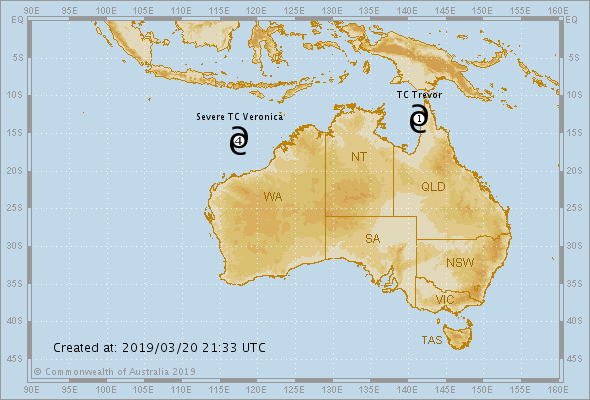
In less than 24 hours, Veronica went from an unnamed tropical low to a Category 4 intense tropical cyclone as it spun off the northwestern coastline of Western Australia. Further strengthening is expected as Veronica turns southward toward the Australia coastline in the coming days.
Video shows current state at 11 am AWST, Wednesday 20 March 2019:
Beyond Friday, two scenarios are possible for Veronica’s path. In Scenario A, the storm continues to track southward into Australia with life-threatening impacts.
In Scenario B, Veronica will take a westward turn prior to reaching the coastline, sparing communities the worst impacts from Veronica.

If Scenario A occurs, the cyclone will make a direct landfall along the northern coastline of Western Australia somewhere between Pardoo and Onslow, with locations such as Karratha and Port Hedland at risk for the worst impacts.
If Scenario B occurs, there will still be a risk for some impacts to Western Australia; however, coastal communities will avoid the worst of Veronica’s wind and rain.
Western #Australia is being put on alert for potential impacts from rapidly strengthening Tropical Cyclone #Veronica: https://t.co/Ow7tmqMn60 pic.twitter.com/AbgmiJEKlX
— AccuWeather (@breakingweather) March 21, 2019
Anyone in Veronica’s potential path should make preparations for the storm now and check back updates in the coming days.

Know your weather. Know your risk. Check BOM for the latest cyclone advice and warnings, and follow advice from your local emergency services.

Get prepared for Tropical Cyclone Veronica NOW!
Follow us on FACEBOOK and TWITTER. Share your thoughts in our DISCUSSION FORUMS. Donate through Paypal. Please and thank you
[BOM]


