Bomb cyclone after Bombogenesis and explosive cyclogenesis…
Is that the new normal for Alaska?
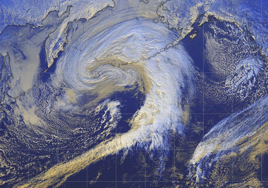
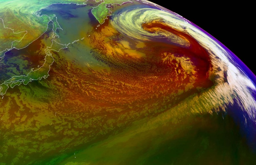
Just five days after a violent North Pacific cyclone exploded in a vicious winterstorm in Alaska, another extra-tropical cyclone is undergoing Bombogenesis. But it’s not just a Bomb… No, it’s a double bomb cyclone, after its center pressure dopped by more than 59 mbar in 48 hours!
TPW2 over the Pacific Ocean depicts the #AtmosphericRiver that has been drenching #Washington & fueling snow in Olympic & Cascade mountains this weekend. Meanwhile an enormous & deep low pressure storm is impacting Alaska’s Aleutian islands. #WAwx #AKwx https://t.co/aBJf3yVi7l pic.twitter.com/iJpfiMGWvx
— UW-Madison CIMSS (@UWCIMSS) February 1, 2020
Pretty amazing video isn’t it. And in the next tweet, windspeed of more than 90mph measured!
This 948 mb North Pacific storm takes the cake right now. Winds gusting to 90 mph in heavy snow at Cape Newenham Airport, Alaska.
— Greg Postel (@GregPostel) February 2, 2020
PAEH 021555Z AUTO 11044G78KT 020V150 1/2SM +SN FG VV006 M01/M03 A2921 pic.twitter.com/DlUiPKs65P
The first rapid cyclogenesis took place south of Kamchatka peninsula on January 31, 2020:
- 1005 mbar at 00 UTC, Jan. 31
- 994 mbar at 06 UTC, Jan. 31
- 987 mbar at 12 UTC, Jan. 31
- 978 mbar at 18 UTC, Jan. 31
- 967 mbar at 00 UTC, Feb. 1
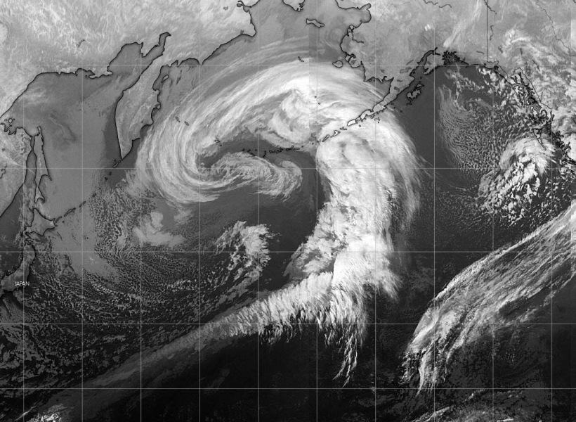
The second rapid intensification happened on February 1, 2020 as the system was growing in power towards the Aleutian Islands (Alaska) and the Bering Sea:
- 978 mbar at 18 UTC, Jan. 31
- 967 mbar at 00 UTC, Feb. 1
- 955 mbar at 06 UTC, Feb. 1
- 948 mbar at 12 UTC, Feb. 1
- 946 mbar at 18 UTC, Feb. 1
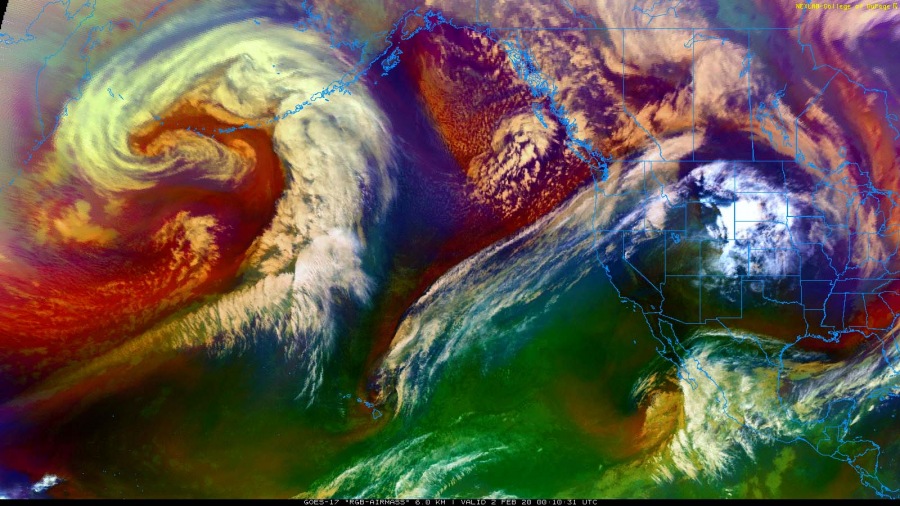
When taking all the data together (from the beginning of the storm on January 31, 2020 to the end of the rapid cyclogenesis on February 1, 2020), there is an amazing drop of 59mbar of the center pressure. That’s indeed a Rare Double Bomb Cyclone!
- 1005 mbar at 00 UTC, Jan. 31
- 994 mbar at 06 UTC, Jan. 31
- 987 mbar at 12 UTC, Jan. 31
- 978 mbar at 18 UTC, Jan. 31
- 967 mbar at 00 UTC, Feb. 1
- 955 mbar at 06 UTC, Feb. 1
- 948 mbar at 12 UTC, Feb. 1
- 946 mbar at 18 UTC, Feb. 1
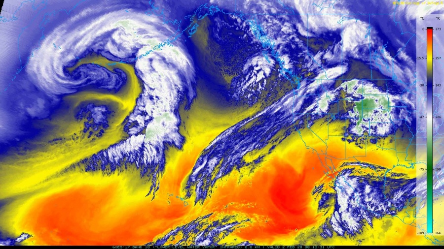
Although the cyclone has stopped growing in power, it is still growing in size!
Here some news about this new storm wave in Alaska:
This 948 mb North Pacific storm takes the cake right now. Winds gusting to 90 mph in heavy snow at Cape Newenham Airport, Alaska.
— Greg Postel (@GregPostel) February 2, 2020
PAEH 021555Z AUTO 11044G78KT 020V150 1/2SM +SN FG VV006 M01/M03 A2921 pic.twitter.com/DlUiPKs65P
ASCAT #SatWinds (2nd image) help the illustrate the size, structure, and expansive wind field of a deep low pressure centered just SW of the Aleutian Islands this morning, at last analysis at 946 mb. #MarineWx #AKwx pic.twitter.com/oiGYGC3qvx
— NWS OPC (@NWSOPC) February 2, 2020
The rapid intensification of a W Pacific low pressure system approaching the Aleutian Islands and Bering Sea, as seen via Himawari RGB air mass imagery. Primary marine hazards continue: #storm force winds to 60 kt, freezing spray, and seas well in excess of 30 ft. #MarineWx pic.twitter.com/wC7TG9vYll
— NWS OPC (@NWSOPC) February 1, 2020
Low pressure expected to rapidly intensify en route to the Aleutian Islands over the next 24 hours, forecast to deepen below 950 hPa by Feb 1. The expansive low is expected to produce widespread #gale and #storm force winds with seas building in excess of 35 ft. #MarineWx pic.twitter.com/PMVehOUzAZ
— NWS OPC (@NWSOPC) January 31, 2020
An incoming front will produce gusty winds and snow tomorrow for coastal SW Alaska. Snow and blowing snow will be present around Bristol Bay, while the Kuskokwim Delta will be impacted mainly by blowing snow. Visibility will be ½ mile or less at times. Travel will be difficult. pic.twitter.com/qMiz9uCwvi
— NWS Anchorage (@NWSAnchorage) February 2, 2020
This giant bouble bomb cyclone will bring some powerful windstorms across the Aleutian Islands. Be ready! Read more on Strange Sounds or Steve Quayle




Drones can look like birds. It’s flock is called a Murder of crows.