

Volcanoes • Iceland • Fissure Eruptions • New Research
Why does a long underground crack filled with magma erupt violently in one place — yet fail to reach the surface just a few kilometres away? New research from Iceland’s giant Laki and Eldgjá fissure eruptions suggests that part of the answer may be sitting directly above the magma: the landscape itself.
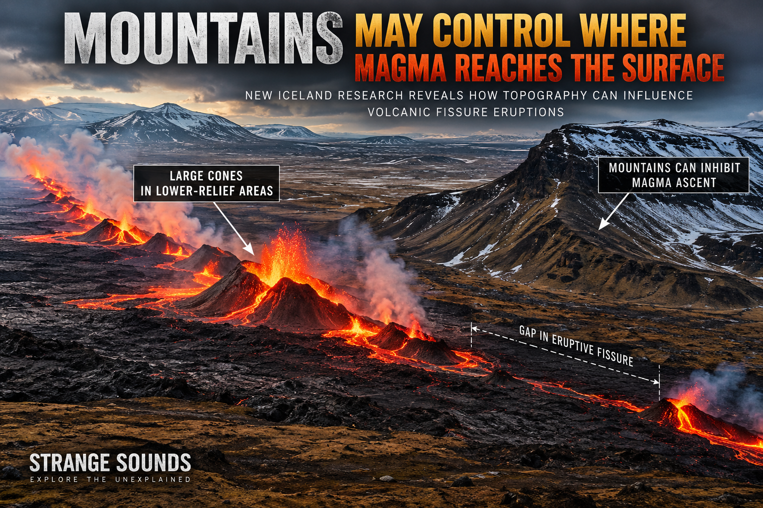
When magma forces its way through Earth’s crust during a fissure eruption, it can travel underground for tens of kilometres inside a near-vertical sheet of molten rock called a dyke.
But something strange can happen when that dyke approaches the surface.
The underground intrusion may be remarkably long and continuous, while the eruption above it is anything but. Lava fountains and volcanic cones appear along some sections, disappear completely along others, then suddenly reappear kilometres farther away.
Why?
A new study of Iceland’s enormous Laki and Eldgjá fissure eruptions suggests that mountains, valleys and other surface topography can modify stresses in the shallow crust strongly enough to influence where magma can rise — and where its path toward the surface becomes restricted.
The finding adds another piece to the increasingly detailed picture of how Iceland’s volcanoes, rift zones and fissure eruptions behave above one of the most volcanically active tectonic environments on Earth.
In some places, the researchers found, steep topography coincides with dramatic gaps in eruptive fissures.
In others, the biggest volcanic cones occur where the landscape appears to provide much less resistance to magma moving upward.
The discovery could eventually help volcanologists improve forecasts of where new eruptive vents are most likely to open during a fissure eruption.
More Than 300 Volcanic Cones Reveal a Hidden Pattern
The study, published September 2, 2026 in Communications Earth & Environment, was conducted by Maria Hurley and Thomas R. Walter of the GFZ Helmholtz Centre for Geosciences and the University of Potsdam, together with Francesco Maccaferri of Italy’s National Institute of Geophysics and Volcanology.
The researchers investigated two extraordinary volcanic systems in Iceland’s East Volcanic Zone: Lakagígar, created during the devastating Laki eruption of 1783–1784, and Eldgjá, formed during the enormous eruption of approximately 939–940 CE.
These were not ordinary eruptions.
Laki produced approximately 14.7 cubic kilometres of lava, while Eldgjá produced around 19.7 cubic kilometres.
Their surface fissure systems extend for approximately 27 km at Lakagígar and 70 km at Eldgjá.
Together, they provided the researchers with nearly 100 kilometres of volcanic fissures crossing very different landscapes.
Both eruptions belong among the extraordinary events documented in the geological record and provide important case studies for understanding historic volcanic eruptions and how large fissure systems develop.
Using high-resolution satellite observations, drone-derived topography and numerical stress modelling, the team mapped 226 eruptive cones at Lakagígar and another 85 at Eldgjá.
The volumes of those cones varied enormously — from roughly 1 cubic metre to 10 million cubic metres.
But their distribution wasn’t random.
At Laki, the Biggest Cones Formed on Lower Ground
One of the clearest patterns appeared along the Lakagígar fissure.
The researchers found an inverse relationship between elevation and eruptive-cone volume.
Southwest of Mount Laki, where the fissure crosses relatively low terrain, some of the largest volcanic cones formed, with volumes exceeding 100,000 cubic metres.
Then the fissure approaches Mount Laki.
There, at the highest pre-eruption elevations along the central section, cone sizes collapse dramatically. Instead of enormous volcanic structures, the landscape contains clusters of cones measuring less than about 100 cubic metres, together with small breaks in the fissure.
Farther northeast, where elevations become more moderate again, larger cones return.
Something associated with the landscape was apparently influencing how magma reached the surface.
At Eldgjá, Mountains Coincide With Kilometre-Scale Gaps
Eldgjá provides an even more dramatic example.
Unlike the relatively continuous Lakagígar system, Eldgjá is broken into separate eruptive segments, with large gaps between them.
Several of those gaps coincide with major topographic barriers.
In other words, an underground dyke could continue through the region while the surface eruption stopped, only for volcanic activity to resume farther along the fissure.
The researchers’ modelling indicates that this segmentation can be explained partly by the way steep terrain changes the stress field inside the shallow crust.
A mountain isn’t simply scenery sitting above a volcanic system.
It is an enormous mass of rock.
And that mass exerts a load.
Mountains Change the Stress Inside Earth’s Crust
Regional tectonic forces remain the primary control determining the overall direction in which volcanic dykes propagate.
But as magma approaches the surface, the local situation becomes more complicated.
Mountains, steep slopes, valleys and changes in elevation redistribute stresses in the crust beneath them.
The study found that high topography-induced stress gradients can create mechanically restrictive zones for upward magma transport.
When a dyke encounters one of these areas, magma may have greater difficulty continuing vertically toward the surface. Flow can instead become concentrated elsewhere along the fissure.
Conversely, areas with lower confining-stress gradients appear more permissive, allowing magma to rise more easily and potentially feed larger volcanic cones.
The researchers therefore divided portions of the fissure systems into what they call “Permissive” and “Restrictive” domains.
The distinction produced a striking result: the topography above a dyke may act as a final shallow filter determining how an eruption expresses itself at the surface.
A Mountain Can Even Break an Eruptive Fissure Into Segments
The effect isn’t limited to the size of volcanic cones.
Sharp changes in horizontal stress associated with steep topography also corresponded with places where eruptive fissures stopped and restarted.
At Eldgjá, the strongest lateral stress changes occurred around mountains crossing the fissure system.
At Lakagígar, something similar happens around Mount Laki.
As the fissure climbs the mountain’s slope, vents disappear. They reappear in local depressions and then resume again on the opposite flank.
That suggests the apparently chaotic pattern of volcanic vents across a landscape may contain a mechanical fingerprint of the terrain itself.
The mountain does not necessarily stop the entire underground dyke.
Instead, topographic stresses can make particular shallow sections of the crust less favourable for magma to breach the surface.
Why This Matters After Iceland’s Recent Fissure Eruptions
The discovery is especially relevant because Iceland has recently provided scientists with spectacular real-world examples of how difficult fissure eruptions are to forecast spatially.
Since 2021, repeated dyke intrusions and eruptions on the Reykjanes Peninsula have opened fissures across different sections of Iceland’s volcanic rift system.
These eruptions are part of the broader tectonic and volcanic processes explained in our guide to Iceland volcanoes and rift eruptions.
Modern monitoring using earthquakes, GPS measurements, satellite radar and other geophysical techniques can reveal when magma is moving underground with extraordinary precision.
But knowing that a dyke is propagating is not the same thing as knowing exactly where the ground will split open.
That’s a critical distinction when towns, roads, power infrastructure and other facilities lie above or near an active volcanic system.
Understanding possible vent locations is therefore an important part of volcano monitoring and eruption forecasting.
The new research suggests topographic-stress modelling could eventually provide another piece of that puzzle.
The 2022 Fagradalsfjall Eruption Offers a Modern Example
One recent Icelandic eruption already provides an intriguing comparison.
During the 2022 Fagradalsfjall eruption, the eruptive fissure opened inside the Meradalir valley and terminated abruptly against its steep valley walls.
The researchers argue that incorporating topographic stress into existing volcanic monitoring could eventually help estimate not only where a fissure might propagate, but also where individual vents and larger eruptive centres are more likely to develop.
Such information could ultimately improve assessment of volcanic hazards, particularly in populated or infrastructure-rich volcanic rift zones.
The Effect May Extend Far Beyond Iceland
Iceland isn’t the only volcanic region where this process may matter.
The researchers point to comparable behaviour at Piton de la Fournaise on Réunion Island, where volcanic cones formed in the steep inner caldera are much smaller than those on flatter outer rift zones.
Median cone volumes in the steep caldera are around 7,200 cubic metres, while cones on flatter outer areas can exceed median volumes of 2 million cubic metres.
Topography also influences volcanic processes at systems including Mount Etna, while gravitational loading from enormous volcanoes such as Mauna Loa can alter stresses and help control rift-zone development.
But not every fissure eruption is dominated by this effect.
Kīlauea’s East Rift Zone in Hawaii, for example, crosses relatively uniform terrain. There, variations in eruption intensity appear to depend more strongly on processes occurring inside the magma-filled dyke itself.
That contrast is important.
The new study does not suggest that mountains alone determine where volcanoes erupt.
Regional tectonic stresses, magma pressure, crustal structures, dyke dynamics and magma supply remain crucial.
Instead, the research identifies topography as another potentially important control, particularly during the final stages when magma is trying to break through the shallow crust.
Can Scientists Predict Where the Next Volcanic Fissure Will Open?
Not yet.
And that’s an important limitation of the study.
The researchers developed their stress thresholds retrospectively using the known locations and sizes of cones created during the Laki and Eldgjá eruptions.
They propose that similar thresholds could eventually be tested in future volcanic hazard models, but forecasting applications still require validation at other volcanic systems.
So this isn’t a new machine that can look at an Icelandic mountain and announce where tomorrow’s eruption will occur.
It is something potentially more useful scientifically: a new measurable variable that could be incorporated into increasingly sophisticated eruption forecasts.
Volcanologists already monitor earthquakes, deformation, gas emissions and magma intrusions to determine what is happening beneath active volcanoes.
You can explore these methods in our complete guide to how volcanoes are monitored and eruptions are forecast.
Now the landscape above a volcanic system may provide additional clues.
The Landscape Is Part of the Volcano
Perhaps the most fascinating implication of the research is also the simplest.
We tend to imagine an eruption as something moving upward from deep inside Earth, with the landscape above merely receiving whatever comes out.
But the interaction goes both ways.
The shape and weight of the surface alter stresses in the crust.
Those stresses influence magma.
And magma ultimately determines where new pieces of landscape are created.
During giant fissure eruptions like Laki and Eldgjá, mountains and valleys may therefore help determine where magma makes the final breakthrough to the surface — and where it doesn’t.
The scars left across Iceland suggest that even a dyke stretching for tens of kilometres underground
still has to negotiate the last part of Earth’s crust before erupting.
And sometimes, the landscape itself may change the outcome.

