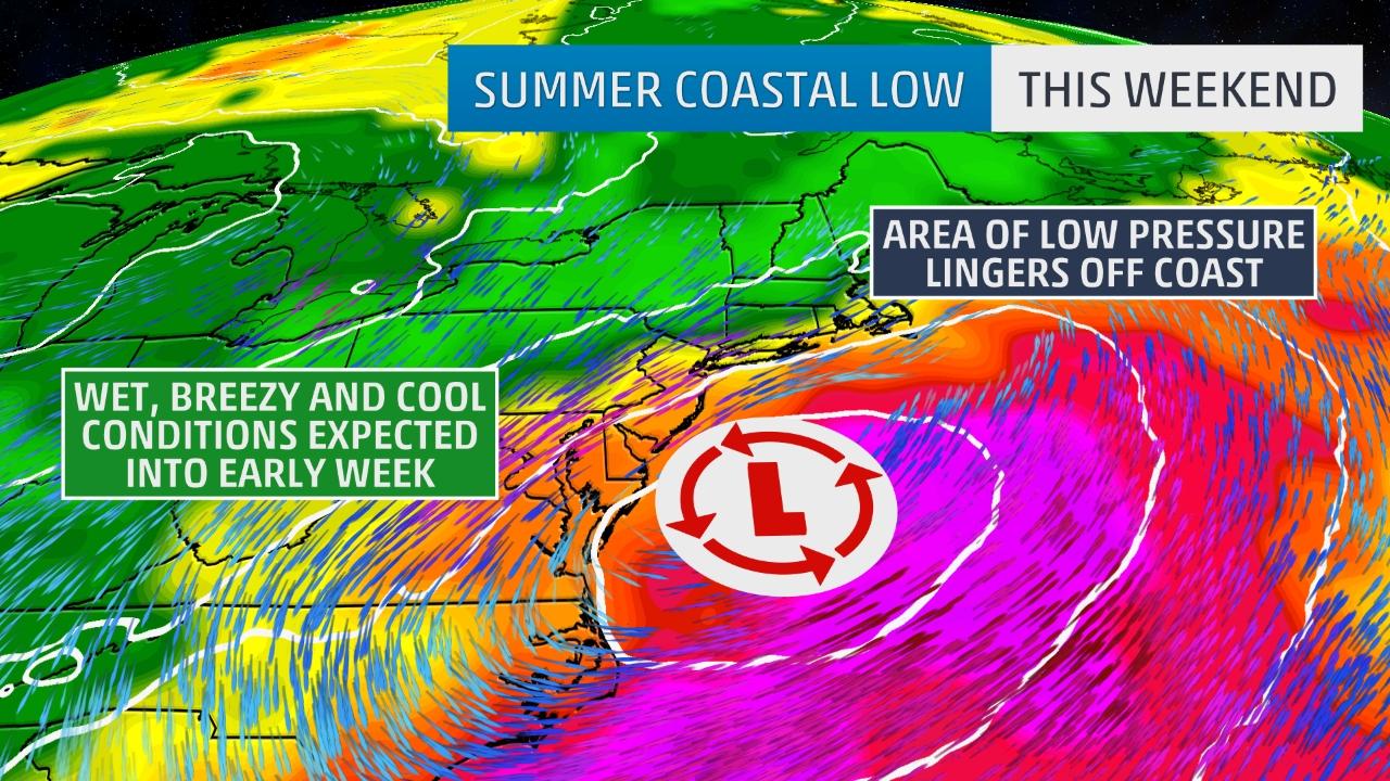
An unusual weather pattern for late July is taking shape and will bring a winter-like coastal storm, with the threat of life-threatening flash flooding, to the mid-Atlantic and Northeast coasts this weekend and possibly into early next week.
A strong upper-level trough, or southward dip in the jet stream, will move into the East this weekend with a cold front that will even push through much of the South, bringing cooler temperatures and lower dew points from the Midwest into the East and South.
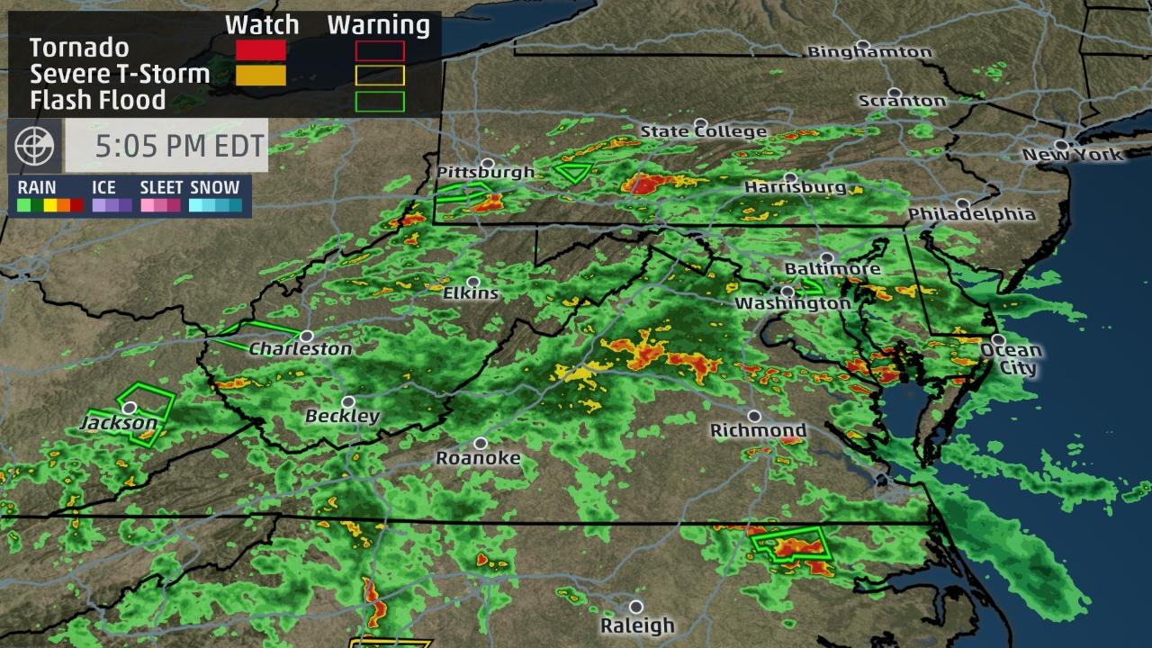
As this system approaches the region, a first round of rain and storms will develop Friday in the mid-Atlantic and Northeast. Ample moisture will be in place, which will bring locally heavy rainfall and the risk of flooding, along with a few severe thunderstorms.
Over 3 inches of rain fell in about 45 minutes midday Friday near Silver Spring, Maryland. Water rescues were also reported near Wheaton and Garrett Park in Maryland, with multiple vehicles trapped in high water.
More than 4 inches of rain has fallen in Onley, Maryland (4.25 inches) already through mid-afternoon Friday.
The heaviest rainfall is expected Friday into Saturday morning, with 3 to 6 inches possible during this time period from West Virginia into Delaware and southern New Jersey. A few spots may see in excess of 6 inches in eastern Maryland or elsewhere on the Delmarva peninsula.
Flash flood watches have already been issued for portions of the Ohio Valley and mid-Atlantic, including Washington D.C., Baltimore and Philadelphia, due to the risk of heavy rain in a short period of time falling on saturated ground.
However, there remains uncertainty regarding the forecast track, timing and strength of this low-pressure system. There is also the chance that this low will track away from the region this weekend and another wave of low pressure may emerge off the mid-Atlantic coast Sunday into Monday.
This unusual weather pattern, including gusty northeast winds at times, will also keep temperatures on the cool side for late July, with highs 5 to 20 degrees below average for portions of the mid-Atlantic and Northeast.


 in 3 days of storm")


[…] DNC IT Scandal Is Unfolding & It’s Crazier Than Fiction As Staffer Is Arrested For Bank Fraud Unusual winter-like low pressure brings coastal storm with life-threatening flash flooding to the mi… The cholesterol and calorie hypotheses are both dead — it is time to focus on the real culprit: […]