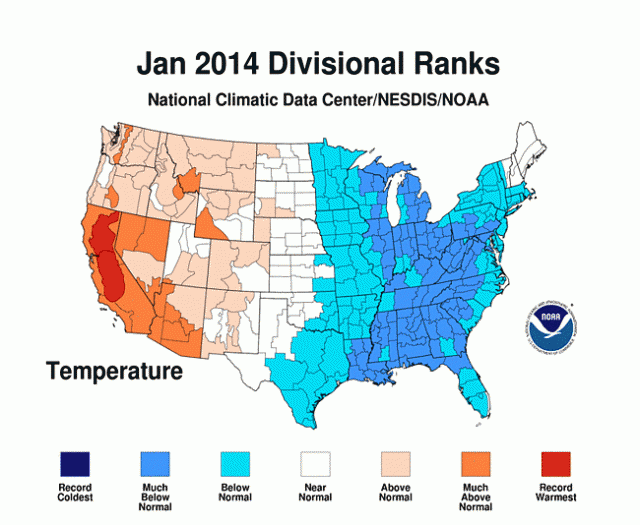
This amazing map from NOAA summarizes January 2014 extreme weather for the continental US. As clearly shown, the U.S. was divided into two nations during January, with a cool East and a warm West.

Pretty much everywhere east of the Rockies endured unusually cold conditions, while most regions west of the range experienced record-breaking warmth (most notably in California, where a devastating drought recently extended into its 13th month).
According to Mashable,
The divide between East and West during January was the result of a buckle in the jet stream that rerouted Pacific storms north, into Canada, bypassing drought-ridden California, before opening the door to the Arctic refrigerator by steering upper level winds from north to south across the East.
You can get more weather maps here.


