Earth from space photos: Discover our Planet Earth from space!
This collection of amazing satellite images will make you wanna travel our beautiful Planet Earth right now. Enjoy the trip!
There are more than 1,000 satellites orbiting Earth In his new book Earth from Space, photographer Yann Arthus-Bertrand has collected some of the best satellite images around. Discover my selection in the photographs below:
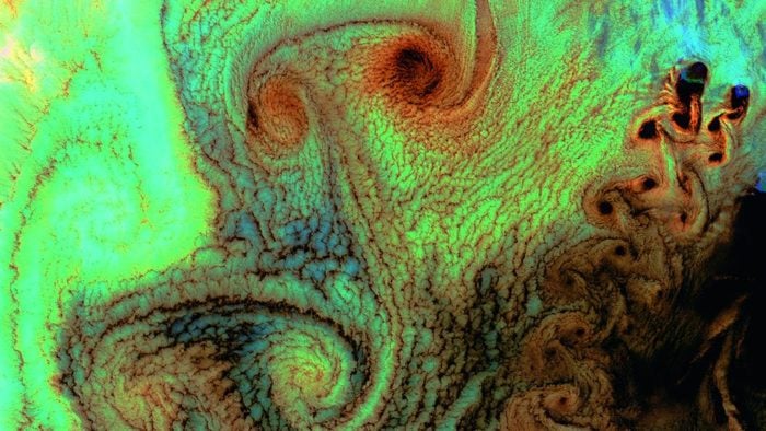
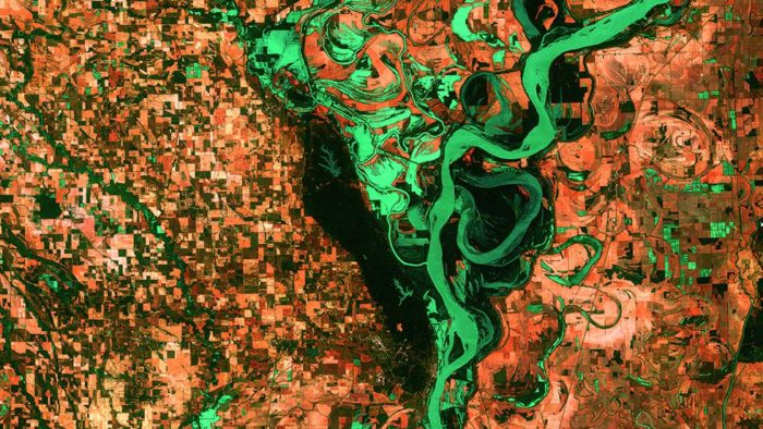
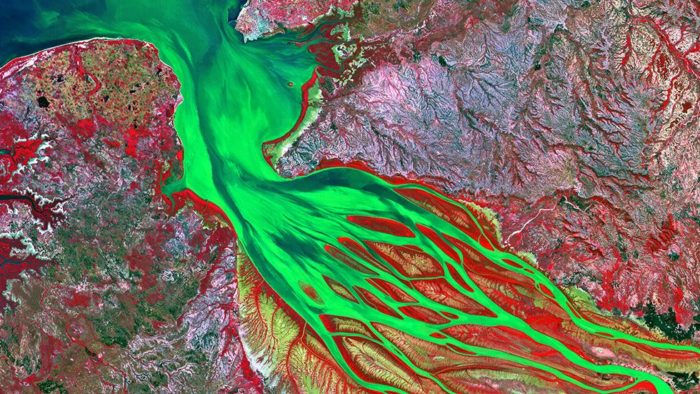
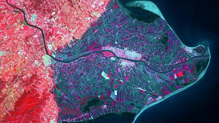
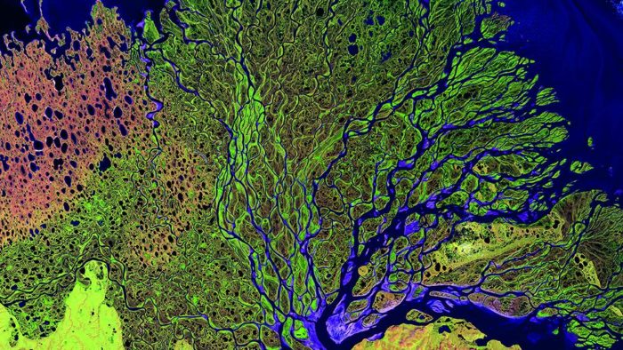
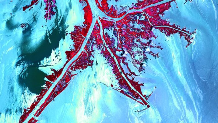
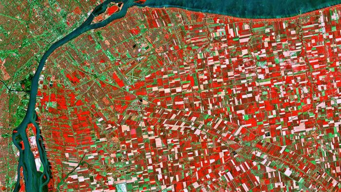
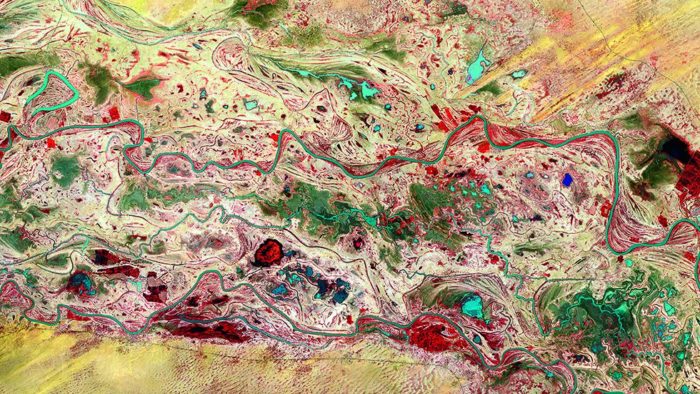
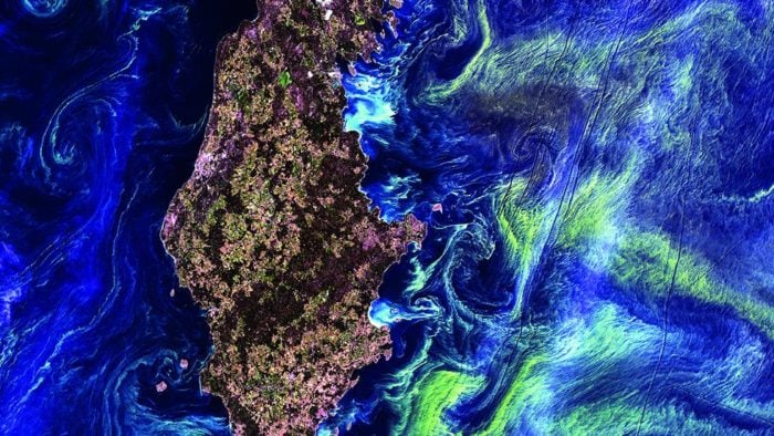
These swirling vortices are marine clouds over Alaska’s volcanic Aleutian Islands. Variations in color represent different temperatures and the size of the raindrops inside the clouds. (NASA/GSFC/USGS EROS Data Center)The Mississippi River dominates the fields and pastures of Arkansas and Mississippi. (NASA/GSFC/USGS EROS Data Center)Mango trees, in red, partially cover islands in Madagascar’s Bombetoka Bay, estuary of the Betsiboka River. (CNES 1986 – Distribution Astrium Services/Spot Image)Spain’s 550-mile long Ebro River cuts a swath through a vast delta and into the Mediterranean Sea. (CNES 2008 – Distribution Astrium Services/Spot Image)This image captures Russia’s Lena River, one of the longest in the world at 2,734 miles. Green represents vegetation, pink represents sand and blue-mauve is water. (NASA/GSFC/USGS EROS Data Center)In this image of Louisiana, released two months after the Deepwater Horizon oil spill, red represents plant cover and blue and white represent water. Spots of brighter white indicate oil slicks, which increase reflection. (NASA)Detroit is divided into large squares called townships and sits across a strait near Windsor, Canada. (CNES 1988 – Distribution Astrium Services/Spot Image)The Senegal River runs through the war-torn Mauritania-Senegal border. (CNES 2008 – Distribution Astrium Services/Spot Image)Gotland Island, in the Baltic Sea, is surrounded by swirling green clouds of microscopic phytoplankton. (NASA/GSFC/USGS EROS Data Center)
Yes, from space, Earth is a magnificent sight, splashed with vivid colors, patterns, textures, and abstract forms. Views from above can also provide telling information about the health of our planet. To help us understand the more than 150 breathtaking satellite photographs in Earth from Space, Yann Arthus-Bertrand, an aerial photographer and devoted environmental activist, discusses the impact of deforestation, urban sprawl, intensive farming, ocean pollution, and more. Earth from Space compelling selection of satellite images raises important questions about our future, while also showcasing the planet’s beauty—leaving no doubt that it is something crucial to protect.
We use cookies on our website to give you the most relevant experience by remembering your preferences and repeat visits. By clicking “Accept”, you consent to the use of ALL the cookies.
This website uses cookies to improve your experience while you navigate through the website. Out of these, the cookies that are categorized as necessary are stored on your browser as they are essential for the working of basic functionalities of the website. We also use third-party cookies that help us analyze and understand how you use this website. These cookies will be stored in your browser only with your consent. You also have the option to opt-out of these cookies. But opting out of some of these cookies may affect your browsing experience.
Necessary cookies are absolutely essential for the website to function properly. This category only includes cookies that ensures basic functionalities and security features of the website. These cookies do not store any personal information.
Any cookies that may not be particularly necessary for the website to function and is used specifically to collect user personal data via analytics, ads, other embedded contents are termed as non-necessary cookies. It is mandatory to procure user consent prior to running these cookies on your website.
Hey, Friends!
Sign Up To My Newsletter To Receive Your Daily Dose Of Natural Disasters And Amazing Phenomena


")


