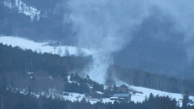
Snow devils or “snownadoes” are extremely rare weather phenomena since they require very specific meteorological conditions to form.
Snow tornadoes are so rare that only six have ever been captured on camera and very little is known about them.

These twisting columns of snow are closely related to waterspouts since they form over either frozen lakes or snow-covered areas.
For snow devils to occur, the necessary conditions include a colder air mass passing over a relatively warmer surface heated by sunlight, and a low-level wind shear (change of wind speed or direction with height) or colliding air currents to get the rising air to spin.
A warmer surface causes the snow or ice to form fog or steam, and if there is a column of colder, low-pressure air above this fog, it will begin to rise, and the wind shear or currents will cause it to rotate and begin to pick up loose snow forming the recognizable funnel shape.
The combination of these conditions is what makes snownadoes so rare and less intense than tornadoes.
Snownadoes have been reported as large as 30 feet wide, 45 feet high, and capable of lifting objects over 1,500 pounds.
They usually occur under or before a snow squall, meaning they are often indicators that more snow is on the way.
The one above, recorded by Tom Ording Dahl in Skjåk, Norway on March 1, 2016 was definitely not dangerous, but mesmerizing.


