Elevated volcanic activity reported at Mount Michael on Saunders Island, South Sandwich Islands in the Southern Atlantic Ocean

0

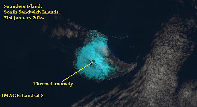
A thermal anomaly inside the summit crater of Mount Michael on Saunders Island was discovered in a satellite image by Landsat 8 taken on January 31, 2018. Now in new images from February 10, 2018, the thermal anomaly is still present inside the summit crater of Mount Michael in the Southern Atlantic Ocean. This is clearly indicating that some elevated activity is taking place inside the crater of the volcano. It could either be low level strombolian activity, or lava flows covering a small part of the crater interior, or a new lava lake.

The volcanic activity was first discovered in satellite images on January 31, 2018:

Volcanic activity reported inside the crater of Mount Michael Volcano in the South Sandwich Islands in february 2018, eruption mount michael saunders island south sandwich islands, volcano eruption south sandwich islands february 2018, volcanic eruption Saunders Island february 2018,
Volcanic activity reported inside the crater of Mount Michael Volcano in the South Sandwich Islands, Southern Ocean, on January 31, 2018. SOURCE: Landsat 8/USGS/NASA.

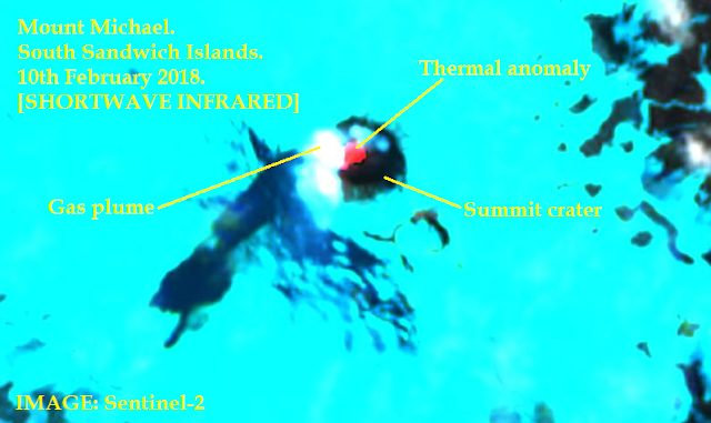
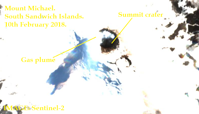
Then, about ten days after, on February 10, 2018, the bright, red thermal anomaly was still visible, had grown larger, and was accompanied by a degassing plume floating around the volcano crater:

Volcanic activity reported inside the crater of Mount Michael Volcano in the South Sandwich Islands in february 2018, eruption mount michael saunders island south sandwich islands, volcano eruption south sandwich islands february 2018, volcanic eruption Saunders Island february 2018,
The volcanic activity has increased at Michael volcano on Saunders Island in the southern Atlantic ocean, with a larger thermal activity and a degassing plume visible in and over the volcanic crater on February 10, 2018. Shortwave Infrared image by Sentinel-2/EOS Data Analytics.
Volcanic activity reported inside the crater of Mount Michael Volcano in the South Sandwich Islands in february 2018, eruption mount michael saunders island south sandwich islands, volcano eruption south sandwich islands february 2018, volcanic eruption Saunders Island february 2018,
Natural colour image of the summit area of Michael Volcano near Antarctica. SOURCE: Sentinel-2/EOS Data Analytics.

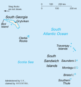
Here a map of the South Sandwich Island

Location of South Georgia and the South Sandwich Islands in the southern Atlantic Ocean
Location of South Georgia and the South Sandwich Islands in the southern Atlantic Ocean. By Wikipedia User Tubbs

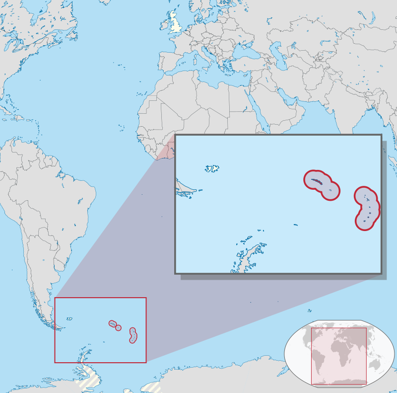
Here the name of the different islands:

South Georgia and South Sandwich Islands
CIA map of South Georgia and South Sandwich Islands. Via Wikipedia

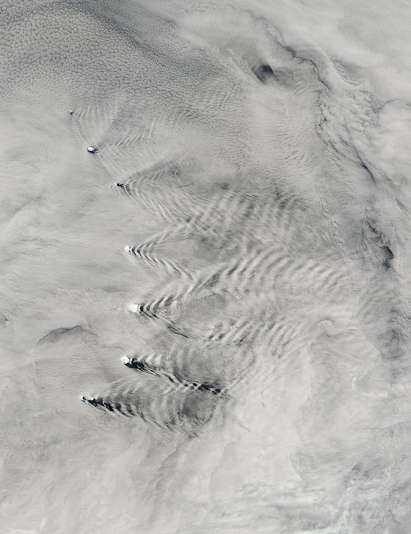
Sometimes, the islands are producing weird cloud patterns:

south sandwich islands, south sandwich islands and weird cloud patterns, south sandwich islands volcano eruption
The South Sandwich Islands conspired with air currents to make wave patterns in clouds. Saunders, Montagu, and Bristol Islands, part of the South Sandwich chain, all trigger V-shaped waves that fan out toward the east. By Jeff Schmaltz – NASA Earth Observatory via Wikipedia

Another example that eruptions occur all over the world, even in remote and inhabited islands, lost between the southern pit of South Amarica and Antarctica in the unknown southern Atlantic Ocean. Meanwhile a seismic swarm is currently hitting under the Cumbre Vieja volcano in the Canary Islands.

Follow us: Facebook and Twitter

South Sandwich Monitoring

Leave a reply

Please enter your comment!
Please enter your name here

This site uses Akismet to reduce spam. Learn how your comment data is processed.