We saw it coming for days, but it still was a shock to feel the extreme cold after such a warm fall.
Many awoke to the double whammy of record snow, then the cold Sunday and Monday across large swath of the US west coast, from Alaska to California, Nevada and the Prairies.
Cold Temperature Records Broken In California
After a storm on Friday another hit on Sunday bringing cold temperatures, rain and snow to much of the state, with more than 18 inches at Sierra-at-Tahoe ski resort, and 10 inches at Sugar Bowl.
That looks close to a foot of snow to me on the chairs and roof, and still coming down @Sierra_at_Tahoe ! pic.twitter.com/hwHOFmZen2
— Tahoe Weather (@TahoeWeather) November 8, 2020
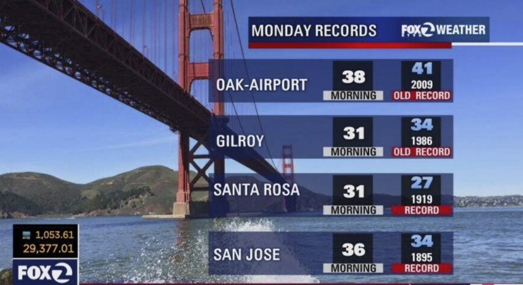
Moreover, cold temperature records were set on Monday, Nov. 9th:
- 38°F at the Oakland Airport (previous recond in 2009 with 41°F)
- 38°F at Gilroy (previous record in 1986 with 34°F)

The same storm brought 0.11 inches of rain to downtown Los Angeles on Saturday, breaking a streak of 172 days with no measurable precipitation.
Record cold and snow plunge into Nevada
Several kinds of records snow fall were set over the same weekend across northern Nevada with single day snowfall records were broken in Reno, Carson City, and Yerington just to name a few.
Most of the area saw a general 3 to 5 inches and that was historic for the date. We normally see our first snowfall around the middle of November, but what’s so unusual is the amount that fell.
“To get that dramatic temperature change, and the amount of snow we did get is uncommon. We broke some single day snowfall records down in Yerington. They ended up with about 13 inches of snowfall at the Lyon County Sheriff’s office out there,” said NWS Reno Meteorologist Tony Fuentes
It’s not just the record snow, but also the extreme cold. Several cold records were broken all across the area, both at night and during the day.
?️☁️It was a wild weather weekend.
— NWS Las Vegas (@NWSVegas) November 9, 2020
?Record low max temps occurred yesterday & will once again be in jeopardy today at many locations.
❄️?The higher elevations saw a taste of winter with many folks in the lower elevations seeing some rainfall SAT & SUN. #nvwx #azwx pic.twitter.com/ukgmRQl6c1
Las Vegas broke its record-low high temperature set in 1946. The National Weather Service recorded a high temperature of 54°F, 1 degree lower than the 1946 record of 55°F.
This cold temperature record was set after Las Vegas had three consecutive days of record-breaking heat with highs of 86 degrees on Wednesday, Thursday and Friday.
Record amount snow blankets Interior Alaska
A winter storm dropped significant snowfall with Fairbanks setting a new snowfall record at 14.7 inches of snow in 24 hours (last record 14.6 inches in 1970).
Fairbanks established a Nov 24-hour snowfall record according to @NWSFairbanks. From 8pm Thursday to 8pm Friday, 14.7" (37.4cm) of #snow fell, eclipsing the previous record 14.6" (37.1cm) in 1970. Here are the monthly records through the year. #akwx @Climatologist49 @alasjules pic.twitter.com/Iud3mPR1VA
— Rick Thoman (@AlaskaWx) November 7, 2020
Blizzard paralyzes the Prairies in Canada
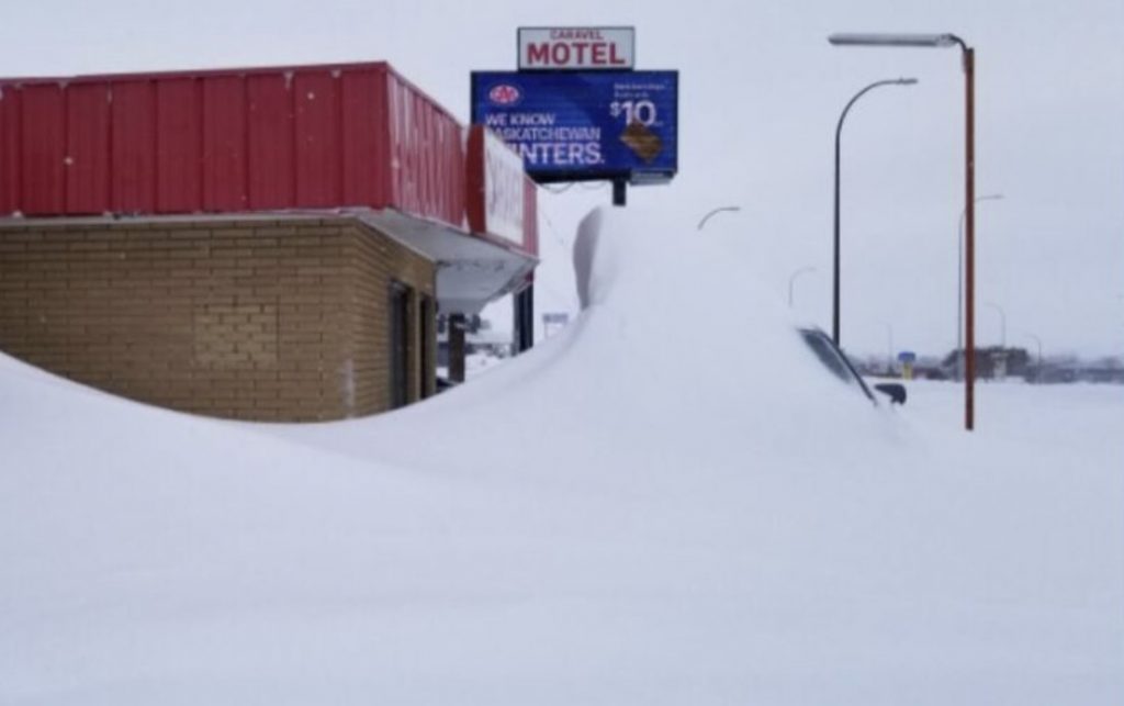
The extreme weather on the Prairies brought blizzard conditions with heavy snowfall.
20-40 cm of snowfall were reported near Edmonton, Alberta and a wind gust hitting 102 km/h was recorded in Ardenville.
In Kindersley, Saskatchewan 47.6 cm of snow piled up, making it the snowiest November day on record and the largest two day snowfall event for the city.
Travel was dangerous and / or nearly impossible in several regions, with many roads shut down in Saskatchewan and Alberta.
Adding to the dangerous travel was the widespread and prolonged freezing drizzle, freezing rain and ice pellets in Alberta and Saskatchewan, with the risk for ongoing power outages with the significant ice accretion and strong winds.
The pictures of this November “winter nightmare” are very impressive. Just have a look below:
42 years in Medicine Hat and I don’t remember too many snow days. But today is one! What a mess! #medhat #abstorm pic.twitter.com/oMnWGk7Uoc
— Bryan Leitch (@Bryan_Leitch) November 9, 2020
My front door in SE Saskatoon #skstorm @CBCSaskatoon pic.twitter.com/73VZyohWNJ
— L G (@lucasjgoetz) November 9, 2020
Hey Saskatoon!
— Red Cross SK (@RedCrossSK) November 9, 2020
The snow may have stopped but there are still lots of hazards & many things are closed.
Some reliable places to get up-to-date information include @cityofsaskatoon @SaskatoonPolice @SaskatoonFire & @SaskatoonEMO
Stay safe out there everyone #skstorm pic.twitter.com/fEi7btbL0H
VERY POOR visibility #hwy1 at Gleichen #abroads #abstorm #yycroads #medhat pic.twitter.com/ovCCr8tqTl
— Prairie Sprinter (@prairiesprinter) November 8, 2020
No I will not come inside thank you very much…#doggos#husky #snowmageddon #Snowpocalypse #abstorm #LifeIsBeautiful pic.twitter.com/VjJbHrq4CQ
— Gena Marie (@GenaMarieM) November 8, 2020
Yes definitely, the world is warming up! Huh! More extreme weather events on AccuWeather, Strange Sounds and Steve Quayle.
Follow us: Facebook and Twitter. By the way you can also support us on Paypal. Please and thank you!


Well, that’s good news for skiers. I know when I was young, I skied alot. Always looked forward to ankle deep powder and a good snow pack.
At least if you have to shovel out, you know there’s a slope full of powder and snowbunnies to look forward to.
We have two possibilities..Global warming OR H.A.A.R.P. Can’t be global warming, soooo??