

Tornadoes • Severe Thunderstorms • France
A powerful tornado tore through villages south of Carcassonne in southern France on August 24, 2026, injuring 39 people and damaging roughly 300 homes. The destructive vortex developed beneath a violent supercell that also unleashed giant hail, torrential rain, intense lightning and damaging winds across the Aude region.
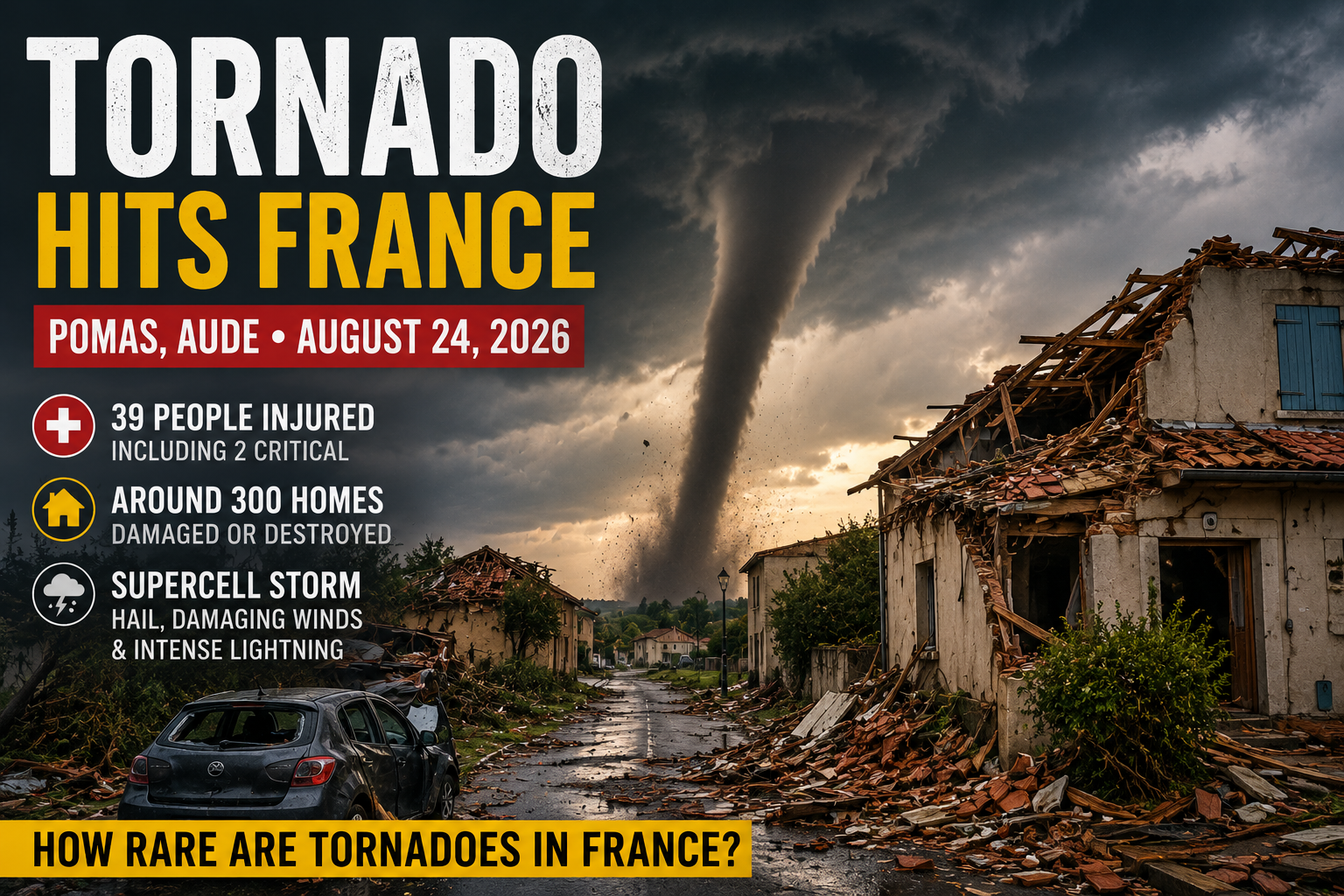
A violent tornado has ripped through southern France, tearing roofs from houses, uprooting trees and leaving parts of a small village looking as though they had been hit by a much larger disaster.
The tornado struck the Aude department south of Carcassonne late Monday afternoon, August 24, with the village of Pomas suffering the worst destruction.
Authorities said 39 people were injured, including two critically, while approximately 300 homes were damaged.
More than 120 emergency personnel were deployed as rescue crews searched damaged buildings, cleared fallen trees and secured unstable structures.
Residents described roofs disappearing, debris flying through the air and buildings collapsing as the rotating storm passed through.
“Half the village has been destroyed.”
That was how one local resident described the scene after the tornado passed.
For anyone accustomed to associating major tornadoes almost exclusively with the American Great Plains, the footage may come as a surprise.
But tornadoes are very much part of Europe’s severe-weather landscape — including France.
Watch the Tornado Tear Through Southern France
Videos recorded from around Pomas and neighboring communities show a large rotating funnel descending beneath a dark thunderstorm base and moving across the landscape.
The Tornado Struck Beneath a Violent Supercell
This wasn’t an isolated whirl appearing beneath an otherwise ordinary rain shower.
French meteorologists reported that the tornado developed around 5:00–5:20 p.m. local time beneath an especially violent supercell thunderstorm.
A supercell is a highly organized thunderstorm built around a persistent rotating updraft. That rotating structure allows the storm’s inflow, updraft, precipitation and downdrafts to remain partly separated, helping the storm survive much longer than an ordinary thunderstorm and produce multiple forms of extreme weather.
At the heart of that structure is a broad rotating circulation known as a mesocyclone. A mesocyclone is much larger than a tornado and does not automatically produce one, but under favorable conditions its low-level rotation can become increasingly concentrated until a tornado develops beneath the storm.
See our complete visual guide to supercell structure, mesocyclones, rotating updrafts and tornado formation for how this three-dimensional storm architecture works.
Supercells are among the thunderstorm types most capable of producing strong tornadoes, giant hail, destructive straight-line winds, torrential rain and intense lightning.
The Aude storm delivered several of those hazards simultaneously.
Meteorological observations reported:
- hailstones around 3–5 cm in diameter near the storm track;
- 117 km/h wind gusts at Arquettes-en-Val;
- 105 km/h gusts at Lézignan-Corbières;
- 35.1 mm of rain in one hour at Montolieu;
- and widespread intense lightning across southern France.
These are classic examples of the multiple hazards produced by severe thunderstorms.
The Reported 117 km/h Wind Was Not the Tornado’s Confirmed Wind Speed
Several early reports linked the figure 117 km/h (73 mph) directly to the tornado.
That needs an important clarification.
The 117 km/h gust was measured at Arquettes-en-Val during the wider thunderstorm event. It should not automatically be interpreted as the maximum wind speed inside the tornado itself.
Tornado wind speeds are rarely measured directly.
Instead, tornado intensity is usually estimated afterward by examining the type and severity of damage along the tornado’s path.
Investigators look at damaged roofs, collapsed walls, uprooted trees, displaced vehicles and other structural indicators to estimate the winds required to produce the observed destruction.
Until a formal damage survey is completed, assigning the Pomas tornado a specific wind speed or Enhanced Fujita rating would be premature.
Hundreds of Homes Damaged in Pomas and Surrounding Villages
The most serious destruction occurred in Pomas, a village of roughly 1,000 residents between Carcassonne and Limoux.
Images from the area show entire roofs removed, walls collapsed, trees snapped or uprooted, damaged vehicles and streets buried beneath debris.
Roughly 300 residences were damaged across the affected area, according to authorities.
Emergency accommodation centers were established for residents unable to return to their homes.
Power infrastructure also took a major hit.
Thousands of homes across southern France lost electricity during the broader storm outbreak, including communities in the Aude department.
Giant Hail Hit the Region at the Same Time
While Pomas was being hit by the tornado, other parts of the storm system were being hammered by large hail.
Hailstones measuring approximately 3–5 centimeters were reported around the Aude region.
That’s large enough to damage vehicles, roofs, agricultural crops and exposed infrastructure.
The third stage of the Vuelta a España cycling race was also disrupted as severe weather and hail forced riders to seek shelter.
Large hail develops when powerful thunderstorm updrafts repeatedly carry ice particles through supercooled water high inside the storm.
The stronger the updraft, the larger the hailstone can potentially grow before gravity finally wins.
Explore the physics behind those storms in Giant Hail Explained.
Nearly 20,000 Lightning Strikes Across France
The tornado was part of a much broader outbreak of violent thunderstorms across southern France.
According to Météorage figures cited by French meteorologists, approximately 19,638 lightning impacts were detected during the August 24 storm episode.
That made it the second most electrically active day of the summer in France at that point in 2026.
Severe thunderstorms are essentially enormous atmospheric heat engines.
Strong rising and sinking air currents collide ice particles and water droplets inside the cloud, separating electrical charge until the electrical field becomes strong enough to discharge.
The result is lightning — sometimes tens of thousands of times during a major regional storm outbreak.
How Rare Are Tornadoes in France?
More common than many people think.
Météo-France says dozens of tornadoes occur in metropolitan France each year.
The exact number is difficult to determine because tornadoes are often extremely small and short-lived.
Some cross open fields or forests without striking buildings.
Others happen at night or in areas without weather instruments.
Historically, that meant many weaker tornadoes were simply never documented.
Smartphones, surveillance cameras and social media have dramatically increased the number that are now photographed and confirmed.
So the surprising part isn’t that France gets tornadoes.
The surprising part is how few people realize it.
Most French Tornadoes Are Weak
Although tornadoes occur regularly in France, the majority are relatively weak.
Météo-France notes that tornadoes stronger than EF1 on the Enhanced Fujita scale are uncommon.
The scale is based primarily on damage:
| EF Rating | Typical Estimated Winds | General Damage Potential |
|---|---|---|
| EF0 | 105–137 km/h | Light damage |
| EF1 | 138–177 km/h | Moderate damage |
| EF2 | 178–217 km/h | Considerable damage |
| EF3 | 218–266 km/h | Severe damage |
| EF4 | 267–322 km/h | Devastating damage |
| EF5 | >322 km/h | Incredible damage |
France has nevertheless experienced extremely violent tornadoes in the past.
Météo-France cites the Hautmont tornado of August 3, 2008 and the Levier tornado of June 2, 1982 as EF4 events.
Historical records even include exceptionally violent tornadoes at Palluel in 1967 and Montville in 1845, both classified retrospectively at EF5 intensity.
So while violent French tornadoes are rare, they are certainly not unprecedented.
Where in France Are Tornadoes Most Likely?
Tornadoes can occur virtually anywhere in France.
But Météo-France notes that two broad regions appear especially exposed:
- northwestern France;
- and areas along the Mediterranean coast.
The Pomas tornado occurred relatively close to that Mediterranean severe-weather corridor.
Southern France is particularly capable of producing violent thunderstorms when warm, moisture-rich Mediterranean air interacts with cooler air aloft and favorable wind shear.
Add strong instability and rotation, and the atmosphere can produce supercells capable of tornadoes, giant hail and destructive wind gusts.
Why Can a Thunderstorm Start Rotating?
Tornado formation usually begins much larger than the tornado itself.
Winds near the ground may move in one direction while winds several kilometers above the surface move faster or from a different direction.
This variation of wind speed and direction with altitude is called vertical wind shear.
Wind shear can create broad horizontal tubes of rotating air in the surrounding atmosphere.
A powerful thunderstorm updraft can tilt part of that rotation into the vertical. As the rotating air rises and stretches, the circulation can become stronger and more organized.
When a persistent rotating updraft becomes established, the storm has developed the defining architecture of a
supercell thunderstorm.
The broad storm-scale rotation within that updraft is commonly called a mesocyclone.
But a mesocyclone is not a tornado.
For tornadogenesis to occur, rotation must become concentrated much closer to the ground through complex interactions between the updraft, downdrafts, storm outflow boundaries and near-surface vorticity.
If a tightly rotating column eventually extends from the thunderstorm cloud to the ground, it becomes a tornado.
Tornadoes are therefore one member of a much larger family of atmospheric vortex phenomena, ranging from tiny dust devils to enormous rotating storm systems.
Tornado or Downburst? The Damage Can Be Confusing
Severe thunderstorms can destroy buildings even without producing a tornado.
Powerful thunderstorm downdrafts can hit the ground and spread outward as destructive straight-line winds.
These events can exceed 100 km/h and produce widespread tree and structural damage.
Meteorologists distinguish tornado damage from straight-line wind damage by examining the pattern left behind.
Tornado debris often shows signs of convergent and rotating winds, whereas downbursts generally produce a broader divergent pattern as air spreads outward after striking the ground.
Both belong within the broader world of extreme wind phenomena.
Was Climate Change Responsible for This Tornado?
It would be scientifically premature to attribute one tornado directly to climate change.
Tornadoes are extremely localized phenomena controlled by a complicated combination of atmospheric moisture, instability, wind shear and storm-scale dynamics.
Climate change is increasing atmospheric temperatures and can influence some of the ingredients associated with severe thunderstorms, particularly moisture and instability.
But how those changes affect tornado frequency and intensity in individual European regions is much harder to determine.
The Pomas tornado should therefore be treated first as a specific severe-thunderstorm event, not as proof of a simple climate trend.
France Is Not Tornado-Free — It Never Was
The Pomas tornado is dramatic partly because tornadoes still feel “foreign” to many Europeans.
They are often imagined as an American phenomenon — something belonging to Oklahoma, Kansas or Texas.
The United States certainly experiences far more tornadoes than France and has environments capable of producing extraordinarily violent outbreaks.
But the basic atmospheric ingredients required for tornado formation exist in Europe too.
France gets tornadoes every year.
Most are weak.
Most affect relatively small areas.
Occasionally, however, the ingredients align over a populated place.
On August 24, 2026, they aligned over Pomas.
And within minutes, one rotating thunderstorm transformed an ordinary French village into a disaster zone.
Frequently Asked Questions About the Pomas Tornado
Where did the August 2026 tornado hit in France?
The tornado struck the Aude department of southern France on August 24, 2026, with the village of Pomas south of Carcassonne suffering some of the most severe damage.
How many people were injured in the Pomas tornado?
Authorities reported 39 injured people, including two in critical condition. Hundreds of homes were also damaged across the affected area.
Was the Pomas tornado’s wind speed really 117 km/h?
Not necessarily. A 117 km/h wind gust was measured during the wider thunderstorm event at Arquettes-en-Val, but that should not automatically be interpreted as the maximum wind speed inside the tornado. Tornado intensity is normally estimated through post-storm damage surveys.
What kind of storm produced the tornado?
The tornado developed beneath a violent supercell thunderstorm. Supercells contain persistent rotating updrafts known as mesocyclones and are capable of producing tornadoes, large hail, damaging winds, heavy rain and intense lightning.
Are tornadoes rare in France?
Tornadoes are not exceptionally rare in France. Several dozen are observed or estimated to occur in metropolitan France each year, although most are relatively weak and short-lived. Strong and violent tornadoes are much less common.
Where are tornadoes most common in France?
Tornadoes can occur almost anywhere in France, but northwestern France and parts of the Mediterranean region are among the areas with comparatively greater tornado activity.
What is the difference between a supercell and a tornado?
A supercell is a large, organized thunderstorm containing a persistent rotating updraft called a mesocyclone. A tornado is a much smaller, tightly rotating column of air extending from a storm cloud to the ground. Many supercells never produce tornadoes.
Sources and Further Reading
- BBC News — Tornado tears through French village, leaving dozens hurt and homes ravaged
- Associated Press — Tornado tears through Pomas in southern France
- Reuters — Tornado in southwestern France damages hundreds of homes
- Le Figaro — Images of the tornado near Carcassonne
- Associated Press Video — Tornado near Carcassonne
- Météo-France — Tornadoes and Waterspouts in France
- Météo-France — Tornadoes in France and Around the World

