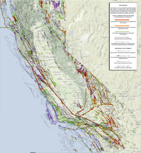
This updated map of California fault lines shows 50 new California SURFACE faults! This new map is a reminder of California’s quake risks.
These quake hazard regions have been discovered over the last two decades and will help educate the public and aid in planning and quake preparadness.
The geological maps of California are constantly evolving. For example, the last Napa Valley quake in August 2014 has created new surface fault lines in California. But Within the last two decades, geologists from the California Geological Survey have found more than 50 new surface earthquake faults that have been now placed on a map:

These new faults are of course not all dangerous. They range from very small to very large ones, like that responsible for the 7.1 Hector Mine earthquake that shook Southern California in 1999. The new earthquake faults created by the Napa quake will probably appear on the next California fault line map!
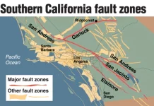
This updated earthquake map should educate the state about quake risk zones and help residents grasp the geography of the fault lines. Because, one thing must be known: The more scientists study quakes in California, the more faults — and dangers — they find.
Here a video about the San Andreas Fault:
Residents of California: You should not however necessarily be alarmed if you live or work near one of California’s estimated 15,000 faults. Many of those are fairly short, and experts have found no evidence that they have generated sizable temblors. Just be aware of the new earthquake hazard potential!


[…] California Fault Lines Map: Updated Map of Earthquake Hazard in California shows 50 New Faults […]
[…] California Fault Lines Map: Updated Map of Earthquake Hazard in California shows 50 New Faults […]
[…] California Fault Lines Map: Updated Map of Earthquake Hazard in California shows 50 New Faults […]
[…] California Fault Lines Map: Updated Map of Earthquake Hazard in California shows 50 New Faults […]