All signs point to a new monster El Niño event later this year.
And it may be exceptionally hazardous.

Scientists thought the emerging El Niño conditions emerging in the Pacific Ocean was too week and too late, so unsignificant. But weather conditions have changed over the past several months.
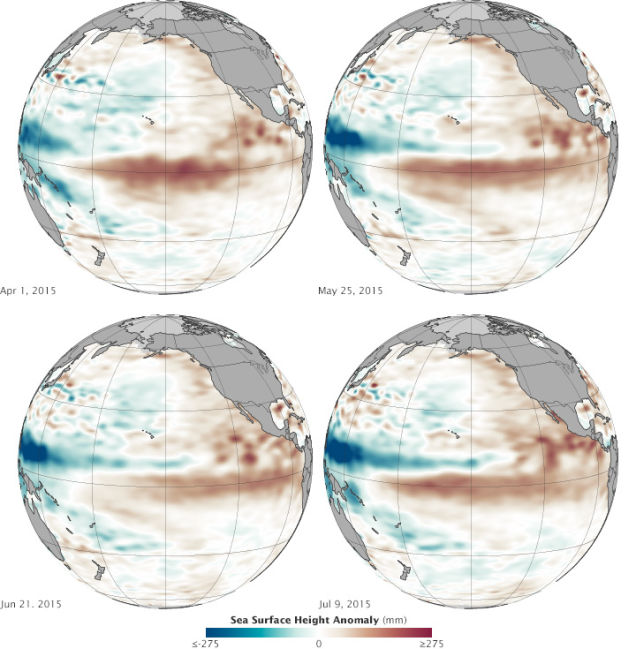
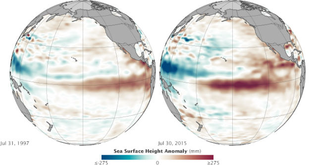
Surface waters are getting warmer in the central and eastern Pacific, while conditions to the west are getting drier and cooler, LIKE before the substantial El Niño event of 1997-98.

Climate experts even say:
[quote_box_center]We have not seen a signal like this in the tropical Pacific since 1997. It’s no sure bet that we will have a strong El Niño, but the signal is getting stronger. What happens in August through October should make or break this event.[/quote_box_center]
The new images by the OSTM/Jason-2 satellite show averaged sea surface height anomalies since March 2015. Sea-surface heights have shifted about 50 cm across the Pacific, a strong indication of El Niño’s strength. Moreover, 2015 may become the hottest year on record.
[quote_box_center]Traditionally, El Niño reaches it peak between December and April, so there’s still time for conditions to change. Factors that could influence its growth include the mysterious warm blob in the Pacific and shifts in the Pacific Decadal Oscillation.[/quote_box_center]


[…] This insane El Niño is responsible or at least implicated in extreme weather phenomena around the world: […]
[…] comparison of both monster El Nino events is available here. The video was found on Live […]