A major earthquake hit Alaska on January 24, 2016 at 10:30 UTC
The epicenter is situated just 83km (52mi) E of Old Iliamna and 261km (162mi) SW of Anchorage, Alaska at a depth of 117 km (73mi).
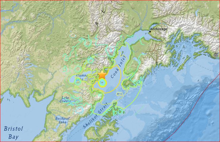
According to USGS, the January 24, 2016 M 7.1 earthquake southwest of Anchorage, Alaska, occurred as the result of strike-slip faulting at intermediate depths, within the subducted lithosphere of the Pacific plate.
In the region of the earthquake, the Pacific plate moves northwestward with respect to North America at a rate of 60 mm/yr, and begins its decent into the mantle at the Alaska-Aleutian Trench almost 400 km to the southeast of this earthquake.
The mechanism and depth of the earthquake are consistent with its occurrence within the interior of the subducted Pacific plate, rather than on the shallower plate boundary thrust between Pacific and North America.
The focal mechanism indicates faulting occurred on either a northwest striking right-lateral structure, or on a northeast striking, left-lateral fault.


