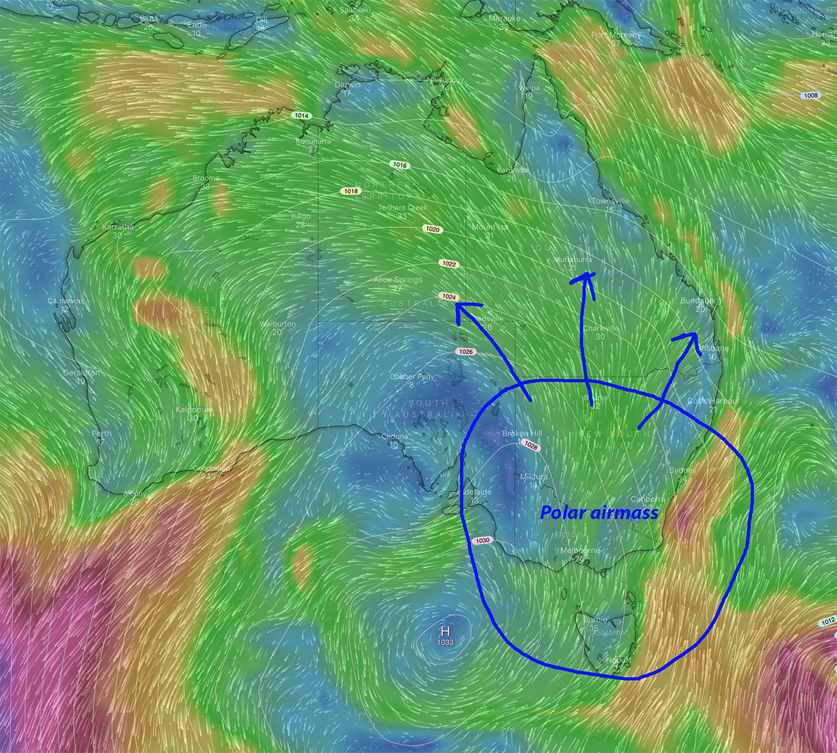
Weather conditions will become bitterly cold across large parts of Australia this week as a polar airmass surges North.
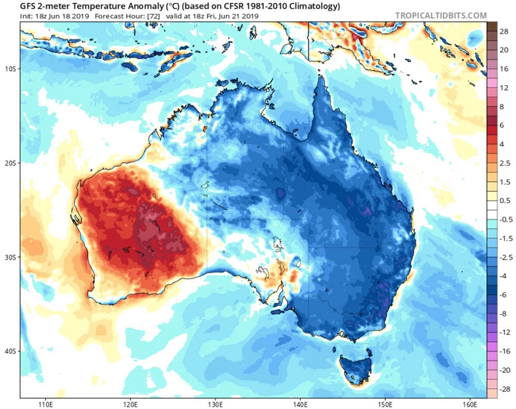
Over half of the country will experience below average temperatures.
There will be however no snow as the systemis very dry with only around 5cms of fresh snow for the AU Alps this week.
A very cold mid to upper level polar airmass will be projected Northwards across South East Australia on Thursday thanks to a slow moving high just west of Tasmania.
The polar airmass remains persistent until Monday causing a big reduction in minimum and maximum temperatures across large parts of Australia.
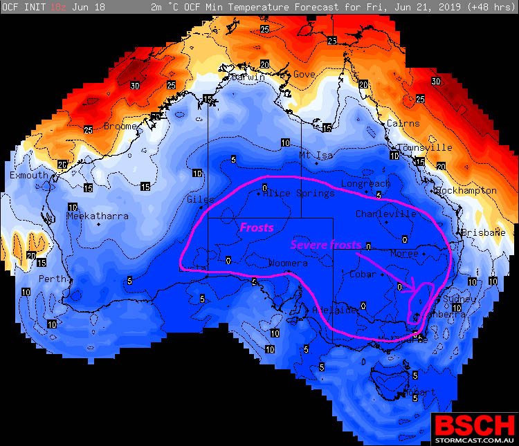
Widespread Frosts
Widespread morning frosts will develop for the rest of the week through inland South Australia, Victoria, New South Wales, the ACT, Southern Northern Territory and Southern inland Queensland.
Severe frosts are expected across the Central and Southern Tablelands of NSW including the ACT where minimums will drop to -4°C or less. Ground temperatures could reach a bone chilling -10°C.
Cold and gusty winds
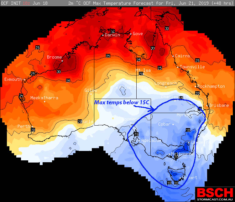
Cold and gusty Southerly winds will keep maximum temperatures below 15°C across South East SA, Tasmania, Victoria, most of NSW and Southern inland QLD for the rest of this week. Adelaide maximum temperatures are 12 to 14°C, Hobart 11 – 12°C, Melbourne 12 – 14°C, Canberra 10 – 12°C and Sydney 16°C.
The much cooler weather and morning frosts will extend well into QLD. Coastal districts including the tropics south from Cairns will be in the low 20s while across the Southern inland it will be very cold. Toowoomba 15°C, Charleville 15 – 17°C and Birdsville 17°C are all below average for this time of year.
While the start of Winter has been fairly mild, the rest of this week will remind us how cold it can get.
Aussie! Make sure you have the Winter woollies ready along with plenty of firewood!

