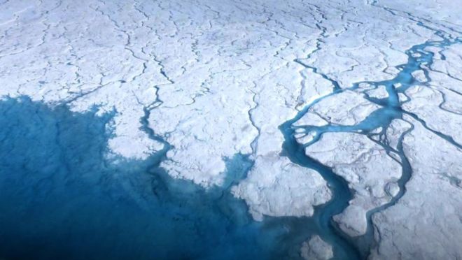
Fifty-six previously uncharted lakes below Greenland’s Ice Sheet have been mapped by researchers using aerial imaging tools.
That’s the first inventory of subglacial lakes below the Greenland Ice Sheet and brings the total number in the region to 60.

“This study has for the first time allowed us to start to build up a picture of where lakes form under the Greenland Ice Sheet,” said lead author Jade Bowling, from Lancaster University. “This is important for determining their influence on the wider subglacial hydrological system and ice-flow dynamics, and improving our understanding of the ice sheet’s basal thermal state.”
Role of subglacial lakes
Subglacial lakes are lakes that form below ice masses and play a role in rising global sea levels, contributing to our understanding of where water occurs in the world and how it drains.
To determine the role of Greenland’s Ice Sheet on the planet’s hydrologic system, researchers analyzed 500,000 kilometers (over 310,000 miles) of airborne echo sounding data to image the bed of Greenland’s Ice Sheet, which measures about seven times the size of the UK. They found the lakes range from 0.2 to 5.9 kilometers (0.1 to 3.7 miles) in length and are mostly found below slow-moving ice away from the interior.

By contrast, more than 400 subglacial lakes have been detected beneath the Antarctic ice sheet – before now, the science community had only confirmed four underneath Greenland’s.
“Researchers have a good understanding of Antarctic subglacial lakes, which can fill and drain and cause overlying ice to flow quicker. However, until now little was known about subglacial lake distribution and behavior beneath the Greenland Ice Sheet,” said Bowling.
Unprecedented results
The lakes below Greenland’s Ice Sheet also differ from Antarctica’s in that they are mostly small and stable; an estimated 40 percent of Antarctic lakes are active compared to just under 7 percent of Greenland’s.
The researchers identified three zones of formation:
- Stable lakes in the northern and eastern regions away from the interior
- Hydrologically active lakes recharged by surface meltwater
- Small, seasonally active lakes that form over the winter and drain during the melting season.

The ice sheets appear to be relatively stable now, but the authors note that a warming climate may turn surface meltwater into lakes and streams at higher elevations. Drainage of this water to the bed could cause the subglacial lakes to become active.
“The lakes we have identified tend to cluster in eastern Greenland where the bed is rough and can therefore readily trap and store meltwater and in northern Greenland, where we suggest the lakes indicate a patchwork of frozen and thawed bed conditions,” said study author Stephen Livingstone. “These lakes could provide important targets for direct exploration to look for evidence of extreme life and to sample the sediments deposited in the lake that preserve a record of environmental change.“
Meanwhile in Greenland, a major glacier is growing, while huge masses of ice are melting! Completely weird, no?


