In August 2019 a large raft of pumice appeared in the territorial waters of Tonga.
As in many other cases, this pumice raft was the only surface expression of a major submarine volcanic eruption.

Do you remember, when the ocean off Tonga was suddenly covered by tons of volcanic ash and rocks August 2019? We knew it was due to an underwater volcanic eruption, but we didn’t know from which submarine volcano exactly. It seems that this geological mystery has been debunked today.
Which Submarine Volcano Is Responsible For The Pumice off Tonga?
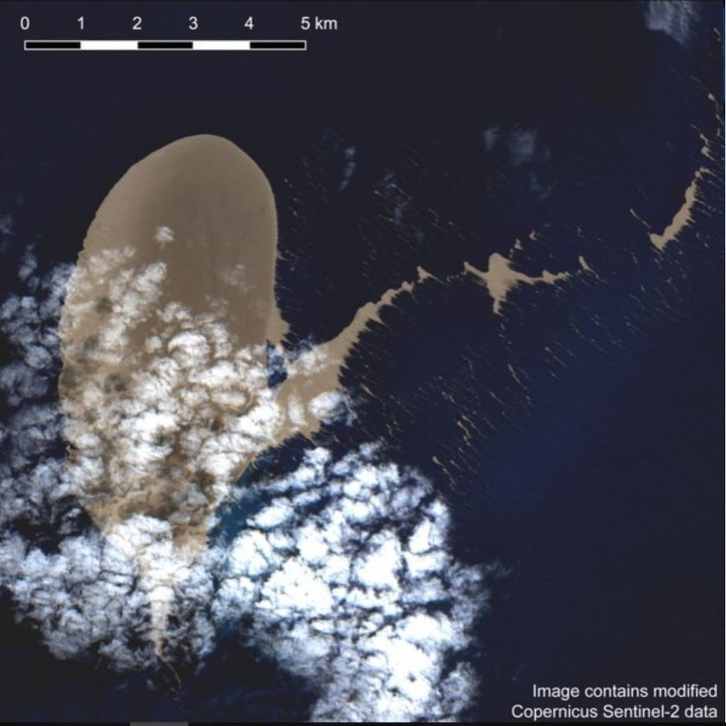
The submarine eruption created over 10 million cubic meters of pumice, which formed a giant 150 km sq raft in the south pacific and started to drift westward.
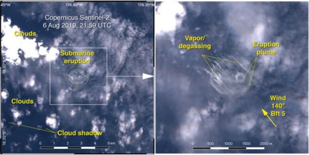
The new study presents imagery from ESA’s Sentinel-2 satellite that captured the start of the submarine eruption on August 6, 2019 and the waning of the eruption on Aug. 8, followed by observations of the drifting pumice raft until Aug. 14.

Based on the discolored water and reconstruction of the drift path using satellite imagery, scientists have determined the most likely volcanic source to be ‘Volcano F’ in the Tofua Arc NW of the island of Vava’u.
Moreover, this start time is consistent with T-phase records at the seismic stations on Niue Island and Rarotonga. And the signal delay time of 733 seconds between the two stations is consistent with an origin at or at least near Volcano F.
What is Pumice?
During a volcanic eruption, molten lava – rich in water and gas – is rapidly depressurised and cooled.
The dissolved gases are exsolved when depressurized and then frozen in the lava that becomes igneous rock when cooled.
Thus, pumice is a rock full of gas bubbles, causing it to float.
How Strong Was The Underwater Eruption in Tonga?
On 8 August, a >136.7 km2 large raft of pumice appears at the sea surface.
The modelled minimum raft volume is 8.2–41.0*106 m3, which is equivalent to 2.5–12.3*106 m3 dense rock.
According to those calculations, the eruption corresponds to a volcanic explosivity index (VEI) 2–3 eruption in the submarine environment.
Prior to the volcanic eruption, a series of earthquakes close to Volcano F was recorded. The series started Aug. 5 with a M4.7 event, followed by at least six shallow earthquakes (> M3.9) on Aug. 6.

First Bathymetric Map of Volcano F
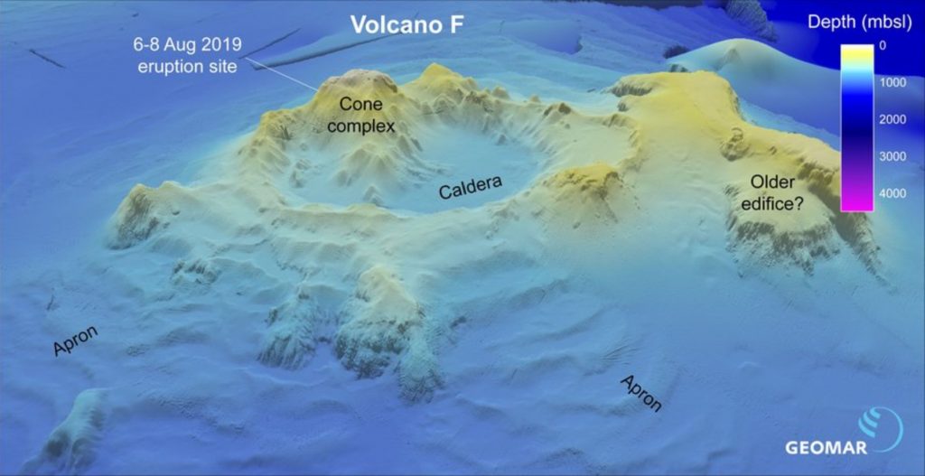
Based on multibeam sonar surveys in December 2018 and January 2019, scientists were able to construct the first comprehensive bathymetric map of Volcano F edifice and its geologic setting.
Volcano F is a major arc volcanic complex, situated at a depth of ∼700 meters under the sea surface. Its basal diameter mesures more than 50 km and its large central caldera 8.7 x 6 km.

Volcano F shows geochemical differences to the adjacent arc volcanoes on Fonualei and Late islands.
Owing to its pristine volcanic morphology and two documented eruptions (2001 and 2019), we are in presence of a highly active volcanic system that needs further scientific studies. [Science Direct, Geomar, Schmidt Ocean]


