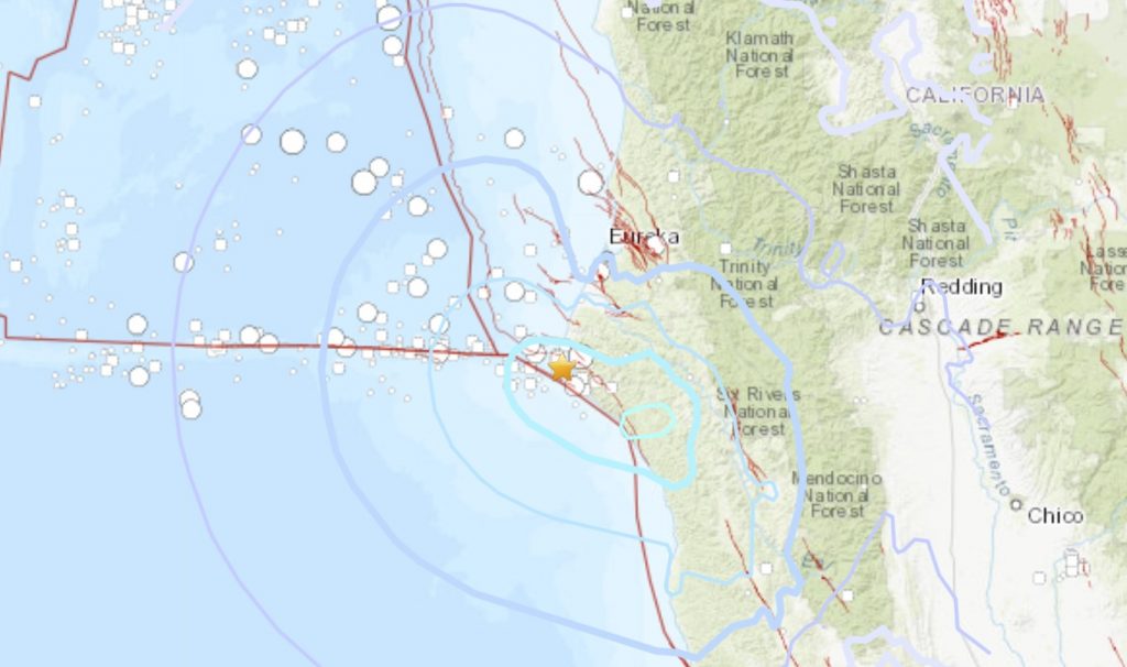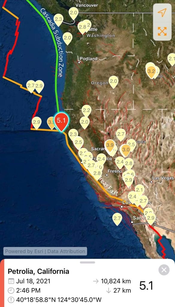
A magnitude 5.1 earthquake struck off the Northern California coast late Saturday.
According to the U.S. Geological Survey, the earthquake just before midnight was about 12 kilometers (7.5 miles) west of Petrolia in Humboldt County and 56 kilometers (35 miles) southwest of Eureka.
The depth was just over 30 kilometers (18.5 miles).
The shaking could be felt as far south as San Francisco and as far east as beyond Yuba City, according to reports submitted to USGS.
There were no immediate reports of damage. Below you will find some ‘I felt it’ reports:
Camping and was woken up by a jolt and then rocking. Shaking continued for several seconds, perhaps 5-7.
House creaked; bed shook a little for a few seconds; nothing fell/shifted position. I heard something thump or scrape outside the house just before I felt the shaking.
After the initial rolling jolts, It lingered on, gently for about 3 minutes. It tapered off. Dog was concerned.
I heard a noise; the house creaked and shook and my bed, on a wooden stand, shimmied significantly. It stopped quickly, but I was alarmed. am more than 3 miles inland from the Coast Highway # 1 in Little River, 95456 zip code.
1 strong jolt followed by several seconds of quite strong shaking. 15–20seconds and it was over.
Woke me up as my bed shook and heard creaking noises.
Why is this California earthquake interesting?
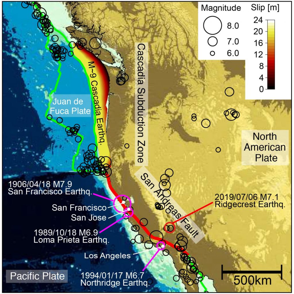
The M5.1 earthquake hit near the Mendocino Triple Junction, where three tectonic plates (Gorda plate, the North American plate, and the Pacific plate) and several fault lines meet (among others the Cascadia Subduction Zone and the San Andreas Fault).

In oder to better visualize what happening at this spot, imagine a busy intersection with a three-way stop sign at rush hour. It takes only a few irresponsible drivers who don’t want to wait their turn and traffic jams and accidents are likely to occur.
Something very similar is happening every day in the Earth’s crust under Cape Mendocino. There upheaval is caused not by impatient drivers but by tectonic plates, which are crashing into each other with unstoppable momentum.
This tectonic three-way intersection is called the Mendocino Triple Junction. It is one of the few places in the world where three of the gigantic plates which continuously drift on the Earth’s mantle meet.

Along the length of most of California, the San Andreas Fault defines the boundary between the Pacific Plate to the west and the North American Plate to the east. Along the fault line, the Pacific Plate slides horizontally in a northnorthwesterly direction with respect to North America.
Under Cape Mendocino, this trip comes to an abrupt halt, because another plate gets in the way. North of the Cape the off-shore Gorda Plate, a small cousin of the Pacific Plate, glides under the North American Plate in what is called a subduction zone.
The boundary line between the Pacific Plate and the Gorda Plate is a fault similar to the San Andreas, called variably the Mendocino Transform or the Mendocino Fracture Zone. It goes from Cape Mendocino for several hundred miles due west into the Pacific Ocean.
Along this fault, the Gorda Plate slides horizontally to the east with respect to the Pacific Plate with a speed of about 2 inches per year.
Lots of mechanical strain
Because of the different directions and the various rates of movement of the three plates, the area under Cape Mendocino and a region immediately off-shore has to absorb a lot of mechanical strain. That makes this area one of the most seismically active regions in the state. During the last three decades alone, two strong earthquakes with magnitudes above 7 have occurred there, one in 1980 and the other one in 1994. Every year at least 80 temblors with magnitudes over three are recorded in this region.
Don’t forget that both the Cascadia and the San Andreas Fault are overdue and the Cascadia will trigger the worst disaster in North America…
So, prep right now And be ready for the Big Ones… They are just around the corner! [USGS, AP, Berkeley]
Now subscribe to this blog to get more amazing news curated just for you right in your inbox on a daily basis (here an example of our new newsletter).
You can also follow us on Facebook and/ or Twitter. And, by the way you can also make a donation through Paypal. Thank you!
You should really subscribe to QFiles. You will get very interesting information about strange events around the world.


I start raising my eyebrows at Mag 5’s. Also, the location. Need to get some popcorn ready.
When smaller earthquakes occur on junctions near fault lines it is always hard to distinguish if they are relieving pressure, or foreshadowing future events.
Also when we see heavy rainfall followed by sunshine —it seems to trigger seismic activity. Ground gets saturated and heavier, then it drys out. Contraction and expansion.
Seems to trigger plate shifting and slippage. It may be my imagination playing tricks on me, but I remember a few earthquakes that occured during times like these.
When will the end of the world, can someone answer me? Oddities with climate and planet.