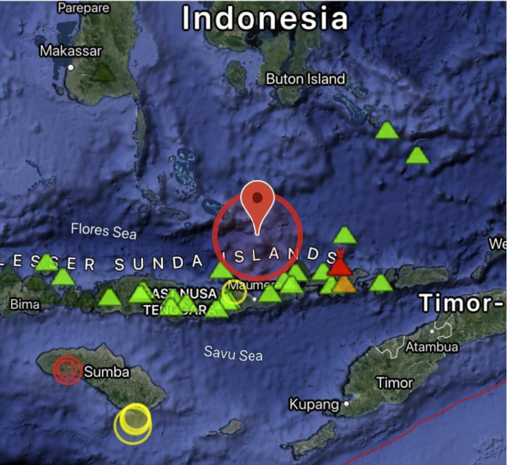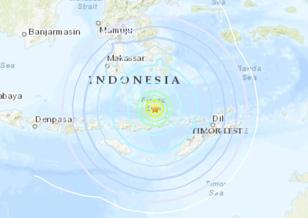
An undersea earthquake of magnitude 7.3 has struck off the coast of Indonesia’s Flores Island, prompting the country’s monitoring agency to issue a tsunami warning which was later called off.
The US Geological Survey said that the quake occurred at a depth of 18.5km under the sea and was located 112km north of the second-largest island town in East Nusa Tenggara province.

The casualties from the undersea earthquake are not immediately clear. However, authorities said several buildings and public properties suffered damage as photos showed roads cracked open by the temblor.
7.3 magnitude #earthquake hits off coast of #Indonesia (VIDEO)https://t.co/0sQ70SjtMI#Gempa Magnitudo 7,4 Guncang NTT, NTB, #Maluku, Sulsel dan Sultra #sismo #terremoto #quake #temblor #Erdbeben #deprem pic.twitter.com/4ezc6XPY2J
— flurudha (@flurudha) December 14, 2021
Another photo by local media showed a wall demolished due to the impact of the quake and bricks strewn on the road in South Sulawesi.
Almost two hours after the quake, Indonesia’s Meteorology, Climatology, and Geophysical Agency agency called off the tsunami warning but asked locals in East Nusa Tenggara and South Sulawesi to remain vigilant.
Hazardous tsunami waves are possible for coasts located within 1,000km of the epicentre, the US-based Pacific Tsunami Warning Centre had said in the initial warning.
Preliminary visuals from the island nation showed people rushing out of their homes, away from the sea and running towards safe areas.
“Everyone ran out into the street,” according to a resident of Maumere town on Flores island.
Areas facing immediate threat of tsunami include Maluku, East Nusa Tenggara, West Nusa Tenggara and Southeast and South Sulawesi.
Aftershocks of 5.6 magnitude from the quake were felt in Larantuka, authorities said. The quake was also felt strongly in Makassar in South Sulawesi, according to reports.
The quake was felt for several minutes, forcing more people to rush out of their homes, said Alfons Hada Betan, head of the East Flores Disaster Mitigation agency.
People in coastal areas were urged to get away from the beach lines, especially from the northern side, “as there was a big tsunami there back in 1972”, said chief of Flores Timur district Anton Hayon.
Prone to strong earthquakes, Indonesia last suffered a major earthquake of 6.2 magnitude in January which claimed 105 lives and injured close to 6,500 in West Sulawesi province.
The undersea quake comes exactly 10 days after the Mount Semeru volcanic eruption in the island nation in which at least 48 people were killed and hundreds were injured.
Placed around the “Pacific Ring of Fire”, Indonesia rests on an area of high seismic activity and has already seen four earthquakes this year over the magnitude of 5.0. [Independent]
Now subscribe to this blog to get more amazing news curated just for you right in your inbox on a daily basis (here an example of our new newsletter).
You can also follow us on Facebook and/ or Twitter. And, by the way you can also make a donation through Paypal. Thank you!
You should really subscribe to QFiles. You will get very interesting information about strange events around the world.


As opposed to ‘screaming silently’?
Yep, its been quiet for a couple of weeks since the volcanic activity, and boooom a huge eathquake. Lucky there was no tsunami. So far.
Not for long the Madrid fault is ready to unzip any moment let’s hope its next year rather than before
Yeah, it’s so hard to predict quakes. I know Mo likes to on California, Oregon, Washington area.
I really thought La Palma, Cumbre Vieja was going to blow up on 11/31, but my prediction came up short.
Just have to wait and see?
If the depth was 18km under sea level makes sense that it was around 11 mag with the USGS downgrading quakes by 4 magnitudes
Yeah, but each tenth of a point increase on the scale is exponential. 11.3 mag seems too much varience if it was downgraded like you say.
Yh probably regulated may be downgraded by just 2 . 4 may be the max they are downgradimg
?FT1%