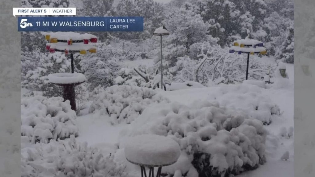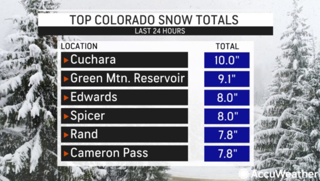
After Montana, Utah (USA) and Alberta and Saskatchewan (Canada), a winterlike storm blanketed the Rockies in Colorado with up to 10 inches of snow on Wednesday and Thursday and even brought the first measurable snow of the season to communities around the Denver metro area.
People and animals alike reveled in the season’s first snow around Denver on Thursday by participating in snowball fights and frolicking through the winter wonderland.
Snowfall slowed traffic and occasionally closed portions of I-70 Thursday morning near Idaho Springs west of Denver.
Several atmospheric ingredients came together this week to produce the accumulating snow.
Prepare now! Protect your home and cars againts EMP, solar flare and lightnings…
“As vigorous low pressure rolled through the southern Rockies, moisture was pulled up from the south ahead of the storm, while cold air plunged southward behind it,” explained AccuWeather Senior Meteorologist Heather Zehr.
After starting the week with highs in the upper 60s, temperatures settled in the mid-40s in Denver.
Communities around the Mile High City and in the nearby foothills measured about 2-4 inches of snow. However, the official observing site for the city, Denver International Airport, which is about 19 miles northeast of downtown, measured only a trace of snow (less than 0.1 of an inch).
Higher amounts were observed in the mountains west of Denver, with many reports above 6 inches.
Cuchara, a town located in south-central Colorado at nearly 8,500 feet in elevation, reported the highest amount in the state of 10 inches.
While residents in locales with higher accumulation spent the day shoveling out, for downtown Denver and points east, the snow amounted to a dusting of accumulation at most, which quickly melted.

Officially, the season’s first measurable snow in the city has yet to occur, as a trace of snow does not qualify as a measurable total.
Prepare now! You will never go without electricity with this portable power station!
“We’re 5,000 feet closer to the sun, so when that sun comes out, it takes care of it quickly,” quipped Colorado resident Tony Laubach, while pointing to a snowless landscape near Denver later in the day on Thursday.
In recent years, the date of the first measurable snow in Denver has been highly variable.
Last year, it took until Dec. 9 for the first measurable snow at Denver International Airport.
That day, 0.3 of an inch of snow was reported, which was a new record for the latest first official measurable snow.

In 2020, the first accumulating snow fell on Sept. 8, marking one of the earliest first snowfalls on record there.
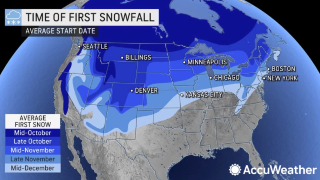
The average date of the first measurable snow in Denver is Oct. 18.
Prepare now! Stock up on Iodine tablets for the next nuclear disaster…
The cold and snowy conditions won’t stick around in Denver as November arrives. A warmup is in store for the area, and high temperatures could settle around 70 degrees Fahrenheit by this coming Tuesday, forecasters say. The average high for this time of year in the city is around 62. [Accuweather]


So much for global warming BS winter just keeps coming back every year its been doing this my whole life and I had thought by what the warmers have been telling us for the last thirty years that Denver would be a city by the bay instead i still have to use the snow blower half the winter.
I think you will still use your snow blower for a long time… I really enjoyed staying in Denver (and around Colorado)! Wonderful state!
Global water boddeling trillians of gallons for spring water at 98 cent
gasp, aka normal weather in spite of weather manipulators.
How is it with all this snow that the rivers and lakes are drying up?
Answer,___________________________________________________.
You would need a deluge. Just look at Lake Mead water level. The huge downpour it experiences end of July, beginning of August, only slightly increased the water level. Within 3 months the level of the lake has just grown by 6 feet. You would need billions of gallons more just to reach the full pool level at 1,229 feet. You would need several biblical deluge to do so…
Here the data: https://mead.uslakes.info/level.asp
Part of the problem is the government subsidizing “farmers” to grow high water usage crops like RICE in the deserts of Kalifornia & the very liberal Kali politicians keep destroying dams to “protect” the Delta Smelt & other species that are invasive, NOT indigenous. Also, the heavy snow is needed in the right places. The Colorado River headwaters are in Green River, Wyoming & there are numerous resevoirs before the water gets to Lake Powell & Lake Mea. Another factor is the “managers” in Las Vegas & Clark County Nevada keep allowing more houses to be built every day when the lake is at 25% capacity!!
Golfs, swimming pools, cities in the desert and water distribution… The water war has already started between states that rely on the same waterways for their agriculture, power generation and drink water… Could end bad…
Earl,
That is what I am concluding as well. Good observations.
Dang global wariming.
Warming oops.
Yep! there’s nothing like that going on…
It’s going to be a really bad winter, I can feel it in me bones.
Yes, you are right. We currently have a heatwave in Europe. But it will soon trun crazy cold…
Global warning narrative is an avalanche of horseshit. We almost got some of that snow, but it was 2,000′ higher in elevation. All my animals are eating double now. That means snow is imminent, and early Winter is inbound. Trees are going into dormancy, and leaves are dropping on orchard. Even the rabbits are trying to fatten up, and hitting my feed pile. Mice are trying to fatten up too. Traps show plenty of micetivity. This is normal, and maybe early by one week. Wild birds are thick at feed pile. Little bastards eat alot more when cold. I don’t shoot them, but sure feel like it sometimes. Feed is spendy. Up 30%.
I agree 100%. We’re all in for a long cold winter; and for scores of winters to come. David Dubyne is all over it on adapt2030.