A major seismic event is underway, and scientists at the Pacific Northwest Seismic Network are saying the Puget Sound could be at a higher risk for earthquakes.
The event is called a slow-slip event and brings tiny tremors in the region that could potentially lead to a larger earthquake at the Cascadia subduction zone.
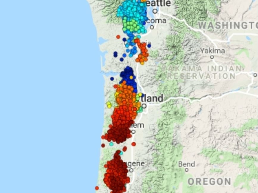
Steve Malone, a professor emeritus with PNSN, thinks the first tremor of this ETS cycle began Aug. 11 just south of San Juan Island.
The last two quakes stronger than M1.0 of the slow-slip event, a M2.5 and M2.4, hit today, September 2, 2019.
Back in July, the area suffered a 4.6 magnitude quake, the largest in the region in some time. It was strong enough for most people to feel but did not cause any damage.
“Over this week the tremor has on average gotten stronger and more frequent but is not yet as near-continuous as during some previous ETS events,” Malone wrote. “Thus far I have not been convinced that the GPS data is yet showing displacements consistent with a full-blown ETS, but then it is early in the sequence, and I am just a seismologist. If this activity continues as I expect it likely will then it likely will spread a bit farther south but it should mostly head to the northwest.“
The slow slip event is a semi-regular occurrence happening once every 14 months or so, according to scientific records and notes.
Small tremors are a good reminder to make sure you and your family are prepared for the next earthquake.
When the ‘Big One” Hits the Cascadia Subduction Zone, It’s Game-Over for Seattle
Local media outlets in Western Washington have been talking a lot lately about the Cascadia Subduction Zone. A recently published simulation shows how the state would be impacted by a magnitude 9 earthquake:
For one, large tsunami waves would barrel in and out of the Washington coast, including through inland waterways that connect to Seattle and its surrounding communities. Though the size of these waves would certainly vary, Washington’s Chief Hazards Geologist Corina Forson notes that they would generally be “incredibly tall,” and thus devastating.
Another concern is what’s known as trough, which is when water levels suddenly recede following an earthquake, following their rapid return ashore.
“That’s one of the things we struggle with messaging,” Forson told KING5, which used the example of the massive 2004 Indian Ocean tsunami that pulled water out from the beach before sending it roaring back, killing many.
“When you see the water recede, that could be an indication that the tsunami wave is coming,” she adds.
Another concern is the fact that the Cascadia Subduction Zone is located right next to the Juan de Fuca tectonic plate, which plunges underneath the North American plate. A large section of the Juan de Fuca plate is missing underneath central Oregon, or rather tearing apart and splitting the plate, which has raised more concerns about how a cascading seismic event might impact both states.
Apart from the Cascadia, Seattle is also threatened by the seismically active Seattle Fault and South Whidbey Island Fault. So just be ready, because those three fault lines are overdue for a large earthquake.
- https://pnsn.org/tremor/tremor-log/ets-event-of-summer-2019
- https://www.kiro7.com/news/local/seismologists-seismic-event-underway-that-could-increase-risk-of-large-earthquake-in-region/978035722
- https://www.king5.com/article/news/local/disaster/tsunami-simulations-for-washington-show-what-could-happen-after-90-earthquake/281-840f6210-5744-4c0d-b773-bf11a28123d9
- https://www.naturalnews.com/2019-09-01-cascadia-subduction-zone-about-to-blow.html


