There are many seismically active fault zones across the United States and some still have to be discovered.
Here we present a list of the most dangerous fault lines in the USA, those known to have caused terrible damage in the past.
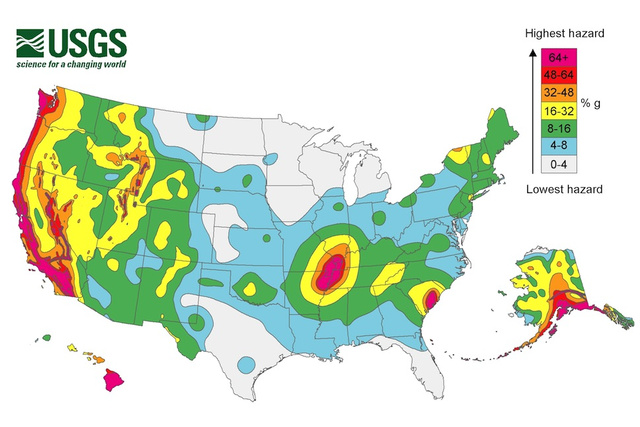
1. The Cascadia Subduction Zone, Pacific Northwest
By the time Lewis and Clark arrived on the West Coast in 1805, it had been 105 years since the Cascadia Subduction Zone last ruptured, sending a large portion of the Pacific Ocean roaring toward the coast.
The few remaining Native Americans in the area spoke of the earth shaking and ocean rising to consume the land. Many tribes even left the region permanently.
However, it wasn’t until the discovery of the Cascadia Fault in the 1960s that modern settlers truly understood the dangers they faced.
Running 680 miles along the Pacific Northwest coastline, the Cascadia Fault directly threatens 3 major metropolitan areas: Portland, Seattle, and Vancouver.
With Cascadia capable of producing a magnitude 9.0 earthquake, the Pacific Northwest may soon face shaking 16 times more powerful than San Francisco’s devastating 1906 earthquake, lasting 4 minutes and delivering a mighty tsunami of unimaginable proportions.
2. The New Madrid Seismic Zone, Missouri, Arkansas, Tennessee, Kentucky, Illinois
It’s not just the West Coast that needs to watch out for tectonic obliteration.
The New Madrid Seismic Zone spans southeastern Missouri, northeastern Arkansas, western Tennessee, western Kentucky, and southern Illinois. It’s the most active earthquake zone east of the Rocky Mountains.
Between 1811 and 1812, this zone experienced some of the largest quakes in history.
And although they originated in the Mississippi Valley, they rang church bells in Boston and shook New York City — over 1,000 miles away!
Even then-President James Madison and his wife Dolley reportedly felt shaking at the White House.
After one particularly large rupture in the fault, the mighty Mississippi River was forced to run backward for several hours, devastating acres of forest and creating 2 temporary waterfalls.
Fortunately the Mississippi Valley was sparsely populated back then. Today millions of people live in densely populated urban areas like St. Louis and Memphis, making this zone one of the biggest concerns for the Federal Emergency Management Agency.
3. The Ramapo Seismic Zone, Pennsylvania, New Jersey, and New York
In 1884, Brooklyn was rattled by an earthquake originating near the Ramapo Fault System.
Toppling chimneys in New York City and felt as far away as Maine and Virginia, the magnitude 5.2 earthquake was a sudden wake-up call for settlers in the region.
Running through Pennsylvania, New Jersey, and New York, the Ramapo has remained quiet for about 200 years.
While studies have shown that a quake greater than 5.0 to 5.5 in magnitude is unlikely, urbanization in the tristate region leaves the area extremely vulnerable.
A mid-magnitude earthquake in the right place could cause devastating damage.
One of the faults in the Ramapo system even crosses New York City around 125th Street.
A magnitude 5.0 rupture lasting more than a minute or 2 could cause intense structural damage to numerous Manhattan skyscrapers, most of which are not designed to withstand such tectonic activity.
4. The Hayward Fault, California
This very unstable fault in California has been threatening the San Francisco Bay Area for generations.
It’s capable of producing quakes ranging from 7.0 to 8.0 in magnitude.
The last major movement along the Hayward Fault occurred on October 21, 1868, virtually destroying downtown Hayward.
In fact, it was considered the “great earthquake” until the San Andreas Fault tore San Francisco apart 38 years later.
Running for nearly 74 miles through cities including Fremont, Hayward, Oakland, Berkeley, and Richmond, the Hayward Fault has the potential to wreak more havoc than most California faults.
Over 2.4 million people live within close proximity to the fault today, not to mention the key infrastructure developments, including a major public transit system and the Caldecott Tunnel that run precariously through the fault.
5. The Denali Fault System, Alaska
If we’re talking sheer magnitude, the largest recorded earthquake on North American soil hit Alaska on November 3, 2002.
Starting on the Susitna Glacier Thrust Fault, the rupture raced along the Denali Fault System and continued 220 kilometers until it reached the Totschunda Fault, rattling 70 more kilometers.
Here a video about the 1964 Alaskan earthquake, also known as the Great Alaskan earthquake and Good Friday earthquake, which occurred at 5:36 PM AST on Good Friday, March 27, 1964.
The estimated magnitude of this earthquake ranged from 7.0 to 7.9 with a surface wave magnitude of close to 8.5.
This almighty quake caused extensive damage to the transportation systems in central Alaska.
Multiple landslides and rock avalanches occurred in the Alaska Range and Black Rapids Glacier. This event was literally felt across the nation, even causing waves in pools and lakes in Texas and Louisiana!
6. San Andreas Fault, California
California sits at the border between two major tectonic plates — the Pacific plate, which is moving northwest, and the North American plate, which is sliding past it to the southeast.
The two plates don’t just meet at a single line, and the state is crisscrossed with dozens of earthquake faults.
The San Andreas is the most worrisome, because it generates the quakes that are really dangerous to California residents.
The fault indeed slices California in two from Cape Mendocino to the Mexican border. San Diego, Los Angeles and Big Sur are on the Pacific Plate. San Francisco, Sacramento and the Sierra Nevada are on the North American Plate.
While San Andreas does not go through San Francisco, it crosses Desert Hot Springs, San Bernardino, Wrightwood, Palmdale, Gorman, Frazier Park, Daly City, Point Reyes Station and Bodega Bay, (or just a few other million people).
The northern San Andreas leveled San Francisco in 1906, but it’s been a lot longer since the southern part of the fault ruptured.
On average, Southern California has seen big quakes every 110 to 140 years, based on records of past earthquakes and studies of earthquake faults.
The last big quake near Los Angeles, a magnitude 7.9, struck Fort Tejon in 1857. Farther south, near Palm Springs, the fault hasn’t ruptured in over 300 years. The fault has to break.
If you live near one of those dangerous faults in the USA, I would rather have a plan ready for surviving the next ‘Big One.’ Get prepared and be ready! [ESurance]


You are mistaken about the magnitude of the Good Friday Earthquake on 3/27/1964. It was 9.2 on the Richter scale. Check usgs.gov.
EARTHQUAKES IN DIVERS PLACES THE BIBLE SAYS USGS!. PRAYER FOR EVERYBODY TO READ ODBORG AND THE BIBLE THE OLDEST BOOK IN THE WORLD ABOUT THE BENINNING AND END OF THE WORLD. KNOWING JESUS LIGHT FOR THE DAY ODB.ORG AMEN.
[…] article source […]