The stratospheric polar vortex turns beastly, as it reaches its coldest temperature in the past 40 years.
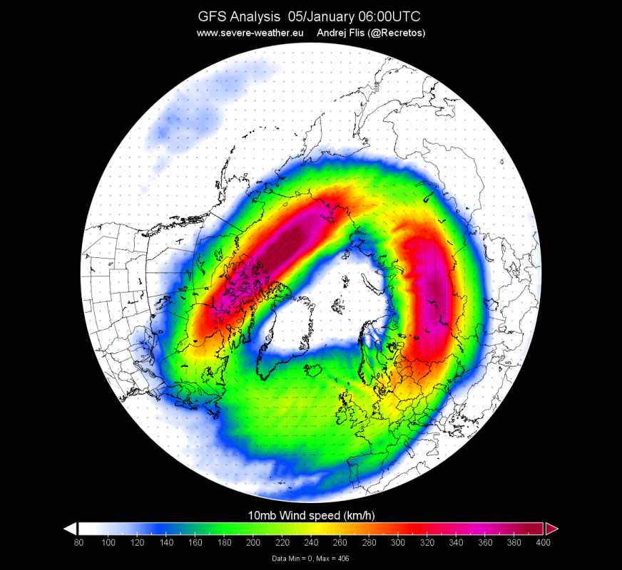
It is set to connect down and dominate our weather patterns as it spins at over 600km/h on top! This will push cold air into USA but mild air into Europe.
New radiosonde data obtained over Reykjavik, Iceland, show that the stratospheric polar vortex reached its lowest temperature at -96°C (-141°F) in the past 40 years.
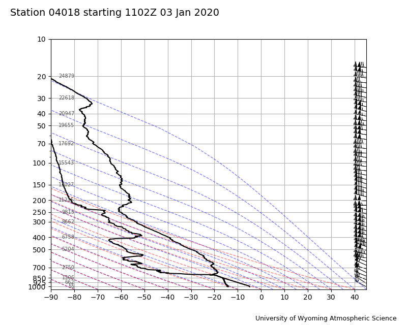
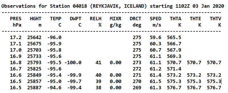
The raw data below show that -96°C was reached at 17.2mb level (25.6 km or 84,000 feet) altitude.
Looking at the globe below (10mb), the NASA/GMAO analysis of the black spots around West Iceland and South-East Greenland shows that Greenland dark spot is at -97°C. However, this calculation hasn’t been verified by a direct temperature measurement.
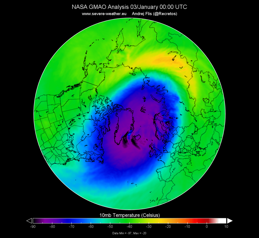
This is the coldest temperature in the last 40 years (MERRA-2 data set). Such cold temperatures enable the formation of Polar Stratospheric Clouds (PSC).
Check out this quick video of the biggest polar stratospheric cloud I’ve ever seen!
— Oliver C Wright (@OW_Photography) January 6, 2020
Was drinking a coffee and saw this out of the window. Did a quick phone vid as I left the house.
Good job as normal cloud rolled in ?
Feel free to share to any cloud/weather folks! pic.twitter.com/L4tV7Mz9Il
or here over Sweden:
#Nature ? Polar stratospheric clouds in Östersund (Sweden).
— YourWeather (@yourweathercouk) January 5, 2020
These spectacular images were recorded a few days ago ⛅️ pic.twitter.com/tYoOu9mzWf
and here above Finland:
WOW!!! Absolutely stunning view of the #Nacreous clouds display (Polar stratospheric clouds) in Kilpisjärvi, Finland yesterday morning 29th December! Video by ? Grayling land Facebook; https://t.co/RMa6xGoyFJ #severeweather pic.twitter.com/8wyTM6jLNk
— WEATHER/ METEO WORLD (@StormchaserUKEU) December 30, 2019
How does the polar stratospheric vortex influences our weather?
Temperature is one indicator of the strength of the polar vortex, but its wind spped gives a better estimate of its strength and thus its possible influence on our weather.
A good way to estimate the power of the polar vortex/circulation is with the graph below in which negative values mean a weaker vortex while positive values mean a stronger vortex. The forecast clearly show that the polar vortex is strengthening (positive values).
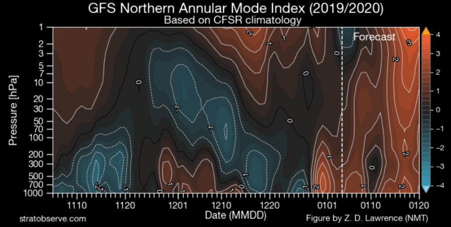
Stratospheric Polar Vortex rages
The wind speeds of the stratospheric polar jet at different altitudes is amazingly high with 400kmh (249mph) at 10mb (30km or 131,000 feet).

And 600kmh (373mph) at 1mb (45km or 148,000 feet). The polar vortex is currentl a ferocious a beast.
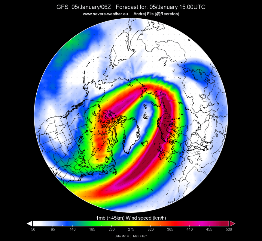
The polar vortex circulation over Greenland promotes cold temperatures into the United States and Canada and mild temperatures in Europe. More headlines on Strange Sounds and Steve Quayle. [Severe Weather]


