The Global Incident Maps news feed reported 3 M7.5 earthquakes off the Kuril Islands.
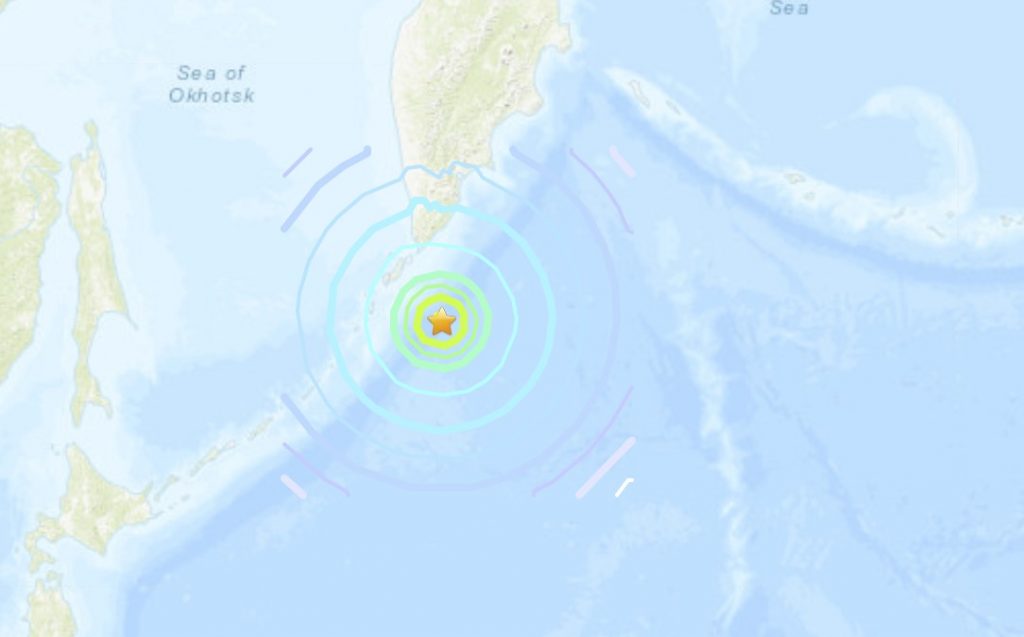
So why is USGS only showing one M7.5 earthquake on its map?
This is weird, really weird.
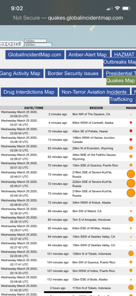
According to the Global incident Maps, three M7.5 earthquakes hit off the Kuril Islands in Russia, early this morning.
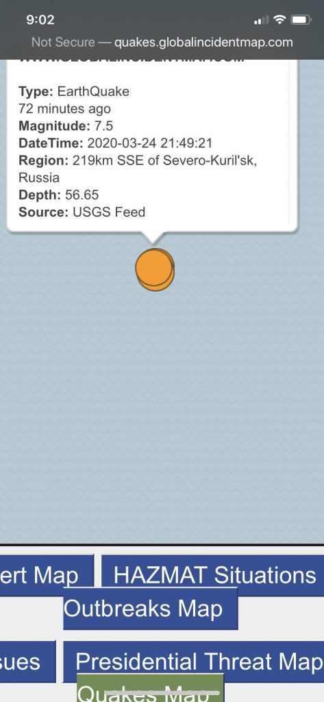
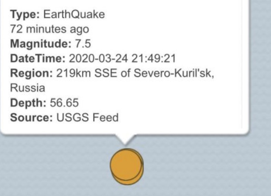
Here again the 3 earthquakes from the USGS feed on the global incident maps. As you can observe, they all have different epicenters: 219, 222, 218 km SSE of Severo-Kuril’sk, Russia.
However, the USGS earthquake map only shows 1 of these three.
Here some videos of the seismic events.
Such a series of earthquakes would be unprecedented… Have you ever heard of 3 M7.5 earthquakes in a row? Never!
Now why this discrepancy, then? Why is this unprecedented event being scrubbed from the earthquake live maps?
The Kurils are known as the Northern Territories in Japan. The four southernmost islands of the Kuril chain – Habomai, Shikotan, Etorofu and Kunashiri – have been disputed between Moscow and Tokyo since the end of the second world war.
Now, let’s keep it short: People are already panicking because of the ongoing pandemic. So government officials don’t want to pour more oil on the fire.
Thank you for the information Steve! More earthquake news on Strange Sounds and Steve Quayle. [Global Incident maps, USGS]


Thanks for this report. It is important to inform us about tricks as these.
Also thanks to you daman for your comment about north cali.
6 months more and we reach the real 2012dec21. check the calendars!
Some liberals who hang out with Nancy Pelosi determined that it was not a seismic event, it was in fact cows farting that caused the 7+ quake. So they made phone calls and had them removed.
I say we replace those USGS people with the sheriff of LOS ANGELS,he a know criminal,and just as stupid as they are,what have we got to lose..WE NEED MORE DEEP STATE people in charge,HEY maybe Nancey Plosie would be a good choice,shes an idiot,everyone would be happy with her,and shes only 80 years old…I WONDER who tells the usgs to take down the numbers,OH,I bet its monsanto….
B*S*A*R*D’*
They also just removed a quake from the map in N California not too far from Redding and it was listed as a 5.5 at about the time 3:00pm EST and now it is gone!