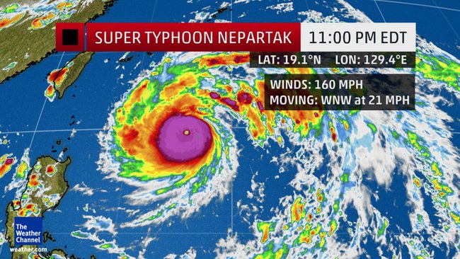
Super Typhoon Nepartak has rapidly intensified just under 300 miles southeast of Taipei, Taiwan, and poses a dangerous threat to Taiwan, Japan’s far southwest Ryukyu Islands and eastern China late this week.
Nepartak exploded from a tropical storm with wind speeds of 110 kilometers per hour (70 miles per hour) on July 4 to a Category 5 equivalent super typhoon with winds hitting 240 kph (150 mph) the following day. And it could surge even higher.
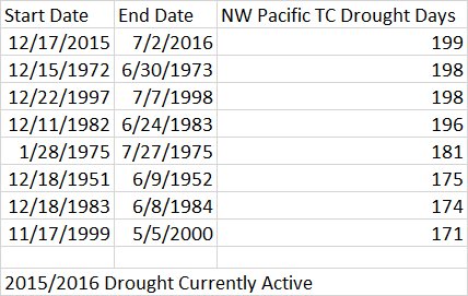
Nepartak developed over the weekend south of Guam and strengthened into a typhoon Monday evening. It is the first named storm in the western north Pacific basin since Dec. 17, 2015, setting a new record for the longest stretch without at least a single tropical storm in the western North Pacific basin in 66 years of records.
Blas is now major hurricane with max winds of 110 kt-1st MH of NE Pacific season-1971-2009 climo for 1st MH is 7/19. pic.twitter.com/0rc2QcuuZ5
— Philip Klotzbach (@philklotzbach) July 5, 2016
Super Typhoon Nepartak is forecast to move west-northwest and then northwest around the periphery of subtropical high pressure that is in place over the western Pacific.
Real-Time #Nepartak 07/06 #Himawari8 2-min VIsible TargetSector https://t.co/mBULkzEkYa #RealEarth™ #UWSSEC #UWCIMSS pic.twitter.com/4ZW29DiIAG
— Russell Dengel (@RussellDengel) July 6, 2016
Exactly when and how sharp Nepartak turns toward the northwest will ultimately determine the impacts in Taiwan, Japan’s far southwest Ryukyu Islands and parts of eastern China later this week.
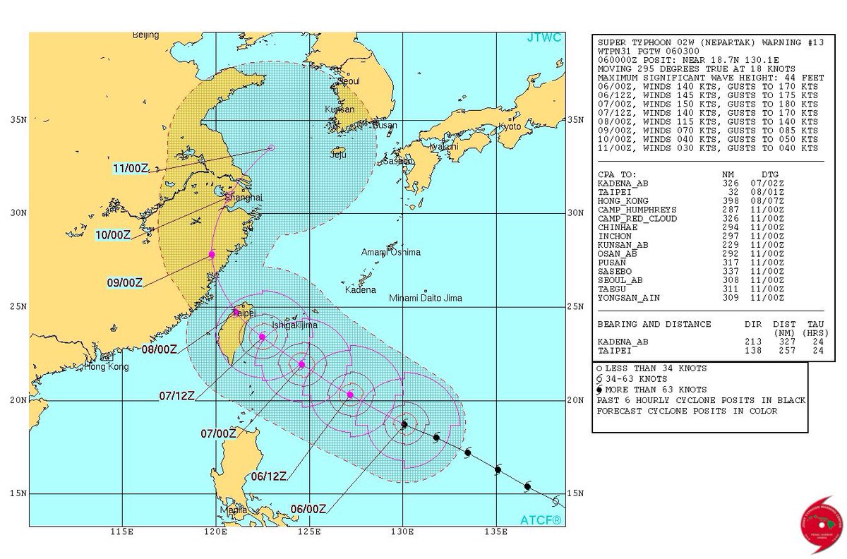
As of this time, it’s too soon to tell which of these areas would take a direct hit from Nepartak’s core of most intense winds and heavy rainfall.
For now, any impacts in Japan’s far southwest Ryukyu Islands and Taiwan would arrive Thursday into Friday (local time), and in eastern China, those impacts could arrive late Friday into Saturday. Of course, the severity of those impacts will depend on the exact track and strength of Nepartak at that time.
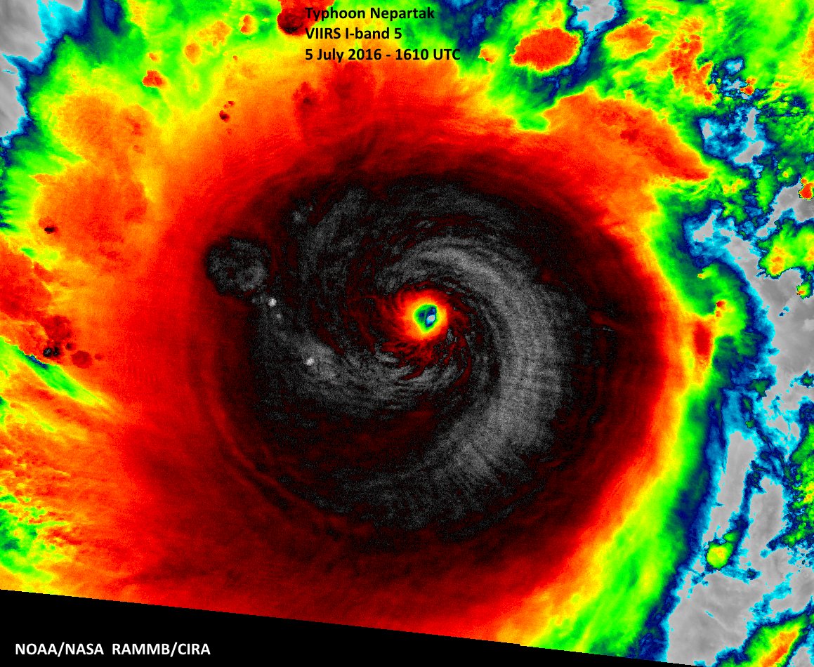
Nepartak is forecast to strengthen further over the next 12 to 18 hours. It may weaken a bit before affecting the southwest Ryukus and Taiwan, but still may be an intense tropical cyclone at its nearest pass to those areas. Nepartak is expected to be considerably weaker once it nears China, but how much weaker remains uncertain, for now.
Record Long Streak For Western North Pacific Ends
Prior to Nepartak’s formation, not a single tropical storm, much less a typhoon (the term for a hurricane in the western North Pacific Basin), had formed west of the international date line – the world’s busiest tropical cyclone corridor – since mid-December 2015.
This set a new record for the longest stretch without at least a single tropical storm in the western North Pacific basin in 66 years of records.
This first six months of 2016 have been completely opposite from what we saw last year. By the end of June 2015, there had already been nine tropical cyclones in the northwest Pacific basin, including three super typhoons of Category 5 equivalent intensity.
Hopefully, this powerful storm will not beat any victim records.


