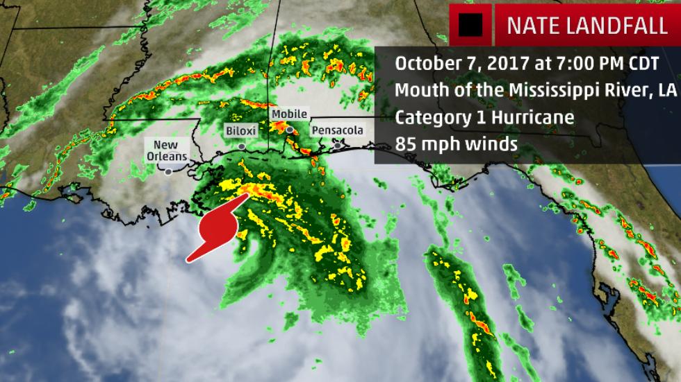
Hurricane Nate made its first landfall as a Category 1 hurricane near the mouth of the Mississippi River.
Nate will make a second landfall on the northern Gulf Coast in the next hour or two.
Hurricane #Nate Advisory 14A: Nate Makes Landfall Near the Mouth of the Mississippi River. https://t.co/VqHn0uj6EM
— NHC Atlantic Ops (@NHC_Atlantic) October 7, 2017
Destructive, hurricane-force winds are now moving ashore along the Mississippi coast within Nate’s northern eyewall.
Life-threatening storm surge is expected along the coast overnight from southeast Louisiana to the western Florida Panhandle.
Water levels have exceeded 4 feet above normal tides at Mobile, Alabama. Storm-surge inundation of 4.75 feet above normal tide levels has been observed at Shell Beach, Louisiana. Bay Waveland Yacht Club, Mississippi, has recorded an inundation over 4.1 feet above normal tides.
Nate will produce a swath of heavy rain from the Gulf Coast to the Appalachians and possibly parts of the Northeast.
Strong winds capable of tree damage and power outages will penetrate inland over the Southeast through Sunday.

Hurricane Nate’s northern eyewall is moving ashore along the Mississippi coast, where a second landfall is expected in the next hour or two.


