The National Hurricane Center says Tropical Storm Dorian is now a Category 1 hurricane.
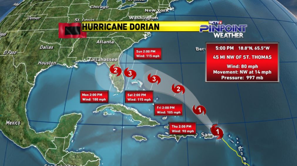
By Sunday morning, it may be as strong as a Category 3 hurricane. And that’s exactly when the now major storm is thought to make landfall in Florida! The entire east coast of Florida is in the cone.

Dorian is now expected to be a major Category 3 Hurricane upon landfall in Florida, where the entire east coast is in the trajectory cone.
So if you have friends or family in eastern Florida or along the southeast coast of the U.S., it’s time to start watching Dorian.
The 5PM Advisory was released by the National Hurricane Center. Hurricane Dorian has winds of 80 mph. It is about 45 miles northwest of St. Thomas. Dorian continues to push northwest at 14 mph.
Dorian’s forecast cone has not changed much. It is forecast to strengthen to a category 3 hurricane by Saturday with winds of 115 mph. Most of Florida and part of South Georgia remain in the forecast cone through Monday.
Be ready for the worst! Get updates about Hurricane Dorian here: https://www.nhc.noaa.gov/graphics_at5.shtml?start#contents


