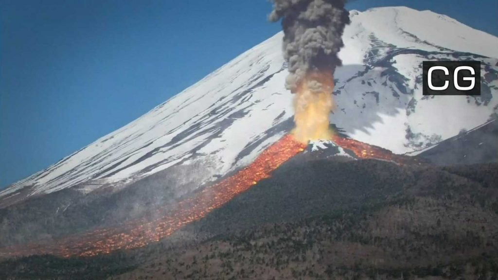
Mount Fuji is one of the iconic symbols of Japan and also an active volcano. Last week, the Japanese government revised its volcanic hazard map of the volcanic peak for the first time in 17 years. And the results are kind of frightening: New data shows that lava flows from a major eruption could spread as far as 40 kilometers from the summit.
The map was presented at an online meeting of the Mount Fuji disaster management council last Friday.
The council updated the map based on the latest studies and geographical data. The major change was the amount of lava anticipated in the event of a large-scale eruption.
Recent estimates show that an eruption could release 1.3 billion cubic meters of lava, about twice as much as previously thought. The new map includes far more craters from which this lava could flow than previous editions.
According to these estimates, lava flows could reach an additional 12 towns and cities in the three prefectures, including Uenohara City in Yamanashi Prefecture, located more than 40 kilometers from the summit.
Previously, Uenohara had been asked to provide shelter for evacuees from municipalities at the foot of Mount Fuji. Now the city will have to find shelters for its own residents.
The new map also shows that an eruption would affect wider parts of Fujinomiya City, Shizuoka Prefecture. Previous estimates indicated that lava would reach the city, located on the southwest side of Mount Fuji, within two hours. The new data suggests it would also reach the area north of the city center.
An eruption could also affect transportation and the distribution of goods, with the new calculations showing that lava flows could reach the Chuo Expressway and the JR Chuo line, which connects Tokyo with Nagoya.
Mount Fuji’s last eruption began on December 16, 1707. It was centered on the southeastern slope and lasted until the following January. Records from the period show that a village about 10 kilometers from the crater was destroyed.
Shizuoka Governor Kawakatsu Heita, who chairs the council, says the group will use the new map to revise evacuation plans for areas that could be affected.
That’s terrifying for all the people living around the Japanese volcano. I would get prepared right now for a possible eruption! [NHK]
Now subscribe to this blog to get more amazing news curated just for you right in your inbox on a daily basis (here an example of our new newsletter).
You can also follow us on Facebook and/ or Twitter. And, by the way you can also make a donation through Paypal. Thank you!
You should really subscribe to QFiles. You will get very interesting information about strange events around the world.


I hope it blows it top and burys that country, pay back is a bitch.