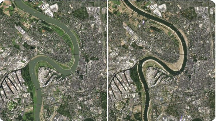
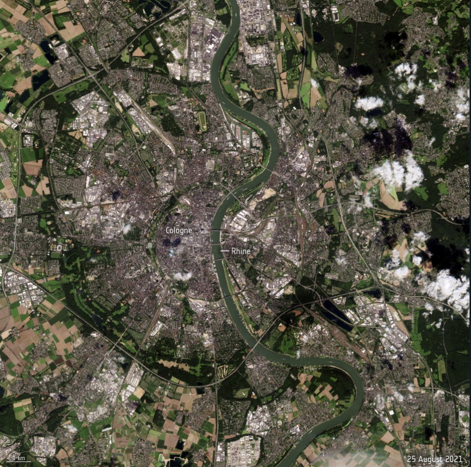
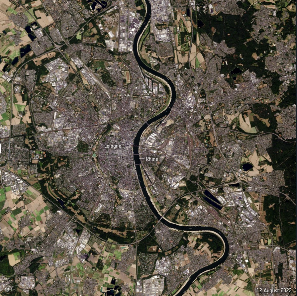
Water levels on the Rhine River, Europe’s second-largest river, have continued to drop owing to soaring temperatures and lack of rainfall, preventing many vessels from navigating through the waters at full capacity. The Copernicus Sentinel-2 mission captured part of the Rhine River near Cologne – showing the stark difference between August 2021 and August 2022.
Flowing from the Swiss Alps to the North Sea, the Rhine River is an important shipping route for many products from grains to chemicals to coal. When water levels drop, cargo vessels need to sail with reduced load, so they don’t run aground.
Water levels at the chokepoint of Kaub, near Frankfurt, fell to 32 cm in depth on Monday, down from 42 cm last week.
Health Ranger Store: Lab-certified, non-GMO superfoods… JUST TRY IT!…
Ships, however, need around 1.5 m to be able to sail fully loaded making it difficult for larger ships to navigate through the waters. Freight ships continue to sail, but only with around 25% to 35% of the ship’s capacity.
The low water levels are emerging earlier than usual, with the lowest water levels typically recorded in September or October.
Stock up on Iodine tablets for the next nuclear disaster…
However, reduced temperatures and predicted rainfall forecasted for this week may offer relief to the Rhine.
The phenomenon facing the Rhine is common across much of Europe after an unusually hot and dry summer – causing wildfires and water shortages.
The Copernicus Sentinel-2 satellites capture high-resolution imagery that provide information about the conditions on Earth, such as plant life, soil and coastal areas.
The mission consists of two satellites both of which carry an innovative multispectral imager – a camera that captures optical images over a range of wavelengths beyond visible light. [ESA]
StrangeSounds.org has been banned from ad networks and is now entirely reader-supported CLICK HERE (or the banner below) TO SUPPORT MY WORK… I will send you a small gemstone if you give more than 25$… Thanks in advance!
Another way to support my work is by signing in to get FREE information about how to invest in GOLD, SILVER and other PRECIOUS METALS to limit the effects of inflation on your IRA/4001K… As the Dow Jones is sinking and the inflation is hiking it’s the right time to invest in precious metals!
You will finally find some great affiliate products that I recommend you to add to your disaster & preparedness kit:
- Qfiles is another great site for alternative news and information…





There were multiple articles on this site about flooding in Germany and storms. I guess this wasn’t enough to keep the Rhine River at a decent water level? Seems fishy when areas receive abundant rainfall and snow you would expect a better water table and river levels?
Europe needs desalinization plants and so does our left coast. Lay pipe, and pump water to where it is needed. If solutions aren’t deployed then it looks even more fishy.
Geoengineering, ain’t it grand!