Hurricane Jose is expected to cause direct impacts from Delaware northward to New England.
Meanwhile, less than two weeks after Irma devastated the region, the Caribbean islands are again under threat from a named storm, this time Hurricane Maria. Computer simulations show Jose and Maria could meet along the US East coast.
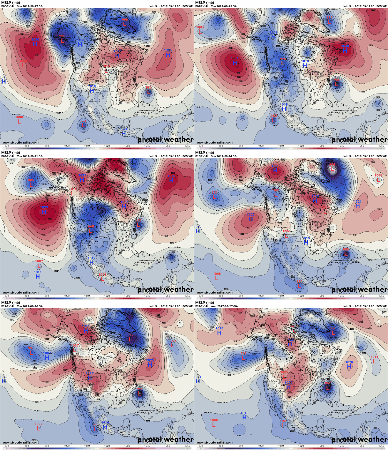
Tropical storm watches have been issued from Delaware up through Cape Cod. Additionally, Maria has officially strengthened to hurricane status, prompting hurricane warnings on the different Carabbean islands.
Hurricane Jose
Hurricane Jose is currently located about 350 miles off the coast of North Carolina with maximum sustained winds of 90 mph. The storm’s intensity shouldn’t change much over the next 48 hours, as the Jose slowly starts to move around the western edge of a large Bermuda High and toward the north.
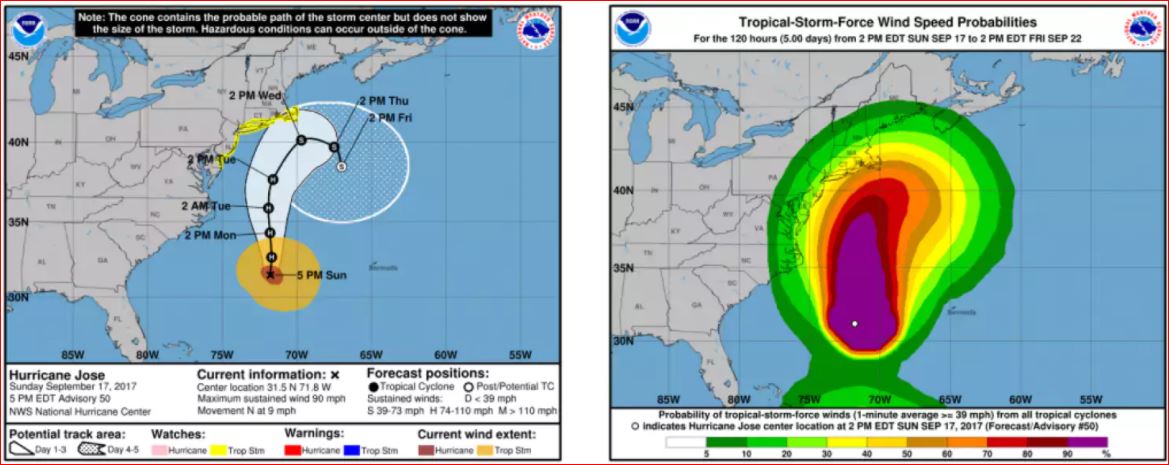
The latest European model forecast on Sunday suggests the storm center could come very close to the Northeast coast on Wednesday and, while remaining offshore, will be slow to depart. If it is correct, it could an extended period of coastal flooding from the Jersey shore to eastern New England, including around Long Island and New York City. In addition to the possibility of significant coastal flooding, the storm could bring tropical-storm force winds and gusts to hurricane force, along with very heavy rain.
Small shifts in the storm track are possible and will have important consequences on how hard coastal areas are hit.
Hurricane Maria
Meanwhile, hurricane Maria, with peak winds of 75 mph, was located about 400 miles east of the Lesser Antilles on Sunday night, moving quickly towards the northwest at 15 mph.
Fueled by warm ocean water and low wind shear, Maria officially reached hurricane strength on Sunday evening. Tropical storm and hurricane warnings extend from Barbados to Antigua as Maria should begin to impact the outer islands as early as tonight.
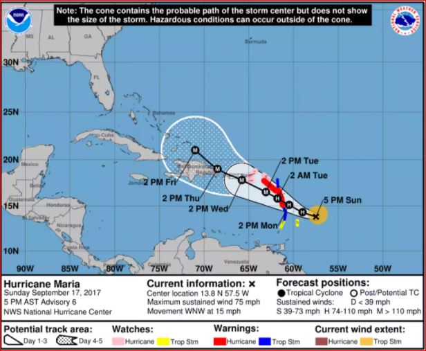
Maria will continue to intensify over the next few days, likely reaching major hurricane status (Category 3 or greater) on Wednesday. By that point, the storm will be on the doorstep of Puerto Rico and the U.S. Virgin Islands. At Maria’s current forecast intensity and path through the Virgin Islands, it would mark the first time that two major hurricanes have passed so close to the island chain in the same season.
Jose and Maria last dance
Both the European and American models have indicated that some interaction between Jose and Maria will occur, affecting the path of both storms. After passing through the Caribbean islands, Maria is expected to continue on a general track toward the northwest, which could put the storm in a threatening position for the U.S. East Coast by next weekend.

The dance between Jose and Maria shown in recent models is known as the Fujiwara effect. It’s a rare phenomenon, especially in the Atlantic Ocean.
In the meantime, Maria’s immediate threat to the Caribbean is very real and very dangerous, while Jose still bears watching for some impacts along the coast from Virginia to New England.







Bye Bye New York ….
HAARP S … OF B ….