This post is a compilation of two amazing supercell thunderstorm formations.
Videos are both beautiful and terrifying at the same time. Enjoy!
This first epic timelapse video is based on photos and movies of a supercell thunderstorm developing between Wright to Newcastle in the northwestern part of Wyoming on Sunday, May 18, 2014.
It was put together by BasehuntersChasing from Norman, Oklahoma.
The second jaw-dropping timelapse video of a supercell outbreak was created by Stephen Locke from images caught near Climax, Kansas on May 10, 2014. It is absolutely mind-blogging!
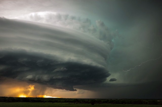
As far as thunderstorms go, supercells are the least common, but they’re responsible for most of the violent tornadoes in the U.S. In addition to extreme winds, they also dump torrential rain and hailstones that are bigger than golf balls — causing flash floods and a whole lot of damage. Their rising, spinning vortices of air — rotating updrafts called mesocyclones — can reach speeds of over 100 miles an hour (about 160 km/h) and sometimes last hours.


[…] love such unexpected cloud formations and mystical ambience triggered by furious thunderstorms… What about […]