A powerful, historic storm has walloped southern Alaska for days, unloading extreme amounts of precipitation and overwhelming its infrastructure in some areas.
The deluge has flooded communities south of Anchorage and transformed trickling waterways into raging rivers. Excessive amounts of snow, measured in feet, have buried the high terrain, and the long-lasting storm won’t fully relent until Wednesday.
The historic rainfall generated by the storm, includes one of the top four heaviest two-day amounts ever observed in the state, nearly 20 inches.
Portage Glacier Visitors Center rainfall since Friday afternoon now way over two feet. This historic event is ending: only a trace of rain between 6 & 7am AKDT Tuesday, ending a streak of 110 consecutive hours with measurable rain. #akwx @Climatologist49 @EmilySchwing @TimLydonAK pic.twitter.com/M4ICltU0H1
— Rick Thoman (@AlaskaWx) November 3, 2021
A fire hose of tropical moisture, the remnants of an atmospheric river, instigated the storm system, which will lash California and the Pacific Coast in the days ahead.
“It started on the 29th, that Friday night, and basically persisted since,” said Mike Ottenweller, a meteorologist at the National Weather Service in Anchorage. “It’s still somewhat ongoing.”
Record rainfall
The moisture translated to exceptional rainfall in the lowlands, like in the Portage River Valley, where double-digit rainfall totals shattered previous records. Alyeska, Alaska, situated on the Kenai Peninsula where it meets the rest of Alaska, reported 9.53 inches on Halloween — the station’s highest daily total ever recorded.
At the Portage Glacier visitor center, 10.34 inches was measured Oct. 30. Its two-day rainfall over the weekend of 18.84 inches ranks as the fourth-highest on record in the state.
Another 3″+ fell at Portage Glacier Visitor’s Center yesterday. This brings their 3-day total to 22.35″. Only Alaska’s rain capital, Little Port Walter, has ever recorded more precipitation in a 3-day period. https://t.co/WMBDgh5rJr pic.twitter.com/OJGm4lIuah
— NWS Alaska Region (@NWSAlaska) November 2, 2021
“It’s the furthest north location to report consecutive days of eight inches or more of rain,” said Ottenweller. “The only other place in Alaska that’s done that is Little Port, which is in southeast Alaska. It’s basically a rainforest down there.”
Ottenweller also noted that the 10.34-inch reading marks the first 10-inch day in Alaska since 2010, calling the precipitation totals “more or less unprecedented.” One location had tallied 22 inches by Monday night as the rain continued to come down, which his office referred to as “prodigious.“
“Some of the impacts we had were roads washed out,” Ottenweller said. “We even had a landslide … basically the side of the mountain just gave in”
Girdwood especially hard hit
Hardest-hit has been Girdwood, nestled in the Glacier Creek valley about 50 miles south of Anchorage, where the core of the atmospheric river blasted ashore. The quaint former gold mining turned ski resort town earned the nickname “Glacier City” for the waterway that runs through its heart. Over the weekend, that quiet creek became a raging, roiling river.
The silty, milky grayish water, fed by glaciers high the Chugach range, carried fallen trees swiftly downstream and swiped precious inches from one neighborhood’s backyard banks. Heavy rains started Friday night. By Sunday, at least a foot of the bank had collapsed.
Early Sunday, a culvert failed, exposing at least six feet of sewer line and a natural gas pipeline. The washout left emergency managers without access to Girdwood’s critical infrastructure, including the wastewater treatment plant, the garbage transfer station and a lot where all the road maintenance equipment is stored.
“Our big hole on Ruane Road was like a new tourist attraction,” joked Michelle Weston, Girdwood’s fire chief. “There were a lot of people coming out in the pouring rain, just to look at the hole.”
Girdwood has no road access to its wastewater treatment plant, transfer station, the lot where road maintenance equipment is stored and there’s both a sewer line and a natural gas line exposed to the elements. Hear about it on @AKpublicnews https://t.co/j8gil6xIau pic.twitter.com/Vj5Suv6Y4G
— Emily Schwing (@EmilySchwing) November 2, 2021
Unfortunately for Girdwood, a town heavily dependent on tourism, October is a slow, shoulder season before Alyeska ski resort opens and after summer tourism has long died down.
Toward the south end of town, up a steep hillside, roughly 20 houses stand along Echo Ridge Drive, ground zero for some of the worst impacts to residents. When daylight finally broke Sunday, after two straight days of heavy rain, the road itself looked like a braided stream.
“Next level” is how Alex Roberto described it. She said she had gone to bed with her window cracked “just to listen to the rain.” At 1 a.m., she awoke to the sound of heavy equipment.
“Echo Ridge basically went from a road and turned into a fast-flowing river,” she said. Crews worked all day Sunday to allow residents to access their homes temporarily. Several railroad tracks were also washed out.
The amount of rain that fell on the region not only smashed records, it obliterated them.
“It’s been moderate to heavy rain now for more than sixty consecutive hours,” said Alaska climatologist Rick Thoman. By midday Monday, Thoman, who works for the Alaska Center for Climate Assessment and Policy in Fairbanks, was using words such as “astounding” and “exciting.”
“What’s remarkable about this is just the absolute amounts of rain and the long duration,” he said.
Excessive snowfall
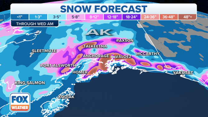
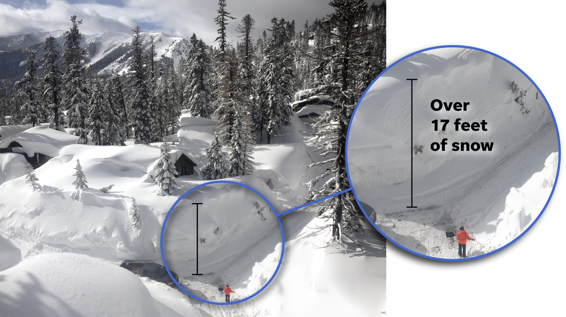
The exceptional amount of moisture has blasted higher terrain with snowfall. The snow has probably already topped 10 feet above 5,000 feet according to Thoman, with up to several feet more forecast.
The National Weather Service had predicted up to 28 feet on Mount Marcus Baker, a 13,176-foot peak in the Chugach Mountains, about 75 miles east of Anchorage. Thoman said that was almost certainly an overestimate but that there’s no way to know for sure how much snow fell, since there aren’t any mountain gauges that high.
Ladies and gentlemen, may I present one of the greatest snow forecasts of all time. The Chugach Mountains in Alaska are being slammed with feet upon feet of snow, with a local maximum of 344″ (28.7′) over a 72-hour period #AKwx 1/3 pic.twitter.com/2AzghJwPCg
— Evan Fisher (@EFisherWX) October 31, 2021
“It’s at a very remote area that’s accessible only by air,” Ottenweller said. “You can only get in there with a chartered aircraft or a private helicopter. Some people do climb that peak, so that’s why the forecast is looked at. It’s kind of like Denali … totally remote and unexplored.”
HAARP weather war at its best! [TWP]
Now subscribe to this blog to get more amazing news curated just for you right in your inbox on a daily basis (here an example of our new newsletter).
You can also follow us on Facebook and/ or Twitter. And, by the way you can also make a donation through Paypal. Thank you!
You should really subscribe to QFiles. You will get very interesting information about strange events around the world.


Could be weather warfare. Or it could just be a heavy cycle of rain and snow.
Let the kids go outside, and play. Make snowmen, or throw snowballs at each other. Enjoy yourselves, and stay healthy.