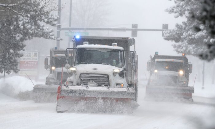
While a record-breaking bombogenesis has brought record amounts of snow in the Sierras and the Rockies this week, weather specialists say a powerful atmospheric river is set to dump much more starting on Sunday.
Meanwhile, the snow doesn’t want to let up in Europe with more on the way this weekend while Japan, Canada and China have already registered their first winter storm alerts.

Snow in U.S.
The last two weeks of November were pretty snowy in western U.S.. The southern Rockies did best with Telluride reporting 10 inches (25 cm).
According to latest weather forecast, there is more on the way. Southern Colorado is in line for 12 inches (30 cm) to 24 inches (60 cm) over the next 24 hours.
ONLY IN COLORADO: Runners & Skiers on 4th Street in Boulder. Are you having some snow day fun? #Colorado pic.twitter.com/YyWbyK6wdO
— FOX31 Denver KDVR (@KDVR) November 26, 2019
California was the big winner with the Tahoe resorts being hammered by 12 inches (30 cm) to 35 inches (90 cm) and up to 20 inches (50 cm) at lake level.
At Mammoth Mountain 35 inches felt in 48 hours.
Snow blankets national forest left charred by California cave fire https://t.co/67lK1n9068 pic.twitter.com/ZHzBBN30Mx
— ABC News (@ABC) November 29, 2019
A powerful atmospheric river will engulf the Sierras on Sunday. That storm is forecast to dump another 35 inches (90 cm) of dense snow on the mountains around Lake Tahoe by Monday.
Actually, it may even be two atmospheric rivers within next week:
California will bear the brunt of at least 2 "atmospheric river" systems over the next 5-8 days.
— Ryan Maue (@RyanMaue) November 27, 2019
Winter storms in the Gulf of Alaska have conveyor belts of moisture extending out of the subtropics.
These narrow "rivers" of moisture are directed into the West Coast. pic.twitter.com/fKzGFYihhI
Here the weather alert from NWS Bay Area:
An atmospheric river will take aim on the Bay Area this weekend through early next week. Heavy rain at times and gusty winds are expected, with potential for localized flooding, mud slides, downed trees, and power outages. #CAwx pic.twitter.com/Z7gFoe7ekp
— NWS Bay Area (@NWSBayArea) November 29, 2019
Snow also started to fall in Utah yesterday. It looks good for widespread snowfalls over the next few days, with 24-35 inches (60-90 cm) for Park City, Alta and Snowbird.
Sow in Canada
A winter storm information alert was issued Wednesday evening, warning travellers to turn back if they’re headed to the Canada-U.S. border crossing at Coutts, Alta. and Sweet Grass, Mont. The border crossing was closed at 6:30 p.m. and reopened on Thursday morning. However, Montana highways remained in poor condition.
In Canadian resorts, the cold but dry start continues for much of western Canada with only a few centimetres of snow earlier in the week for Whistler and other resorts in British Columbia.
However, the atmospheric river could bring up to 12 inches (30 cm) next week.
In overall, the North American Season Outlook forecast an above average season for Canada.
Snow in China
Heavy snow swept northwest China’s Xinjiang Uygur Autonomous Region from Thursday, disrupting traffic. The snow also battered Manasi County in Changji Hui Autonomous Prefecture.
Blowing snow narrowed visibility to 10 meters prompting local police to immediately close more than 124 miles (200 km) of highways, provincial and national roads.
Snow in Japan
Another front crossed Hokkaido yesterday and snow is in the forecast for the next week.
The winds over Hokkaido have enough of a northerly component today to drag the Yobetsu snow plume across #Sapporo #札幌市 ?? leading to persistent #snow #雪❄️ Discussed in the last #YouStormOutlook . Highly localized to escape just drive N, S, or E. #YobetsuPlume #余別岳プルーム pic.twitter.com/D8cAOLAgs0
— YouStorm (@YouStormorg) November 25, 2019
I am sure, you will soon have to use this blowing technique to remove powder snow from your car in Japan:
Using the “Blow” technique of snow-clearing this November morning. I guess this is why they call Rusutsu snow “Blower Powder”!
— RusutsuHoliday (@Rusutsuholiday1) November 29, 2019
白雪紛飛的留壽都村~ ❄️❄️❄️
Rusutsu Holiday Chalet⬇️
✅BOOKING ?https://t.co/FZLABzuT8d#rusutsuholiday #rusutsuholidaychalet #rusutsu #hokkaido pic.twitter.com/4s6pYyNpV4
Snow in Europe
Just when it looked like things were slowing down, this month is wrapping up as one of the snowiest Novembers in parts of the Alps.
The Southern Alps did best with snow accumulation reaching up to 59 inches (150 cm).
Further south, the Pyrenees have already received more than 59 inches (1.50 m) and a number of resorts opened last weekend.
A new low pression could drop more than 27.6 inches (70 cm) in the French Alps and between 8-20 inches (20-50 cm) in Switzerland, Austria and the Dolomites.
November was full of snow and so will be the coming winter. [MountainWatch]


I actually find this all hilarious.
Oh noes! We’ve never had weather like this before! It must be global climate cooling-warming-change!
What really is happening, is that you haven’t seen this NORMAL weather patterns in 20/30 years. And it all seems new to everyone. Kind of like if suddenly all the freedoms and liberties 40/50 years ago suddenly appeared to you today.
When trump is putting the New World Order of its own and forgotten climate change this is what happens globally. Right after NATO meetings he will go to Russia and China. Trump duped all their supporters. He is not here to collapse of New World Order he is here to change New World Order to its own happiness.
Here in northern Arizona we are on our 2nd snow event , temps to -3 farenheit.
Looking at a high temp of 36 , dipping to 9 tonight.
It’s still FALL…
Sorry Dude, not in the World. No “Snow”mageddon in Germany. 😛
I wonder what the name is of the Sow in Canada?
Been way hotter than normal all year here in Hawaii.
Meanwhile , in Anchorage , Alaska , there is no snow on the ground , and the lakes aren’t even frozen over yet.