This winter, rapidly-intensifying cyclones are forming over and over again in the northern Pacific.
Yesterday, the new bombogenesis has dropped an amazing 23 mbar in 12 hours and 36mbar in 24 hours (explosive cyclogenesis = 24mbar drop in 24 hours). The exploding storm will affect south and southeast Alaska until today evening with hurricane-like winds, major waves and swell as well as intense snowstorms.
A new rapidly-intensifying extra tropical cyclone has developped into a monster winter storm over the Gulf of Alaska in the last two days. It is now spreading across the south and southeast Alaska until the end of the day, bringing violent winds, major waves and swell as well as blizzard conditions and tons of snow to coastal areas. Update: There is a double bomb cyclone erupting over the Aleutian Islands RIGHT NOW!
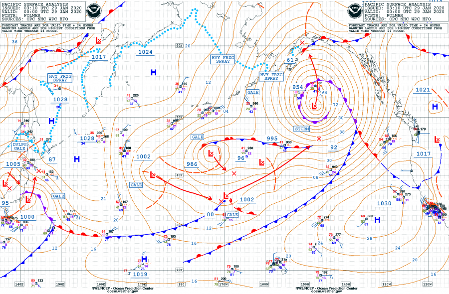
Below, you can follow the pressure data for that particular storm from its beginning (Jan. 27), showing the explosive intensification between January 28 00 UTC (980 mbar) until Jan 29 00 UTC (954 mbar).
- 1001 mbar as of Jan 27th 06 UTC
- 996 mbar as of Jan 27th 12 UTC
- 991 mbar as of Jan 27th 18 UTC
- 980 mbar as of Jan 28th 00 UTC
- 968 mbar as of Jan 28th 06 UTC
- 959 mbar as of Jan 28th 12 UTC
- 955 mbar as of Jan 28th 18 UTC
- 954 mbar as of Jan 29th 00 UTC
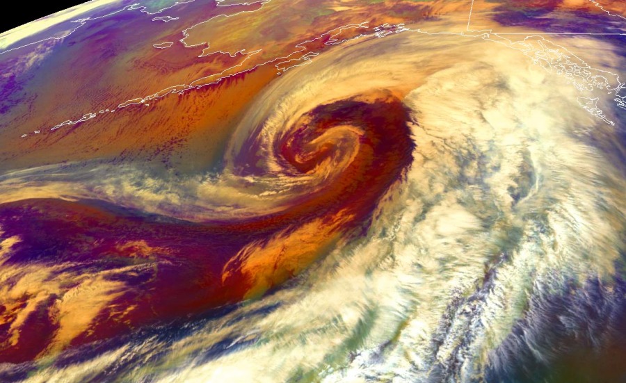
Water vapor satellite animation of explosive cyclogenesis in the North Pacific today. The system will deliver a violent winter storm into the south and southeast Alaska tomorrow! Animation by NOAA pic.twitter.com/ODiXvvAsaz
— severe-weather.EU (@severeweatherEU) January 28, 2020
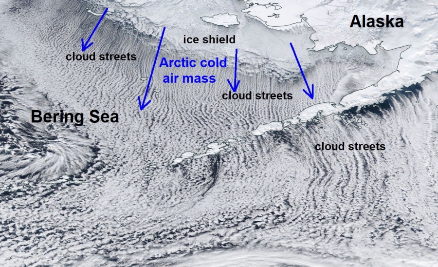
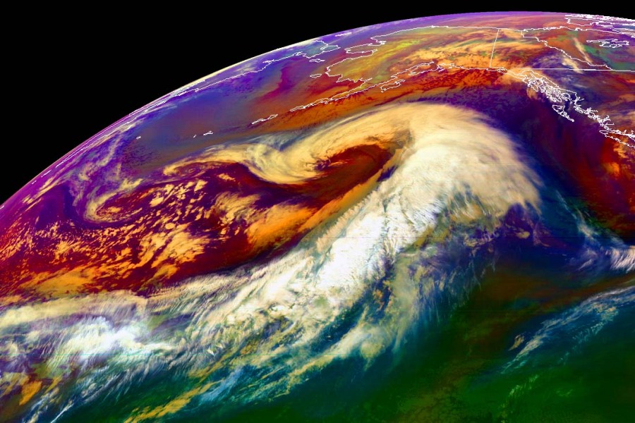
Look at what kind of strange clouds come with this storm system… They are forming weird cloud streets:
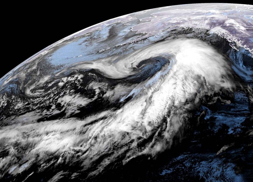
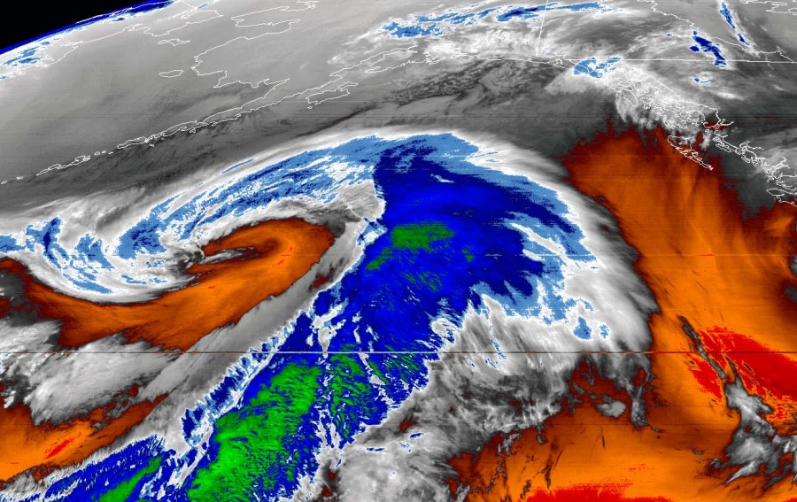
Here some exceptional satellite images of this extremely powerful storm in Alaska.
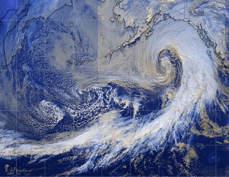
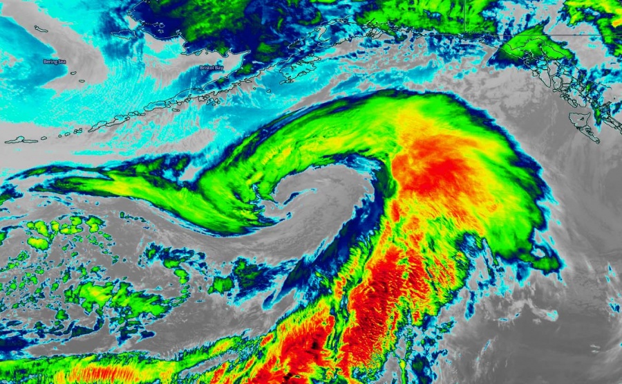
There is a double bomb cyclone erupting over the Aleutian Islands RIGHT NOW!
And here a few news from social media:
POWERFUL WINTER STORM EXPECTED TO AFFECT SOUTHEAST ALASKA LATE WEDNESDAY NIGHT INTO THURSDAY MORNING for 12 forecast zones in [AK] till 7:00 AM AKST https://t.co/OtHVMx2j1B
— IEMBot AJK (@iembot_ajk) January 29, 2020
Updated: Dangerous wind chills, blizzards as #Alaska braces for powerful #stormhttps://t.co/gHvPG60I3h @ASD_SEP
— Absolute Civ Sec?? (@1RACHACSECURITY) January 29, 2020
Major storm heading north from the Pacific into southern #Alaska today through Wednesday, including heavy rain/snow/strong wind in the Panhandle and a Blizzard Warning for #Kodiak! @YourAlaskaLink #Juneauwx #Anchoragewx pic.twitter.com/zl21GagoxR
— Jeff Kirk (@JeffKirkWeather) January 28, 2020
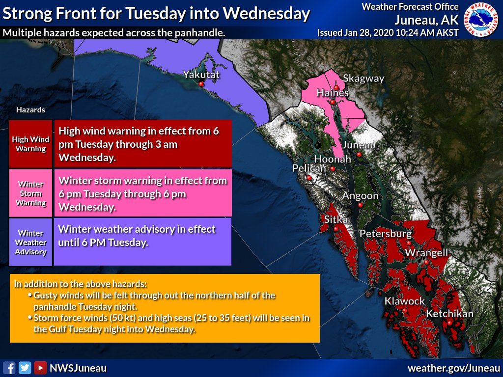
Batten down the hatches. A strong front is expected to impact the panhandle in the next 24 to 36 hours. Multiple hazards are out for various parts of the panhandle and high seas and storm force winds are expected in the Gulf of Alaska. #akwx. pic.twitter.com/OBSLkmFJL4
— NWS Juneau (@NWSJuneau) January 28, 2020
There is a double bomb cyclone erupting over the Aleutian Islands RIGHT NOW!
You better be ready for that next storm! Find similar weather news on Strange Sounds or Steve Quayle. [Severe-weather]


