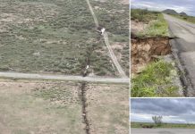
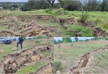
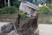
The Taal volcano is currently being hit by hundreds of volcanic earthquakes, resulting in deep earth cracks.
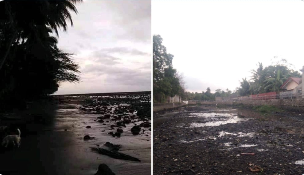
Meanwhile, the ground is so cracked up that parts of Pansipit River in Batangas are drying up.
The Taal Volcanic eruption has been characterized by continuous magmatic and hydrovolcanic activity that generated 700-meter tall dark gray steam-laden plumes that drifted to the general southwest.
Meanwhile, there are hundreds of volcanic earthquakes that are rocking the region. These earthquakes resulted in fissures all around the Taal lake as well as in settlements built around the now active volcano.
Over 450,000 people are estimated to be residing within the 14 km danger zone of the Taal Volcano. On 12 January, alert level 4 was raised and surrounding towns were evacuated. As of 6 a.m. today, @NDRRMC_OpCen reports that over 7,700 people are in 38 evacuation centres. pic.twitter.com/td0Yj0S6Cj
— OCHA Philippines (@OCHAPhilippines) January 13, 2020
Enhanced Seismic Activity
The Philippine Seismic Network recorded a total of five hundred twenty (520) volcanic earthquakes since 1:00 PM, January 12, 2020. One hundred sixty-nine (169) of these were felt with intensities ranging from Intensity I – V.
Since 5:00 AM to 4:00 PM today, January 15, 2020, fifty-three (53) volcanic earthquakes hit the volcano, from which twelve (12) were felt with intensities ranging from Intensity I – III.
ERUPTION UPDATE FOR TAAL VOLCANO ALERT LEVEL 4 (HAZARDOUS ERUPTION IMMINENT) 15 JANUARY 2020 05:00 PM #TaalVolcano #TaalEruption2020 pic.twitter.com/GVeWmISfg9
— PHIVOLCS-DOST (@phivolcs_dost) January 15, 2020
Such intense seismic activity probably signifies continuous magmatic intrusion beneath the Taal edifice, which may lead to further eruptive activity.
Earthquakes crack the ground apart
These hundreds of quakes created fissures around the shores of Lake Taal, in homes, and in roads, thus hampering efforts to evacuate people by road.
Driving through Lemery and some serious cracks starting to appear on the road – caused by intense earthquake activity #taal #volcano #Philippines pic.twitter.com/9DSR8bucUv
— James Reynolds (@EarthUncutTV) January 15, 2020
Here some other examples of long cracks, fissuring the ground and even some homes.
IN PHOTOS: A fissure is seen along the national road in Brgy. Sinisian East, Lemery, Batangas on Tuesday Jan. 14 due to constant earthquakes and the eruption of Taal Volcano. | ?NIÑO JESUS ORBETA/PDI
— Inquirer (@inquirerdotnet) January 14, 2020
Read: https://t.co/sieSN46Rt7 pic.twitter.com/Eb3ymlOK8R
Cracks appearing on the shores of Lake Taal was also observed in the past prior to both major explosive eruptions as well as during periods of volcanic unrest that ultimately didn’t lead to a major eruption.
Pretty incredible comparison of fissuring from #Taal‘s 1911 eruption & now, even if you don’t speak Tagalog (I don’t). Note that fissuring and subsidence are 1 of Taal’s recognized hazards, & this is not on Island but NE,SW in caldera. Follow @phivolcs_dost for official info. https://t.co/ZGvuyXyC58
— Beth Bartel (@EatTheCrust) January 14, 2020
Those fissures and volcanic earthquakes are manifestations of what’s happening below Taal and probably signifies continuous magmatic intrusion beneath the Taal edifice, which may lead to further eruptive activity.
Images of ground fissures from Taal caldera, more information in the original tweet by @phivolcs_dost https://t.co/KTOGwD2lVz pic.twitter.com/FLpChMdm49
— Jascha Polet (@CPPGeophysics) January 14, 2020
Parts of Pansipit River are disappearing in giant cracks
The Pansipit river is the sole drainage outlet of Taal Lake and flows along the towns of Agoncillo, Lemery, San Nicolas and Taal.
According to new pictures and videos, parts of the 9km-long river (5.6-mile long) in Batangas are drying up due to some giant cracks and fissures that opened up in its bed.
Pansipit River is a drainage river of Taal lake. The water receded in the lake or the southwest is bulging up? https://t.co/Gzw9uEyZ5o
— Papa.Ojie (@TataOjie) January 15, 2020
The Pansipit River, connecting West Philippine Sea and Taal Lake, is already dried up.
— JAC | #MalasakitParaSaBatangas (@hadou__KEN) January 15, 2020
Credits to @rbtzzz_ pic.twitter.com/RuNwLBVZxS
A newly acquired video show that the Main Crater Lake (MCL) has been drained and new vent craters have been formed inside the Main Crater and on the north flank of the volcano.
But the crater lake is not Lake Taal and Lake Taal is still full of water, as shown in this picture taken two days ago.
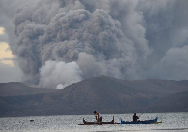
So giant fissures produced by the eruption and the following earthquakes have created giant cracks in the bed of the river that drained all the water… And thus all the water in some parts of the Pansipit River has disappeared. Similar headlines on Strange Sounds and Steve Quayle.


