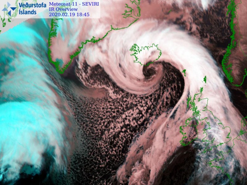
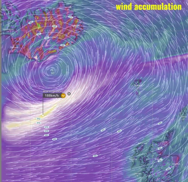
There is another powerful bomb cyclone strenghtening rapidly in the vicinity of Iceland right now!
And the satellite images are just spectacular.
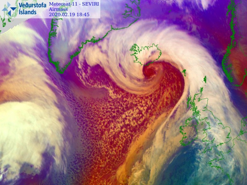
The extra-tropical cyclone season is just insane this winter. One bomb cyclone follows the other. After storm Dennis this weekend, a new bombogenensis is dangerously approaching Iceland, although it shouldn’t make landfall.
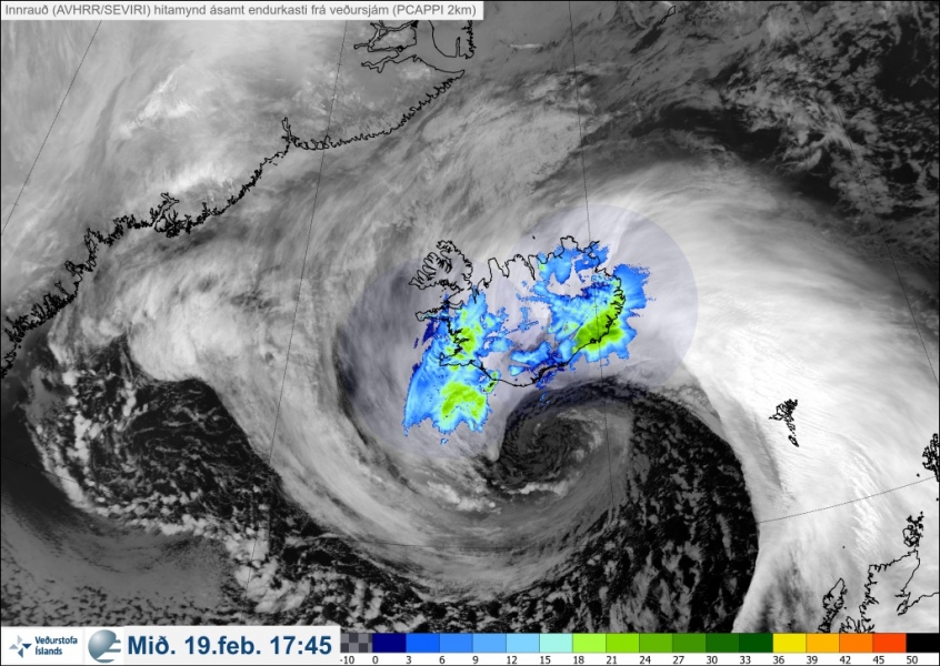
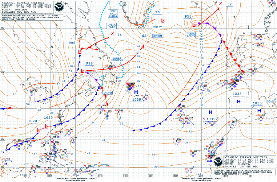
According to the NOAA OPC forecasters, the cyclone has started forming on February 17. Thhe pressure in the central core of the storm was at 958 mbar at 12 UTC February 29.
- 1019 mbar at 12 UTC, Feb. 17th
- 1014 mbar at 18 UTC, Feb. 17th
- 1012 mbar at 00 UTC, Feb. 18th
- 1006 mbar at 06 UTC, Feb. 18th
- 995 mbar at 12 UTC, Feb. 18th
- 984 mbar at 18 UTC, Feb. 18th
- 981 mbar at 00 UTC, Feb. 19th
- 972 mbar at 06 UTC, Feb. 19th
- 958 mbar at 12 UTC, Feb. 19th
The pressure has decreased by an impressive 23mbar in the last 12 hours.
- 981 mbar at 00 UTC, Feb. 19th
- 972 mbar at 06 UTC, Feb. 19th
- 958 mbar at 12 UTC, Feb. 19th
While the pressure dropped 37mbar in the last 24 hours, which is more than enough to be qualified as a exponential cyclogenesis (24 mbar in 24 hours).
- 995 mbar at 12 UTC, Feb. 18th
- 984 mbar at 18 UTC, Feb. 18th
- 981 mbar at 00 UTC, Feb. 19th
- 972 mbar at 06 UTC, Feb. 19th
- 958 mbar at 12 UTC, Feb. 19th
Here some more amazing satellite images of new rapidly intensifying extra-tropical bomb cyclone near Iceland:
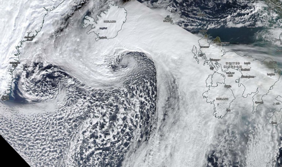
As shown in the last map, another rapid cyclogenesis is forming along the eastern coast of Canada, which is expected to rapidly intensify tonight and tomorrow morning. Hopefully this new storm will not end up like in Newfoundland about a month ago. More extreme weather news on Strange Sounds and Steve Quayle. [Severe Weather]


