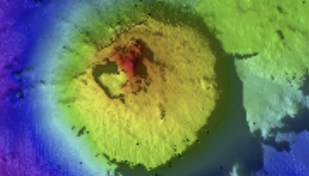
Scientists aboard the Falkor (too) research vessel have documented, for the first time, an extinct volcano towering 5,250 feet above the seabed in international waters in the Pacific Ocean…

Ocean explorers mapping the seabed off the coast of Guatemala have discovered a mountain twice as high as the Burj Khalifa, the world’s tallest building, hiding deep beneath the waves.
The 5,250-foot-tall (1,600 meters) formation is a seamount — a large, underwater geological feature typically formed from an extinct volcano. Scientists discovered the cone-shaped seamount 7,870 feet (2,400 m) below sea level during an expedition organized by the Schmidt Ocean Institute this summer, according to a statement shared with Live Science.
“A seamount over 1.5 kilometers tall which has, until now, been hidden under the waves really highlights how much we have yet to discover,” Jyotika Virmani, the executive director of Schmidt Ocean Institute, said in the statement.
The towering feature covers 5.4 square miles (14 square kilometers) and sits in international waters in the Pacific Ocean, 97 miles (156 kilometers) from Guatemalan waters. The researchers detected the seamount using multibeam sonar mapping during a six-day crossing from Costa Rica to the East Pacific Rise — the boundary between six tectonic plates, including the Pacific plate to the west and the North American plate to the northeast.
Seamounts provide crucial rocky habitats for deep-sea corals, sponges and a host of invertebrates, as hard substrate can be difficult to come by in the ocean, with the majority of the seabed covered in loose, muddy sediment.
“Seamounts can be too steep for mud to stick to, and some animals really thrive on the sides,” Jon Copley, a professor of deep-sea ecology and ocean exploration at the University of Southampton in the U.K, previously told Live Science. “When one sticks up, it creates strong currents for filter feeders to grow up into the water and catch food.”
Satellite data suggest there are more than 100,000 unexplored seamounts that will come to light through continued seafloor mapping. “A complete seafloor map is a fundamental element of understanding our ocean,” Virmani said. “It’s exciting to be living in an era where technology allows us to map and see these amazing parts of our planet for the first time!”
The chief officer of the expedition stands in the control room looking at a digital maritime map.
In April, a research team on a Schmidt Ocean Institute mapping expedition aboard Falkor (too) revealed three new hydrothermal vent fields on the Mid-Atlantic Ridge. In August, they announced the existence of a hidden underworld filled with sea creatures on the East Pacific Rise. Scientists aboard the same vessel also recently discovered two uncharted seamounts and pristine coral reefs near the Galápagos Islands.
The latest find is “yet another breathtaking discovery,” Jamie McMichael-Phillips, the director of the Seabed 2030 project, which aims to map the entire seafloor by the end of the decade together with the Schmidt Ocean Institute and other partners, said in the statement.
Hey guys, it’s time to wake up!
If a few more people choose to support my work, I could expose more lies, root out more corruption, and call out more hypocrites. So, if you can afford it, please support my endeavor by either using PAYPAL or the DonorBox below (PAYPAL & Credit Cards / Debit Cards accepted)…
If you are a crypto fanatic, I do now accept crypto donations:
BTC: 1AjhUJM6cy8yr2UrT67iGYWLQNmhr3cHef (Network: Bitcoin) USDT: 0x490fe5d79d044a11c66c013e5b71305af0a76c1b (Network: Etherum ERC20)
You should join my newsletter to get a daily compilation of different breaking news, pictures and videos… YOU WILL LOVE IT!
Thank you,
Manuel


