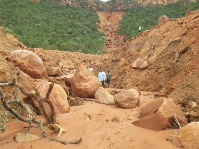
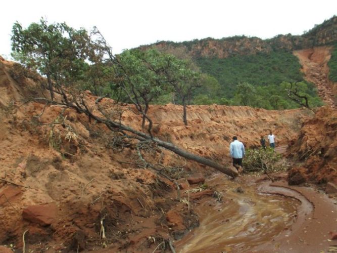
What did happen just around São Domingos and Campos Belos in the northeast of the Goiás State, Brazil? Apocalyptic pictures of this landslide speak for themselves. The flow of mud and stones opened a nearly 7 km long and 200 meters wide crater east of Mosquito river, one of the most important in the north-east of Goiás and south-east of Tocantins.
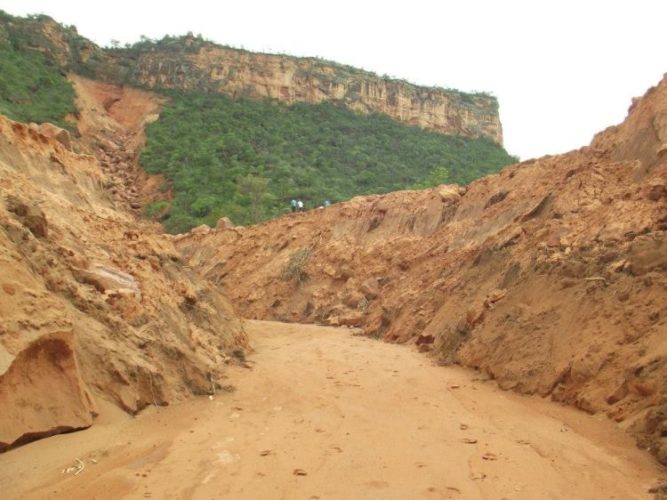
The landslide reached São Vicente River which flows through the Park Terra Ronca Estadual, the largest nature protected area in Goias. Since this mudslide may be contaminated by chemicals and other pesticides, fish populations and the whole ecosystem of this nature reserve of nearly 60 thousand hectares are threatened. – Ministerio Publico Brazil


")

[…] are opening all over the World! And not small ones. After that from Brazil, here another one, this time in Arizona, USA. Although the cause for the huge crack is unknown, it […]