Residents in the Tennessee Valley are cleaning up after a long-lived line of thunderstorms, known as a derecho, brought severe wind gusts on Sunday.
The intense storms caused straight-line wind damage along a path that stretched for more than 600 miles, and in Nashville, the winds were clocked at up to 71 mph.

A powerful line of thunderstorms snapped trees and brought down power lines across Middle Tennessee on Sunday.
“The word ‘widespread’ doesn’t even begin to cover the amount of damage we had,“ said Scott Unger, meteorologist-in-charge at the National Weather Service in Nashville.
The storms knocked out power to more than 100,000 customers, and the local power company is warning residents they could be without electricity for up to two weeks due to the extent of the damage.
Deadly Derecho
An off-duty firefighter was killed by a falling tree limb in Spring Hill, south of Nashville.
Two others in the Nashville area were injured. The same complex of thunderstorms pummeled parts of southwest Missouri with hail the size of baseballs.
A derecho is an arced, curving line of thunderstorms that produces damaging winds as it fans outward. It’s not unusual for the force of winds in a derecho to rival those found in a weak tornado — up to 90 mph.
For a storm to be classified as a derecho, its persistence must match its potency — true derechos sweep their winds along a stretch of at least 400 miles.
Derechos arrive fast, racing forward at highway speeds. For example, the storms on Sunday traveled at nearly 60 miles per hour.
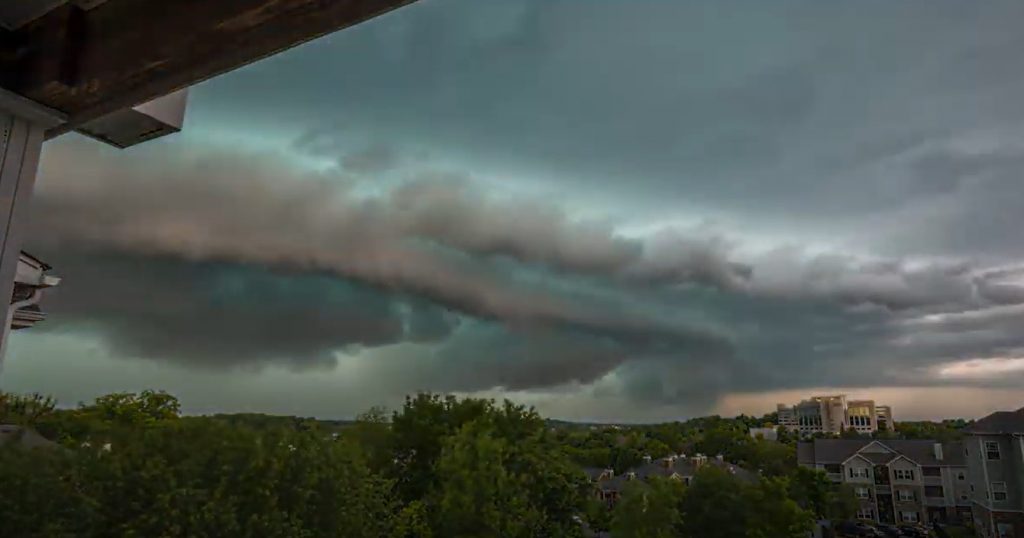
Hardest hit on Sunday was Middle Tennessee, where wind gusts topping 70 mph came on the heels of ominous clouds and a green sky.
The storms, which began in Kansas, skirted the Ozarks in southwestern Missouri before clipping northern Arkansas and dipping into Tennessee.
There are two main classes of derechos — serial and progressive. Sunday’s appears to have been the latter, characterized by a shorter “bow echo” of storms. Progressive derechos manifest their wind gusts in the downdrafts of individual thunderstorm cells embedded within the line; serial derechos more effectively transport down upper-level jet stream momentum.
Derechos are a staple of the summertime, feeding off the oppressive atmosphere found on humid June or July days. May typically features a couple of derechos, but having one this intense and early is noteworthy.
The damage
“It’s not like a tornado where you have a concentrated area of devastation,” said the Weather Service’s Unger, who explained that more moderate damage occurred on a far greater scale.
“In my 14 years here, I’ve never seen something so widespread with snapped trees and uprooted trees. It was like every fifth house I drove past had a tree that was snapped or uprooted.“
Here’s radar loop of Derecho that went through Tennessee yesterday & as another line went through Mid-Atlantic. Heard of many in TN without power & lots of trees down. That line was intense! @TenaciousTopper @hbwx @ChrisClimate @dougkammerer @MatthewCappucci @capitalweather #TNWX pic.twitter.com/NKUA0oNnrn
— Adam Moore (@AdamMooreWX) May 4, 2020
Unger estimated that most areas probably had winds of at least 70 to 75 mph. Officially, the Nashville International Airport reported a gust to 71 mph at 4:44 p.m. as the storms blew through Sunday afternoon.
The tree limbs took out power lines, with 130,000 customers in the dark at one point on Sunday evening. This qualified as one of Nashville’s largest power outages on record, according to the Tennessean newspaper.
Despite the widespread damage, Unger said his office won’t be sending out meteorologists to conduct storm surveys, which are typically reserved for more isolated events where it’s unclear if a tornado or microburst occurred.
Path of destruction
The cluster of storms that would eventually organize into Sunday’s derecho began around sunrise in Kansas, producing a 76 mph wind gust in the town of Iola and a 75 mph gust in Greenwood.
Radar montage of yesterday’s #derecho from KS to TN. pic.twitter.com/J4IzhRfqjb
— Greg Carbin (@GCarbin) May 4, 2020
Shortly afterward, the storms roared into Missouri, where a rotating supercell thunderstorm developed ahead of the main line before merging with the growing derecho. That set the stage for the baseball-size hailstones that fell in the city of Branson.
Up to 30 minutes of hail the size of golf balls to tennis balls was reported in Purcell, Mo., located in Jasper County near the city of Joplin. Tennis ball-sized hail or larger managed to sneak into north central Arkansas as well before the storms merged into a line.
? Check out this video of hail at Table Rock Lake this morning! They had golf-ball sized hail. @kmbc #Mowx pic.twitter.com/2WPPYiwBFL
— Neville Miller KMBC (@NevilleKMBC) May 3, 2020
The storms eventually made it all the way to just west of the Appalachians, where they finally dissipated during the evening.
Forecasting challenges
Derechos are notoriously difficult to predict, oftentimes eluding meteorologists and failing to appear in many computer models. Sunday’s was no exception — but one model saw it coming. This model is known as the high-resolution rapid refresh model because it can zero in on small-scale weather features and is run on a frequent basis, rather than two or three times a day like the global weather models people hear about more often.
“The HRRR EXP actually nailed [Sunday],” said Unger. “That’s why I’m concerned with [Monday]. There’s worry for another one coming today. The setup is a little bit different.“
Unger noted that derechos frequently “make their own environment” and are “going to do what they’re going to do.” So long as the ingredients, like warm and moist unstable air, are in place, the atmosphere can fuel the ferocious storms.
Strong jet stream wind dynamics and certain triggering mechanisms must be in play as well.
Ominously, on Monday morning, a line of hailstorms in southeastern Kansas, northeastern Arkansas, southwestern Missouri and northwestern Arkansas was merging. Baseball-sized hail was reported by emergency management just north of Joplin, Mo.
The National Weather Service Storm Prediction Center did caution that there is a level 2 out of 5 “slight risk” for severe thunderstorms, including the potential for damaging wind gusts, once again in the Nashville area Monday. If that materializes, it’s likely power outages will stagnate or possibly even worsen. More extreme weather on Strange Sounds and Steve Quayle. [WP]


14 Iranian and Iraqi fighters killed in Israel’s airstrike in Syria
Syria Human Rights Organization announced that in last night’s Israeli airstrike on the positions of Iranian forces and its militia in Syria, 14 Iranian and Iraqi fighters were killed. The number of casualties and the injured could be higher.
On Monday night, the official Syrian news agency announced that the country’s anti-air defense system has destroyed Israeli missiles that had targeted a research center in northern Syria. But the experts deny the claim that the missiles were destroyed.
Western intelligence sources say the Assad government was using that research center to produce chemical weapons with the help of Iran.
But the Syrian news agency did not mention the attack on Deir Ez-Zur on Iranian forces and their subsidiaries.
Israel has repeatedly attacked the positions of Iranian and Hezbollah forces in Syria. But the Israeli government rarely comments on the attacks.
According to Reuters, Iran-backed militia have several bases and advanced weapons depots in Aleppo.
Last Friday, Israeli fighter jets bombarded a weapons depot in central Syria, which caused a massive explosion. According to Syria Human Rights Organization, that weapons depot contained missiles and ammo that belonged to Hezbollah of Lebanon.
Hello from Outer space I am from Mars bring me to your In and Out Burger ?
First thing is pizz on steve quayle, the only thing he wants is your money !!
It’s always doom and gloom with him.