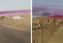
The following video is viral. It features a tube cloud also known as roll cloud or morning glory cloud and was caught as it was rolling in at sunrise on the 4th of November 2013 south of Amarillo Texas in Timbercreek Canyon. But how do these rare, horizontal and rotating clouds form in the sky?
The cloud in the video is comparable to a “Morning Glory,” a roll cloud seen in the months of September and October over northeast Australia.
Formation of roll clouds
“Roll clouds” are a type of arcus cloud—low, horizontal formations typically associated with thunderstorms. Depending on the conditions, a roll cloud can last for several hours and extend for several hundred miles.

The rolling motion is the result of winds changing speed and/or direction at the inversion—when the air temperature reverses from its usual state, resulting in warm air on top of cool air—along which the weather disturbance is traveling. The ‘shear’ across the inversion sets up a rolling motion much like that of a rolling pin used in a baker.
But when there’s too much moisture—during a thunderstorm, for example—a roll cloud may be hard to see because it’s hidden among other clouds.
Considering all of the above factors, the odds of spotting one in your own backyard are pretty slim. But it never hurts to keep your eye on the sky.


